Category:Parks in the City of Wakefield
Jump to navigation
Jump to search
Subcategories
This category has the following 13 subcategories, out of 13 total.
A
- Angler's Country Park (25 F)
C
- Castle Grove Park (6 F)
F
H
- Haw Hill Park, Normanton (9 F)
- Horbury memorial park (4 F)
L
- Lofthouse Colliery Nature Park (108 F)
P
Q
W
Y
Media in category "Parks in the City of Wakefield"
The following 26 files are in this category, out of 26 total.
-

-
 Banks of the River Aire - geograph.org.uk - 3731165.jpg 640 × 480; 80 KB
-
 Betty Eastwood Park - Bull Lane - geograph.org.uk - 765714.jpg 640 × 436; 91 KB
-

-
 Childrens play area - geograph.org.uk - 552736.jpg 640 × 480; 94 KB
-
 Culvert - geograph.org.uk - 851538.jpg 480 × 640; 80 KB
-
 Ferrybridge riverside gardens - geograph.org.uk - 5654646.jpg 4,608 × 3,456; 4.97 MB
-
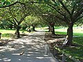
 Footpath - Ledger Lane - geograph.org.uk - 3680322.jpg 640 × 480; 92 KB
-

-
 Green Park - The Green - geograph.org.uk - 4248964.jpg 640 × 480; 138 KB
-
 Haw Hill Park - Castleford Road - geograph.org.uk - 853968.jpg 640 × 480; 74 KB
-
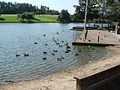 Hemsworth - Water Park.jpg 640 × 480; 128 KB
-
 Illingworth Park - Manor Road - geograph.org.uk - 4249407.jpg 640 × 480; 118 KB
-
 Ledston Hall park grounds - geograph.org.uk - 121922.jpg 479 × 640; 147 KB
-
 Lock Lane Community Centre, Castleford - geograph.org.uk - 4446142.jpg 1,600 × 1,062; 784 KB
-
 Park Hill - geograph.org.uk - 593935.jpg 639 × 468; 88 KB
-

-
 Purston Park - geograph.org.uk - 223818.jpg 640 × 423; 39 KB
-
 Quarry House Knottingley - geograph.org.uk - 5670000.jpg 4,075 × 2,789; 2.83 MB
-
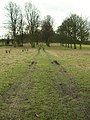
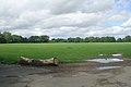
 Recreation field, Calder and Hebble canal - geograph.org.uk - 386521.jpg 640 × 427; 110 KB
-
-

-
 The Green Park Ferry Fryston Castleford - geograph.org.uk - 5650349.jpg 4,071 × 2,562; 2.77 MB
-
 Toll bar - geograph.org.uk - 3355044.jpg 640 × 427; 130 KB
-
-
 Water Course - Haveroid Lane - geograph.org.uk - 765723.jpg 542 × 640; 121 KB


