Category:Parks Department maps of the Bronx published in 1873
Jump to navigation
Jump to search
Maps from: Topographical Map of Westchester County [the Bronx]. (New York City Department of Public Parks, 1873), comprising volume index plus 15 section maps (sheets), some of which also depict parts of Manhattan. This category includes both TIF and JPG versions of the images.
Online at The New York Public Library Digital Collections website, Topographical map….
Media in category "Parks Department maps of the Bronx published in 1873"
The following 32 files are in this category, out of 32 total.
-
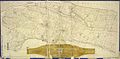 Bronx topographical volume index publ. 1873.jpg 9,795 × 4,850; 11.42 MB
-
 Bronx topographical Sheet 01 publ. 1873.jpg 5,604 × 4,938; 6.03 MB
-
 Bronx topographical Sheet 02 publ. 1873.jpg 5,486 × 4,849; 4.94 MB
-
 Bronx topographical Sheet 03 publ. 1873.jpg 5,464 × 4,850; 4.47 MB
-
 Bronx topographical Sheet 04 publ. 1873.jpg 5,651 × 4,929; 6.65 MB
-
 Bronx topographical Sheet 05 publ. 1873.jpg 5,640 × 4,926; 7.84 MB
-
 Bronx topographical Sheet 06 publ. 1873.jpg 5,616 × 4,926; 6.52 MB
-
 Bronx topographical Sheet 07 publ. 1873.jpg 5,616 × 4,920; 7.34 MB
-
 Bronx topographical Sheet 08 publ. 1873.jpg 5,601 × 4,932; 7.8 MB
-
 Bronx topographical Sheet 09 publ. 1873.jpg 4,662 × 5,172; 4.55 MB
-
 Bronx topographical Sheet 10 publ. 1873.jpg 5,118 × 5,250; 6.03 MB
-
 Bronx topographical Sheet 11 publ. 1873.jpg 5,616 × 4,926; 7.66 MB
-
 Bronx topographical Sheet 12 publ. 1873.jpg 5,616 × 4,914; 7.09 MB
-
 Bronx topographical Sheet 13 publ. 1873.jpg 4,396 × 6,426; 5.89 MB
-
 Bronx topographical Sheet 14 publ. 1873.jpg 5,646 × 4,926; 6.5 MB
-
 Bronx topographical Sheet 15 publ. 1873.jpg 5,634 × 4,908; 6.11 MB
-
 Index to 300 ft. scale lithographed sheets. NYPL1712702.tiff 10,170 × 5,370; 156.27 MB
-

-

-

-

-

-

-

-

-

-

-

-

-

-

-


