Category:Parkhead, Glasgow
Jump to navigation
Jump to search
district in Glasgow City, Scotland, UK  Gatekrysset Parkhead Cross ligger i bydelen og regnes som bydelens sentrum | |||||
| Upload media | |||||
| Instance of | |||||
|---|---|---|---|---|---|
| Location |
| ||||
 | |||||
Subcategories
This category has the following 8 subcategories, out of 8 total.
B
C
E
- Eastern Necropolis (5 F)
L
P
- Parkhead Football Club (2 F)
S
- Salvation Army, Parkhead (1 F)
T
- The Forge Shopping Centre (18 F)
Media in category "Parkhead, Glasgow"
The following 69 files are in this category, out of 69 total.
-
 1918-1949 Glasgow Camlachie.png 694 × 555; 14 KB
-
 A straight section of the Clyde Walkway (geograph 1697861).jpg 1,024 × 768; 282 KB
-
 A vanished street - geograph.org.uk - 2646353.jpg 640 × 480; 136 KB
-
 Bank of Scotland, Duke Street, Glasgow (geograph 5650152).jpg 640 × 379; 108 KB
-
 Celtic Park and Emirates Arena from Whitevale Tower.JPG 2,848 × 2,136; 2.93 MB
-
 Celtic Social Club (geograph 5446429).jpg 640 × 480; 47 KB
-
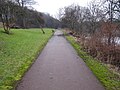
 Clyde Walkway - geograph.org.uk - 5721539.jpg 1,600 × 1,200; 702 KB
-
 Clyde Walkway near Parkhead - geograph.org.uk - 341703.jpg 640 × 480; 165 KB
-
 Clyde walkway, Parkhead - geograph.org.uk - 1322054.jpg 640 × 480; 147 KB
-
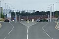
 Construction site, Barrowfield Street (geograph 6195209).jpg 1,024 × 683; 123 KB
-

-
 East End Regeneration Route (geograph 3062624).jpg 640 × 430; 92 KB
-

-
 Eastern Necropolis, Gallowgate - geograph.org.uk - 125147.jpg 640 × 480; 122 KB
-
 Eastern Necropolis, Glasgow - geograph.org.uk - 662318.jpg 640 × 480; 106 KB
-
 Fielden Place (geograph 6195218).jpg 1,024 × 683; 142 KB
-
 Forge Retail Park sign (geograph 3062614).jpg 640 × 624; 161 KB
-
 Former Newlands Public School - geograph.org.uk - 5650145.jpg 640 × 443; 134 KB
-
 Former Newlands Public School - geograph.org.uk - 5650147.jpg 640 × 397; 139 KB
-
 Former Newlands Public School - geograph.org.uk - 5650149.jpg 640 × 480; 187 KB
-
 Gallowgate (geograph 7275059).jpg 1,600 × 1,200; 260 KB
-
 Gallowgate, looking West - geograph.org.uk - 662336.jpg 640 × 480; 68 KB
-
 Gallowgate, Parkhead (geograph 2644979).jpg 640 × 480; 87 KB
-
 Glasgow rooftops - the East End (geograph 3629384).jpg 640 × 368; 114 KB
-
 Glasgow Savings Bank - geograph.org.uk - 563061.jpg 640 × 481; 56 KB
-
 Glasgow wards 2017 no09 Calton.png 2,000 × 2,040; 504 KB
-
 Houses on London Road (A74) (geograph 5446428).jpg 640 × 480; 57 KB
-
 Housing on the Gallowgate - geograph.org.uk - 662472.jpg 640 × 480; 67 KB
-
 John Dewar and Sons (geograph 5446431).jpg 640 × 480; 40 KB
-
 London Road (A74), Parkhead (geograph 5446427).jpg 640 × 480; 54 KB
-
 London Road (geograph 3063850).jpg 640 × 480; 102 KB
-
 London Road, Parkhead (geograph 5650135).jpg 640 × 382; 104 KB
-
 London Road, Parkhead - geograph.org.uk - 5650134.jpg 640 × 362; 101 KB
-
 London Road, Parkhead - geograph.org.uk - 662387.jpg 640 × 480; 87 KB
-
 London Road, Parkhead in 2008.jpg 640 × 480; 61 KB
-

-
 Modern tenements on London Road (geograph 5722346).jpg 1,600 × 1,200; 323 KB
-
 Outdoor 5 a side pitch (geograph 1795221).jpg 2,272 × 1,704; 868 KB
-
 Parkhead - geograph.org.uk - 116201.jpg 640 × 480; 191 KB
-
 Parkhead Cross (geograph 2691025).jpg 800 × 600; 119 KB
-
 Parkhead Cross (geograph 5650150).jpg 640 × 326; 127 KB
-
 Parkhead Cross (geograph 7069732).jpg 971 × 1,024; 372 KB
-
 Parkhead Cross (geograph 7069736).jpg 946 × 1,024; 359 KB
-
 Parkhead Cross (geograph 7069791).jpg 998 × 1,024; 444 KB
-
 Parkhead Cross (street sign) - geograph.org.uk - 562738.jpg 640 × 427; 60 KB
-
 Parkhead Cross - geograph.org.uk - 662348.jpg 640 × 480; 78 KB
-
 Parkhead from the air (geograph 2987425).jpg 640 × 480; 183 KB
-
 Parkhead from the air (geograph 5374235).jpg 640 × 480; 195 KB
-
 Parkhead Public Library - geograph.org.uk - 563093.jpg 640 × 481; 55 KB
-
 Play park in Glasgow's East End - geograph.org.uk - 662353.jpg 640 × 480; 65 KB
-
 Quarryknowe Street (geograph 2646349).jpg 640 × 480; 92 KB
-
 River Clyde, Parkhead - geograph.org.uk - 1322058.jpg 640 × 480; 115 KB
-
 Salvation Army, Parkhead - geograph.org.uk - 2644985.jpg 640 × 480; 87 KB
-
 Salvation Army, Tollcross Road - geograph.org.uk - 1168001.jpg 640 × 480; 136 KB
-
 Springfield Road - geograph.org.uk - 5650137.jpg 640 × 379; 120 KB
-
 Springfield Road - geograph.org.uk - 5650139.jpg 640 × 385; 124 KB
-
 St Annes Primary School (geograph 2996987).jpg 640 × 481; 56 KB
-
 St Michael's Church, Parkhead - geograph.org.uk - 662340.jpg 640 × 480; 56 KB
-
 Steam Hammer on Shettleston Road - geograph.org.uk - 125134.jpg 640 × 480; 191 KB
-
 Tenements in Helenvale Street.JPG 1,112 × 2,153; 399 KB
-
 Tenements on the Gallowgate, Parkhead - geograph.org.uk - 662331.jpg 640 × 480; 78 KB
-
 Tenements, Westmuir Street - geograph.org.uk - 2644989.jpg 640 × 480; 86 KB
-
 The Steam Hammer - geograph.org.uk - 562696.jpg 640 × 481; 78 KB
-
 Tollcross Road - geograph.org.uk - 1167999.jpg 640 × 480; 131 KB
-
 Tollcross Road Flats.JPG 1,176 × 1,595; 362 KB
-
 Tower Block UK photo glw2-24 (Helenvale Parkhead 1981).jpg 2,615 × 1,755; 717 KB
-
 Anchor Bar in Parkhead - geograph.org.uk - 562995.jpg 640 × 427; 64 KB
-
 New housing in Parkhead - geograph.org.uk - 662474.jpg 640 × 480; 63 KB
-
 The Old Black Bull - geograph.org.uk - 563026.jpg 640 × 481; 49 KB

.jpg)

.jpg)

.jpg)


.jpg)

.jpg)


.jpg)
.jpg)


.jpg)

.jpg)
.jpg)


_(geograph_5446428).jpg)

.jpg)
,_Parkhead_(geograph_5446427).jpg)
.jpg)
.jpg)


.jpg)
.jpg)

.jpg)
.jpg)
.jpg)
.jpg)
.jpg)
_-_geograph.org.uk_-_562738.jpg)
.jpg)
.jpg)


.jpg)


.jpg)


.jpg)


