Category:Park Road, Elland
Jump to navigation
Jump to search
Subcategories
This category has the following 3 subcategories, out of 3 total.
Media in category "Park Road, Elland"
The following 20 files are in this category, out of 20 total.
-
 Cottages on Park Road - geograph.org.uk - 4377854.jpg 3,896 × 2,483; 3.75 MB
-
-
 Elland-signal-box-by-Humphrey-Bolton.jpg 640 × 472; 79 KB
-
 Entrance to Park Wood Crematorium - geograph.org.uk - 6407690.jpg 800 × 499; 118 KB
-
 House on Park Road - geograph.org.uk - 6407677.jpg 800 × 587; 104 KB
-
 Houses and mills on Park Road, Elland - geograph.org.uk - 6407922.jpg 800 × 585; 201 KB
-
 Houses on Park Road - geograph.org.uk - 6407683.jpg 800 × 600; 97 KB
-
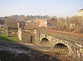
 Mills and railway bridge in Elland - geograph.org.uk - 2361661.jpg 640 × 480; 69 KB
-
 Old Milestone, A6025, Park Road, Elland (geograph 6744838).jpg 493 × 665; 76 KB
-
 Ordnance Survey Flush Bracket S8833 - geograph.org.uk - 3361076.jpg 4,000 × 3,000; 3.83 MB
-
 Park Road (A6025) - geograph.org.uk - 6407681.jpg 800 × 600; 162 KB
-
 Park Road (A6025) towards Brighouse - geograph.org.uk - 6407695.jpg 800 × 637; 208 KB
-
 Park Road Mills, Elland - geograph.org.uk - 1964393.jpg 640 × 480; 138 KB
-
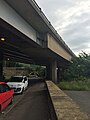 Park Road under the A629 Calderdale Way - geograph.org.uk - 5005429.jpg 960 × 1,280; 250 KB
-
 Park Road, Elland - geograph.org.uk - 2113968.jpg 800 × 600; 272 KB
-
 Park Wood Crematorium, Elland - geograph.org.uk - 2239829.jpg 2,000 × 1,500; 551 KB
-
 Recreation ground and garages off Park Road - geograph.org.uk - 3811289.jpg 2,048 × 1,536; 1.18 MB
-
 Road closure on Park Road (A6025) - geograph.org.uk - 6407692.jpg 800 × 600; 124 KB
-

-
 Water's Edge Children's Day Nursery, Park Road, Elland - geograph.org.uk - 2239877.jpg 2,000 × 1,460; 469 KB


.jpg)

_-_geograph.org.uk_-_6407681.jpg)
_towards_Brighouse_-_geograph.org.uk_-_6407695.jpg)


_-_geograph.org.uk_-_6407692.jpg)

