Category:Park Lane bridge, Aintree
Jump to navigation
Jump to search
| Object location | | View all coordinates using: OpenStreetMap |
|---|
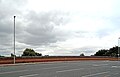
Park Lane bridge lies to the south of Aintree railway station and carries four lanes across the Northern Line (Merseyrail). It is designated SJO2/11 where SJO2 is the Walton Junction to Ormskirk line, and is 4.63 miles from Liverpool Central station.
Media in category "Park Lane bridge, Aintree"
The following 8 files are in this category, out of 8 total.
-
 Aintree station from Park Lane bridge.jpg 4,807 × 3,329; 7.85 MB
-
 Looking south, Aintree railway station (geograph 3786870).jpg 1,024 × 683; 224 KB
-
 Park Lane bridge, Aintree 1.jpg 4,770 × 3,552; 5.88 MB
-
 Park Lane bridge, Aintree 2.jpg 5,016 × 3,618; 9.1 MB
-
 Park Lane bridge, Aintree 3.jpg 4,920 × 3,576; 8.01 MB
-
 Park Lane bridge, Aintree 4.jpg 4,884 × 3,114; 6.63 MB
-
 Park Lane bridge, Aintree 5.jpg 4,698 × 3,552; 8.96 MB
-
 View south from Park Lane bridge.jpg 5,152 × 3,864; 7.7 MB

.jpg)


