Category:Pant, Shropshire
Jump to navigation
Jump to search
English: Pant is a village in Shropshire, England. It lies near to the border with Wales. Pant means 'hollow' in Welsh which fits because it is directly below the disused mines at Llanymynech Rocks Nature Reserve.
Simple English: Pant is a town in Shropshire, England, UK. It is not far from the border with Powys in Wales.
village in Shropshire, England  | |||||
| Upload media | |||||
| Instance of | |||||
|---|---|---|---|---|---|
| Location | Llanymynech and Pant, Shropshire, West Midlands, England | ||||
 | |||||
Subcategories
This category has only the following subcategory.
P
Media in category "Pant, Shropshire"
The following 19 files are in this category, out of 19 total.
-
 A483 at Pant village entrance - geograph.org.uk - 2227944.jpg 640 × 480; 52 KB
-

-
 Bridge 90 in Pant - geograph.org.uk - 2825027.jpg 640 × 480; 100 KB
-
 Building plot in Pant - geograph.org.uk - 2825004.jpg 640 × 480; 83 KB
-
 Canal towpath next to back road to Pant - geograph.org.uk - 2097560.jpg 640 × 480; 124 KB
-
 Course of Montgomery Canal at Pant - geograph.org.uk - 51038.jpg 640 × 511; 144 KB
-
 Cross Guns PH - geograph.org.uk - 2289119.jpg 3,264 × 2,448; 5.53 MB
-
 Cross Guns public house at Pant - geograph.org.uk - 3539755.jpg 640 × 480; 76 KB
-
 Entering Pant - geograph.org.uk - 2985868.jpg 3,402 × 2,588; 2.81 MB
-
 Floods at Llwyntidmon - geograph.org.uk - 313597.jpg 640 × 480; 90 KB
-
 Floods near Llwyn-y-groes - geograph.org.uk - 313606.jpg 640 × 480; 90 KB
-
 Greystones Court Pant - geograph.org.uk - 1393350.jpg 640 × 480; 68 KB
-
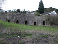 Lime kilns near Pant.jpg 640 × 480; 100 KB
-
 Lime kilns, Pant (geograph 6702830).jpg 1,024 × 576; 233 KB
-
 Montgomery Canal 10 mile milepost - geograph.org.uk - 586852.jpg 640 × 480; 90 KB
-
 Pant entrance sign - geograph.org.uk - 2404633.jpg 640 × 480; 82 KB
-
 Porth-y-waen recreation ground - geograph.org.uk - 3539762.jpg 640 × 480; 79 KB
-
 Primitive Methodist chapel in Pant - geograph.org.uk - 2825012.jpg 640 × 480; 80 KB
-


.jpg)


