Category:Pant, Merthyr Tydfil
Jump to navigation
Jump to search
village and community in Merthyr Tydfil, Wales, UK  Edward Street en février 2012.  | |||||
| Upload media | |||||
| Pronunciation audio | |||||
|---|---|---|---|---|---|
| Instance of | |||||
| Location | Merthyr Tydfil, Wales | ||||
| Population |
| ||||
| Area |
| ||||
 | |||||

Subcategories
This category has the following 5 subcategories, out of 5 total.
B
M
- Morlais Castle (5 F)
- Morlais tunnel (12 F)
P
- Pant (BMR) railway station (43 F)
- Pant Cemetery (3 F)
Media in category "Pant, Merthyr Tydfil"
The following 98 files are in this category, out of 98 total.
-
 A 'pond' no more - geograph.org.uk - 4184692.jpg 1,024 × 768; 207 KB
-
 A weak bridge near Pontsticill - geograph.org.uk - 3084717.jpg 640 × 480; 184 KB
-
 Abandoned workings at Twynau Gwynion - geograph.org.uk - 3294035.jpg 480 × 640; 120 KB
-

-

-

-

-
 BPD Ltd, Pant Industrial Estate - geograph.org.uk - 2791348.jpg 3,296 × 2,472; 1.87 MB
-
 Brecon Mountain Railway - geograph.org.uk - 6168863.jpg 5,184 × 3,888; 6.15 MB
-
 Brecon Mountain Railway - geograph.org.uk - 6168866.jpg 5,184 × 3,888; 5.89 MB
-

-
 Brecon Mountain Railway, Pant - geograph.org.uk - 4050071.jpg 1,024 × 768; 179 KB
-

-

-
 Christchurch, Pant - geograph.org.uk - 2791340.jpg 3,296 × 2,472; 1.88 MB
-
 Christchurch, Pant - geograph.org.uk - 2791341.jpg 3,296 × 2,472; 1.87 MB
-
 Cwm and Pontsticill - geograph.org.uk - 4050791.jpg 640 × 427; 115 KB
-
 Cwm Taf Fechan - geograph.org.uk - 4051619.jpg 1,024 × 768; 137 KB
-
 Cwm Taf Fechan, Brecon Mountain Railway - geograph.org.uk - 3661361.jpg 1,024 × 683; 756 KB
-
 Cycle route signpost, Dowlais Top - geograph.org.uk - 3010608.jpg 640 × 480; 105 KB
-
 Disused water channel - geograph.org.uk - 4186205.jpg 1,024 × 768; 211 KB
-
 Diversionary tactics - geograph.org.uk - 4185078.jpg 1,024 × 768; 192 KB
-
 Edward St, Pant - geograph.org.uk - 2791335.jpg 3,296 × 2,472; 1.87 MB
-
 Footbridge at Pengarnddu, Merthyr Tydfil - geograph.org.uk - 3064170.jpg 1,200 × 1,600; 509 KB
-
 Footbridge over the Afon Taf Fechan - geograph.org.uk - 3475607.jpg 640 × 480; 166 KB
-
 Footpath north from the A465 - geograph.org.uk - 3051187.jpg 2,918 × 2,167; 1.28 MB
-
 Former railway bridge near Pontsticill - geograph.org.uk - 1998281.jpg 640 × 480; 123 KB
-
 Glimpse of Pontsarn Viaduct - geograph.org.uk - 5467768.jpg 3,264 × 2,448; 4.73 MB
-
 Gorge below Pitwellt Pond - geograph.org.uk - 4184709.jpg 1,886 × 740; 242 KB
-
 Gritstone pavement - geograph.org.uk - 3859309.jpg 800 × 600; 128 KB
-
 Gwladys St, Pant - geograph.org.uk - 2791332.jpg 3,296 × 2,472; 1.77 MB
-
 Heol-Y-Bryniau, Pant, Merthyr Tydfil - geograph.org.uk - 3020371.jpg 640 × 480; 102 KB
-
 Hillside Road at Pant - geograph.org.uk - 1673866.jpg 1,600 × 1,200; 476 KB
-

-
 Llwynybrain from the Brecon Mountain Railway - geograph.org.uk - 3661367.jpg 1,024 × 683; 834 KB
-
 Looking across Cwm Taf Fechan - geograph.org.uk - 3768117.jpg 640 × 480; 91 KB
-
 Morlais quarries - geograph.org.uk - 3859338.jpg 800 × 600; 122 KB
-
 Mountain - motocross bike track near Morlais Castle Quarries - geograph.org.uk - 4375655.jpg 2,592 × 1,944; 1.01 MB
-
 Oiling up - geograph.org.uk - 4958393.jpg 3,872 × 2,592; 3.42 MB
-
 Old Pant Station - geograph.org.uk - 2139825.jpg 1,024 × 576; 198 KB
-
 Old quarries near Pant Station - July 2012 - panoramio.jpg 4,000 × 3,000; 3.87 MB
-
 Ordnance Survey Cut Mark - geograph.org.uk - 6312801.jpg 1,024 × 864; 358 KB
-
 Ordnance Survey Cut Mark - geograph.org.uk - 6312808.jpg 1,024 × 788; 286 KB
-
 Ordnance Survey Cut Mark - geograph.org.uk - 6312811.jpg 905 × 1,024; 182 KB
-
 Ordnance Survey Rivet - geograph.org.uk - 6312815.jpg 560 × 1,024; 260 KB
-

-
 Pant Station - geograph.org.uk - 1451270.jpg 640 × 480; 98 KB
-
 Pant Station - geograph.org.uk - 5601432.jpg 3,264 × 2,448; 1.8 MB
-
 Pant, new terminus of Brecon Mountain NG Railway, 2001 - geograph.org.uk - 5619882.jpg 2,297 × 1,133; 1.84 MB
-
 Pengarnddu bridge, Dowlais Top - geograph.org.uk - 3009909.jpg 640 × 480; 97 KB
-
 Penydarnddu industrial estate, from the south-east - geograph.org.uk - 5963030.jpg 2,560 × 1,920; 2.37 MB
-

-

-
 Pompren Taf Fechan Footbridge - geograph.org.uk - 4091266.jpg 640 × 480; 112 KB
-
 Pont Sarn (detail) - geograph.org.uk - 2000719.jpg 640 × 480; 98 KB
-
 Pont Sarn - geograph.org.uk - 2000730.jpg 640 × 493; 115 KB
-

-
 Portal of Morlais tunnel - geograph.org.uk - 1998297.jpg 640 × 480; 157 KB
-
 Preserved Coach at Pant - geograph.org.uk - 1673902.jpg 1,600 × 1,200; 388 KB
-
 Public house, Pantcadifor - geograph.org.uk - 4049749.jpg 1,024 × 768; 141 KB
-
 Pwll Mere - geograph.org.uk - 4185076.jpg 1,466 × 766; 176 KB
-
 Queen St, Pant - geograph.org.uk - 2791333.jpg 3,296 × 2,472; 1.82 MB
-
 Remains of Morlais Junction signal box - geograph.org.uk - 1998320.jpg 640 × 480; 127 KB
-
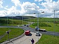 Roundabout at Dowlais Top - geograph.org.uk - 3010564.jpg 640 × 480; 112 KB
-

-
 Taf Fechan in flood - geograph.org.uk - 4767234.jpg 960 × 1,280; 339 KB
-
 Taff Trail across Pontsarn viaduct - geograph.org.uk - 1998329.jpg 640 × 480; 104 KB
-
 Taff trail at site of Morlais Junction - geograph.org.uk - 1998306.jpg 640 × 480; 121 KB
-

-
 Taff Trail near Morlais Junction - geograph.org.uk - 1998290.jpg 640 × 480; 132 KB
-
 Tai yr Efail - geograph.org.uk - 2000520.jpg 640 × 480; 56 KB
-
 Tai-yr-efail, Pant - geograph.org.uk - 2791337.jpg 3,296 × 2,472; 1.84 MB
-
 The Hafod, Pant - geograph.org.uk - 2791330.jpg 3,296 × 2,472; 1.88 MB
-
 The Pantyscallog Inn, Pant - geograph.org.uk - 2791336.jpg 3,135 × 2,385; 2.01 MB
-
 The Quarryman's Arms, Tai-yr-efail, Pant - geograph.org.uk - 2791339.jpg 3,296 × 2,472; 1.87 MB
-
 Track by Brecon Mountain Railway Centre - geograph.org.uk - 2014014.jpg 2,272 × 1,704; 1.54 MB
-
 Track on the north side of Morlais Hill - geograph.org.uk - 5963049.jpg 1,628 × 916; 380 KB
-
 Trackbed at Pant - geograph.org.uk - 1451271.jpg 640 × 480; 91 KB
-
 Train departing Pant Station - geograph.org.uk - 5676651.jpg 640 × 480; 94 KB
-
 Twin turrets of Castell-y-nos - geograph.org.uk - 3859273.jpg 800 × 600; 122 KB
-
 Tyle Haidd disused quarry - geograph.org.uk - 2542708.jpg 2,816 × 2,112; 2.01 MB
-
 Ventilation shaft - geograph.org.uk - 2014013.jpg 2,272 × 1,704; 2.26 MB
-
 View from Brecon Mountain Railway at Pant (8819).jpg 4,288 × 2,848; 5.91 MB
-
 View from Brecon Mountain Railway at Pant (8821).jpg 4,288 × 2,848; 6.45 MB
-
 View from Brecon Mountain Railway at Pant (8823).jpg 4,288 × 2,848; 6.14 MB
-
 View from Brecon Mountain Railway at Pant (8898).jpg 4,288 × 2,848; 5.21 MB
-
 View from Brecon Mountain Railway at Pant (8902).jpg 4,288 × 2,848; 6.21 MB
-
 View from Brecon Mountain Railway at Pant (8903).jpg 4,288 × 2,848; 6.14 MB
-
 View from Brecon Mountain Railway at Pant (8904).jpg 4,288 × 2,848; 5.93 MB
-
 View from Brecon Mountain Railway at Pant (8906).jpg 4,288 × 2,848; 6.26 MB
-
 View from Castell-y-nos - geograph.org.uk - 3859293.jpg 800 × 600; 145 KB
-

-
 View to Castell-y-nos - geograph.org.uk - 3859282.jpg 800 × 600; 160 KB
-
 View towards Morlais Castle Golf Club. - geograph.org.uk - 3020124.jpg 640 × 480; 138 KB
-
 Wales Merthyr Tydfil Community Pant map.svg 512 × 688; 240 KB
-

-
 Y Pant Cad Ifor - geograph.org.uk - 6020389.jpg 2,685 × 1,989; 1.4 MB
-
 Y Pant Cad Ifor Public House - geograph.org.uk - 806491.jpg 640 × 480; 85 KB


_-_geograph.org.uk_-_2000719.jpg)


.jpg)
.jpg)
.jpg)
.jpg)
.jpg)
.jpg)
.jpg)
.jpg)


