Category:Panoramics of West Lothian
Jump to navigation
Jump to search
Council areas (municipalities) of Scotland: Aberdeen · Aberdeenshire · Angus · Argyll and Bute · Clackmannanshire · Dumfries and Galloway · Dundee · East Ayrshire · East Dunbartonshire · East Lothian · East Renfrewshire · Edinburgh · Falkirk · Fife · Glasgow · Highland · Inverclyde · Midlothian · Moray · North Ayrshire · North Lanarkshire · Outer Hebrides · Orkney Islands · Perth and Kinross · Renfrewshire · Scottish Borders · Shetland Islands · Stirling · West Dunbartonshire · West Lothian
Media in category "Panoramics of West Lothian"
The following 17 files are in this category, out of 17 total.
-
 Am linlithgow palace and town.JPG 2,048 × 1,536; 1.74 MB
-
 Armadale from the north-west.jpg 2,592 × 1,944; 1.76 MB
-
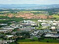
 Bathgate aerial.JPG 4,000 × 3,000; 3.8 MB
-
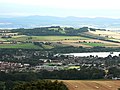
 Broxburn and the Pentland Hills - geograph.org.uk - 781553.jpg 640 × 166; 22 KB
-
 Firth of Forth 23-06-2017.jpg 3,776 × 848; 2.03 MB
-
 Former Broxburn Shale Oil Works - geograph.org.uk - 1018508.jpg 640 × 480; 86 KB
-
 Kite aerial photo of the Armadale Academy.JPG 2,848 × 2,136; 3.01 MB
-
 Linlithgow from Cockleroi - geograph.org.uk - 1007085.jpg 640 × 480; 76 KB
-
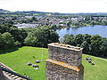
 Linlithgow Palace from Cockleroy Hill.jpg 2,553 × 1,883; 810 KB
-

-
 Livingston - geograph.org.uk - 10572.jpg 640 × 480; 91 KB
-
 Livingston from East Cairn Hill - geograph.org.uk - 946781.jpg 559 × 640; 72 KB
-

-

-
 View from Whitrigg - geograph.org.uk - 1735856.jpg 640 × 341; 81 KB
-
 West Cairn Hill's view - geograph.org.uk - 32141.jpg 640 × 237; 27 KB
-
 West Lothian shale bing, Scotland.JPG 4,000 × 3,000; 3.13 MB


