Category:Panoramas by User:Podzemnik
Jump to navigation
Jump to search

Subcategories
This category has the following 2 subcategories, out of 2 total.
F
Q
- Quality panoramas by User:Podzemnik (163 F)
Media in category "Panoramas by User:Podzemnik"
The following 200 files are in this category, out of 234 total.
(previous page) (next page)-
 "Time Steps" mural by Frank Lewis, Victoria, British Columbia, Canada 07.jpg 8,530 × 4,475; 36.12 MB
-
 120 degrees panorama of Swan Lake, Saanich, British Columbia, Canada.jpg 24,154 × 3,346; 56.49 MB
-
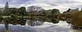 A pond, The Groynes, Christchurch, New Zealand.jpg 12,670 × 5,004; 36.66 MB
-
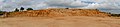 A quarry, Dipkarpaz, Northern Cyprus.jpg 14,465 × 3,249; 29.25 MB
-
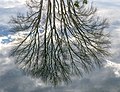 A tree reflected in a pond, The Groynes, Christchurch, New Zealand.jpg 6,501 × 4,998; 25.26 MB
-
 All Souls' Church, Christchurch, New Zealand 03.jpg 10,670 × 4,302; 15.62 MB
-
 Amphitheatre Bay after a storm, Akamas Peninsula, Cyprus.jpg 11,284 × 3,322; 31.29 MB
-
 Anderson Cove Bay, Sooke, Vancouver Island, British Columbia, Canada.jpg 11,182 × 2,983; 29.6 MB
-
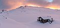 Angelus Hut in the winter, Nelson Lakes National Park, New Zealand.jpg 7,357 × 3,437; 5.13 MB
-
 ANZ Centre, Christchurch, New Zealand.jpg 6,502 × 2,818; 8.82 MB
-
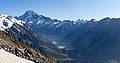 Aoraki - Mt Cook, Aoraki - Mount Cook National Park, New Zealand.jpg 8,185 × 4,299; 15.3 MB
-
 Aoraki from Mueller Hut, Aoraki - Mount Cook National Park, New Zealand.jpg 7,294 × 4,217; 17.06 MB
-
 Avon Heathcote Estuary, Christchurch, New Zealand 02.jpg 14,561 × 3,061; 20.71 MB
-
 Big Hill Range, Canterbury, New Zealand.jpg 15,571 × 5,035; 43.65 MB
-
 Biggs Tops panorama from Biggs Tops Route, Kahurangi, New Zealand.jpg 11,998 × 3,149; 29.57 MB
-
 Black Hill Range from Redcliffe Track, Canterbury, New Zealand.jpg 16,830 × 4,512; 48.2 MB
-
 Black Hill Range, Canterbury, New Zealand 09.jpg 13,341 × 4,912; 7.94 MB
-
 Black Range on the left, Waimak basin in the right, Black Range, Canterbury, New Zealand 11.jpg 18,657 × 4,649; 57.69 MB
-
 Black Rock Point, Taylors Mistake, Christchurch, New Zealand.jpg 14,902 × 3,328; 27.96 MB
-
 Blackburn Lake, Saltspring Island, British Columbia, Canada 07.jpg 8,064 × 2,496; 14.07 MB
-
 Blea Tarn Valley, Lake District, England.jpg 15,437 × 5,054; 42.75 MB
-
 Blenheim School, Blenheim, New Zealand 03.jpg 16,065 × 3,022; 20.86 MB
-
 Bower Park, Christchurch, New Zealand.jpg 7,184 × 4,078; 26.25 MB
-
 BreakFree on Cashel and Kensington House, Christchurch, New Zealand.jpg 6,519 × 3,061; 11.33 MB
-
 Broken Hill from Helicopter Hill Track, Canterbury, New Zealand 11.jpg 11,461 × 4,090; 32.09 MB
-
 Burgoyne Bay with Burgoyne Bay Provincial Park, Saltspring Island, British Columbia, Canada 08.jpg 11,533 × 3,587; 22.59 MB
-
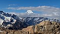
 Burnett Mountains from Mueller Hut, Aoraki - Mount Cook National Park, New Zealand.jpg 10,157 × 4,837; 22.36 MB
-
 Canterbury Earthquake National Memorial - panorama, Christchurch, New Zealand.jpg 14,778 × 3,307; 33.53 MB
-
 Canterbury Earthquake National Memorial, Christchurch City, New Zealand 04.jpg 8,573 × 4,299; 25.13 MB
-
 Canterbury Earthquake National Memorial, Christchurch City, New Zealand.jpg 11,732 × 4,324; 30.87 MB
-
 Canterbury Employers' Chamber of Commerce, 57 Kilmore St, Christchurch, New Zealand.jpg 7,045 × 3,405; 9.74 MB
-
 Canterbury, South Island banner 2.jpg 14,209 × 2,027; 19.11 MB
-
 Canterbury, South Island banner 3.jpg 10,003 × 1,431; 11.2 MB
-
 Canterbury, South Island banner.jpg 7,071 × 1,009; 6.52 MB
-
 Carex secta on Lake Clearwater, Canterbury, New Zealand.jpg 14,843 × 4,567; 52.53 MB
-
 Cass Saddle, Craigieburn Forest Park, New Zealand.jpg 11,737 × 3,551; 31.69 MB
-
 Cass-Lagoon Saddle Track in Cass River Valley, Craigieburn Forest Park, New Zealand.jpg 9,355 × 4,149; 35.62 MB
-
 Cass-Lagoon Saddle Track with Bealey Spur, Craigieburn Forest Park, New Zealand.jpg 11,336 × 2,862; 20.96 MB
-
 Cave Rock panorama during sunset, Sumner, Christchurch, New Zealand.jpg 12,780 × 2,547; 16.04 MB
-
 Centennial Square Fountain, Victoria, British Columbia, Canada 05.jpg 2,713 × 11,397; 26.66 MB
-
 Centennial Square Fountain, Victoria, British Columbia, Canada 06.jpg 2,903 × 12,149; 25.34 MB
-
 Christ's College Music School, Christchurch, New Zealand.jpg 7,458 × 3,242; 24.36 MB
-
 Christchurch Art Gallery, Christchurch, New Zealand.jpg 12,413 × 5,296; 27.67 MB
-
 Christchurch Town Hall - Christchurch, New Zealand 01.jpg 11,818 × 3,399; 25.56 MB
-
 Church of St Michael and All Angels, Christchurch City, New Zealand 05.jpg 9,900 × 4,169; 23.74 MB
-
 Church of the Assumption - tower, Umag, Istria, Croatia 06.jpg 5,411 × 14,181; 38.23 MB
-

-

-
 Cornelius O'Connor Reserve, Christchurch, New Zealand 03.jpg 8,559 × 4,358; 29.53 MB
-
 Craigieburn Edge Track, Craigieburn Range, New Zealand 05.jpg 14,366 × 4,432; 52.03 MB
-
 Craigieburn Range from Helicopter Hill Track, Canterbury, New Zealand 01.jpg 12,940 × 4,981; 48.34 MB
-
 Craigieburn Range from Helicopter Hill Track, Canterbury, New Zealand 05.jpg 14,072 × 4,570; 46.68 MB
-
 Curving Sylvester Lakes Track, Kahurangi National Park, New Zealand 01.jpg 7,633 × 2,880; 18.68 MB
-
 Cusheon Lake in the early morning, Saltspring Island, British Columbia, Canada.jpg 11,009 × 2,521; 16.41 MB
-
 Deloitte Building, Christchurch, New Zealand.jpg 4,502 × 5,391; 12.67 MB
-
 Diamond Harbour from Cass Bay, Canterbury, New Zealand.jpg 8,391 × 1,702; 8.06 MB
-
 Diamond Harbour, Canterbury, New Zealand 05.jpg 10,109 × 3,162; 18.83 MB
-
 Dirt road in the fields, Karpaz, Northern Cyprus.jpg 8,848 × 3,504; 24.16 MB
-
 Duncan Cotterill building from the back, Knox Centre, Christchurch, New Zealand.jpg 13,394 × 4,566; 34.09 MB
-
 Durham Street Gospel Hall, Christchurch, New Zealand.jpg 6,737 × 4,466; 17.69 MB
-
 Esplanade Reserve panorama, Lake Hāwea (town), New Zealand.jpg 13,529 × 2,539; 19.29 MB
-
 Falling Mountain, Arthur's Pass National Park, New Zealand 04.jpg 9,776 × 3,183; 21.78 MB
-
 Falling Mountain, Arthur's Pass National Park, New Zealand 05.jpg 14,862 × 4,104; 43.02 MB
-
 Fog above Lake Heron, Taylor Range, Canterbury, New Zealand.jpg 13,676 × 2,838; 17.01 MB
-
 Fog around Lake Heron, Taylor Range, Canterbury, New Zealand.jpg 16,968 × 3,467; 26.18 MB
-
 French Bay, Akaroa, Canterbury, New Zealand.jpg 10,325 × 2,975; 16.45 MB
-
 Garnet Peak, Poplars Range, Canterbury, New Zealand 05.jpg 12,362 × 4,420; 39.55 MB
-
 Gartur Stitch Farm with trees along a paddock (B&W), Scotland 01.jpg 12,646 × 4,339; 32.04 MB
-
 Glenrock Stream Valley, Black Hill Range, Canterbury, New Zealand.jpg 10,923 × 4,888; 7.7 MB
-
 Hagley Oval, Christchurch, New Zealand (cropped).jpg 2,628 × 1,593; 2.02 MB
-
 Hagley Oval, Christchurch, New Zealand.jpg 11,120 × 2,339; 15.07 MB
-
 Hagley Park, Christchurch, New Zealand 04.jpg 13,175 × 3,018; 25.34 MB
-
 Halswell Quarry, Canterbury, New Zealand 02.jpg 10,609 × 4,101; 37.84 MB
-
 Halswell Quarry, Canterbury, New Zealand 05.jpg 5,695 × 2,550; 13.2 MB
-
 Harbour - Erskine Point in Lyttelton, New Zealand.jpg 12,324 × 2,930; 20.62 MB
-
 Harbour, Kyrenia, Northern Cyprus.jpg 9,808 × 2,859; 17.67 MB
-
 Haydarpasha Mosque, Nicosia, Cyprus 05.jpg 5,119 × 5,757; 14.26 MB
-
 Hills in Lindis Pass, New Zealand.jpg 10,014 × 4,156; 17.42 MB
-
 Hochtor from Hesshütte, Ennstal Alps, Austria.jpg 13,340 × 4,530; 61.45 MB
-
 Hochzinödl, Ennstaler Alpen, Austria.jpg 10,831 × 5,554; 51.49 MB
-
 Horncastle Arena, Christchurch, New Zealand 02.jpg 9,973 × 4,190; 18.35 MB
-
 House of Culture - statues on the top of the building, Ostrava, Czech Republic 17.jpg 19,988 × 4,833; 63.97 MB
-
 Interior of Christchurch Art Gallery, New Zealand 03.jpg 6,365 × 3,449; 9.05 MB
-
 Interior of Christchurch Art Gallery, New Zealand 05.jpg 5,054 × 3,299; 9.29 MB
-
 Iron Lake, Kahurangi National Park, New Zealand 08.jpg 12,297 × 3,678; 35.21 MB
-
 Kaikoura Peninsula, New Zealand.jpg 11,558 × 2,580; 18.17 MB
-
 Korean Presbyterian Church, Christchurch, New Zealand.jpg 8,478 × 3,025; 16.14 MB
-
 Lake Benmore with surrounding hills, New Zealand 01.jpg 12,107 × 3,945; 21.06 MB
-
 Lake Benmore with surrounding hills, New Zealand 02.jpg 11,904 × 3,370; 14.23 MB
-
 Lake Clearwater, Canterbury, New Zealand 03.jpg 12,500 × 4,333; 37.96 MB
-
 Lake Clearwater, Canterbury, New Zealand 09.jpg 11,182 × 2,968; 19.52 MB
-
 Lake Clearwater, Canterbury, New Zealand 15.jpg 12,162 × 3,411; 22.83 MB
-
 Lake Kaniere panorama, West Coast, New Zealand.jpg 10,735 × 2,993; 19.15 MB
-
 Lake Kaniere, West Coast, New Zealand 11.jpg 7,348 × 2,749; 11.52 MB
-
 Lake Man, Doubtful Range, Canterbury, New Zealand 13.jpg 8,192 × 3,077; 19.31 MB
-
 Lake Man, Doubtful Range, Canterbury, New Zealand 14.jpg 9,337 × 4,094; 34.22 MB
-
 Lake Man, Doubtful Range, Canterbury, New Zealand 15.jpg 12,737 × 4,507; 52.6 MB
-
 Lake Poaka, New Zealand.jpg 11,787 × 2,753; 25.02 MB
-
 Lake Pukaki, Canterbury, New Zealand.jpg 16,887 × 3,760; 20.66 MB
-
 Lake Rotoroa, Nelson Lakes National Park, New Zealand (D'Urville River).jpg 2,002 × 1,431; 2.4 MB
-
 Lake Rotoroa, Nelson Lakes National Park, New Zealand (Mount Hutton).jpg 2,523 × 1,927; 3.44 MB
-
 Lake Rotoroa, Nelson Lakes National Park, New Zealand.jpg 9,085 × 2,951; 15.65 MB
-
 Lake Sylvester during the sunrise, Kahurangi, New Zealand.jpg 7,213 × 3,342; 10.93 MB
-
 Landscape close to Dun Saddle, Bryant Range, New Zealand.jpg 19,267 × 3,285; 35.69 MB
-
 Loch Lubnaig from the path to Ben Ledi, Scotland (cropped) P-SCO Panorama.jpg 2,048 × 293; 176 KB
-
 Loch Lubnaig from the path to Ben Ledi, Scotland.jpg 20,997 × 5,039; 59.19 MB
-
 Lyell Peak - Mt Bealey ridge, Avalanche Peak Track, Canterbury, New Zealand 22.jpg 16,699 × 5,190; 55.96 MB
-
 Lyell Peak - Mt Bealey ridge, Avalanche Peak Track, Canterbury, New Zealand 23.jpg 13,173 × 5,119; 47.07 MB
-
 Lyttelton from a pier in Diamond Harbour, New Zealand.jpg 11,411 × 3,385; 20.82 MB
-
 Lyttelton Harbour (Whakaraupō) from Mt Ada, Canterbury, New Zealand.jpg 20,088 × 4,692; 71.05 MB
-
 Lyttelton Harbour, Canterbury, New Zealand 02.jpg 11,488 × 5,085; 34.94 MB
-
 Main ridge of Black Range, New Zealand.jpg 9,852 × 2,858; 17.66 MB
-
 Makarora River, Otago, New Zealand.jpg 15,351 × 3,174; 26.79 MB
-
 Maniniaro - Angelus Peak, Nelson Lakes National Park, New Zealand.jpg 19,835 × 5,127; 41.48 MB
-
 Manuka Bay, Hurunui District, Canterbury, New Zealand 03.jpg 9,004 × 3,032; 18.05 MB
-
 Meall Corranaich, Scottish Highlands, Scotland 02.jpg 13,957 × 4,966; 45.18 MB
-
 Monro Beach, West Coast Region, New Zealand 11.jpg 10,821 × 4,317; 39.38 MB
-
 Morning clouds in Hakatere Conservation Park, Canterbury, New Zealand.jpg 9,543 × 2,599; 8.12 MB
-
 Motukauatirahi - Cass Bay from Coastal Path Lyttelton, Canterbury, New Zealand.jpg 11,256 × 4,367; 39.09 MB
-
 Mount Thomas Forest Park, Canterbury, New Zealand.jpg 14,055 × 3,330; 21.94 MB
-
 Mt Awful, Gillespie Pass, New Zealand 02.jpg 10,531 × 4,861; 32.07 MB
-
 Mt Awful, Gillespie Pass, New Zealand 03.jpg 9,722 × 7,462; 51.51 MB
-
 Mt Bruce (left), Lagoon Saddle and Mid Hill (right), Black Range, Canterbury, New Zealand.jpg 17,264 × 4,842; 64.84 MB
-
 Mt Horrible, Black Range, Canterbury, New Zealand.jpg 8,156 × 3,023; 14.84 MB
-
 Mt Misery from northern side, Black Range, New Zealand.jpg 6,278 × 2,751; 13.61 MB
-
 Mt Sefton massif, Aoraki - Mount Cook National Park, New Zealand.jpg 8,699 × 3,034; 17.34 MB
-
 Mt Somers from Mt Winterslow, Hakatere Conservation Park in Canterbury, New Zealand.jpg 9,106 × 3,093; 15.49 MB
-
 Mt Somers Range from Mt Taylor.jpg 10,578 × 4,510; 31.36 MB
-
 Mt Sugarloaf (1238m) by Lake Heron, New Zealand.jpg 8,240 × 3,153; 13.17 MB
-
 Mt Technical, Lewis Pass Scenic Reserve, New Zealand 01.jpg 10,704 × 3,568; 27.56 MB
-
 Mystery Lake and Two Thumb Range, Canterbury, New Zealand.jpg 12,836 × 4,336; 33.64 MB
-
 North Branch Ashburton River - Hakatere, Canterbury, New Zealand 14.jpg 11,563 × 4,254; 38.14 MB
-
 Northern part of Lake Wanaka with surrounding mountains, New Zealand.jpg 14,714 × 2,740; 15.61 MB
-
 Old ruin and a tree - Karpaz, Northern Cyprus.jpg 8,450 × 3,042; 17.29 MB
-
 Oyster Bay with Willawa Point, New Zealand.jpg 6,594 × 2,805; 16.42 MB
-
 Pancake Range, Canterbury, New Zealand.jpg 7,369 × 2,842; 17.13 MB
-
 Panorama of Hinewai Reserve, Banks Peninsula, New Zealand 02.jpg 18,040 × 4,840; 55.83 MB
-
 Panorama of Hinewai Reserve, Banks Peninsula, New Zealand.jpg 15,517 × 2,512; 24.68 MB
-
 Panorama of Lake Hāwea Cemetery, Lake Hāwea (town), New Zealand.jpg 9,541 × 2,618; 21.69 MB
-
 Panorama of Mueller Hut and Mt Sefton, Aoraki - Mount Cook National Park, New Zealand.jpg 14,432 × 2,745; 19.06 MB
-
 Panorama of Mueller Lake, Aoraki - Mount Cook National Park, New Zealand.jpg 10,804 × 3,548; 23.09 MB
-
 Panorama of northern parts of Christchurch Central City, New Zealand.jpg 18,167 × 4,928; 73.57 MB
-
 Panorama of Taylor Range, Canterbury, New Zealand.jpg 11,529 × 4,538; 31.39 MB
-
 Panorama of the top of 1802 Douglas Street, Victoria, British Columbia, Canada.jpg 10,795 × 3,500; 17.56 MB
-
 Panorama of Umag, Istria, Croatia.jpg 27,147 × 4,861; 71.04 MB
-
 Panoramic view of Black Hill Range, Canterbury, New Zealand.jpg 8,462 × 2,701; 16.81 MB
-
 Panoramics of Black Hill Range, Canterbury, New Zealand 07.jpg 13,912 × 4,091; 45.54 MB
-
 Panoramics view of Double Hill Run Rd and Rakaia River, Canterbury, New Zealand 23.jpg 11,239 × 3,088; 23.77 MB
-
 Pauaohinekotau Head from a pier in Diamond Harbour, New Zealand 02.jpg 12,119 × 3,300; 23.46 MB
-
 Pike of Blisco, Lake District, England.jpg 15,742 × 4,870; 43.8 MB
-
 Planspitze, Ennstaler Alpen, Austria.jpg 10,366 × 4,416; 33.29 MB
-
 Pond, The Groynes, Christchurch, New Zealand.jpg 14,779 × 4,768; 39.3 MB
-
 Port Hill from Coastal Path Lyttelton, Canterbury, New Zealand.jpg 13,484 × 3,143; 21.18 MB
-
 Porters Pass bush fire, Oxford Forest Conservation Area, Canterbury, New Zealand.jpg 19,955 × 3,245; 25.89 MB
-
 Porters Pass with Big Ben Range, Torlesse Range, New Zealand.jpg 13,666 × 3,484; 31.31 MB
-
 Puketeraki Range, Canterbury, New Zealand.jpg 8,541 × 2,874; 18.98 MB
-
 Rainbow over Waimakariri River, New Zealand.jpg 10,685 × 3,332; 11.95 MB
-
 Rakaia River and Double Hill Run Road, Canterbury, New Zealand.jpg 11,684 × 4,488; 38.74 MB
-
 Rakaia River from Black Hill Range, Canterbury, New Zealand.jpg 11,866 × 4,559; 6.31 MB
-
 Rangi Ruru Girls' School, Christchurch, New Zealand 03.jpg 6,206 × 3,195; 9.81 MB
-
 Red Tarn between Cold Pike and Pike of Blisco, Lake District, England 03.jpg 10,944 × 5,330; 32.79 MB
-
 Red Tarn between Cold Pike and Pike of Blisco, Lake District, England 04.jpg 8,535 × 3,665; 22.36 MB
-
 Ridges of Mt Garfield, Doubtful Range, Canterbury, New Zealand.jpg 7,058 × 4,239; 19.74 MB
-
 Rock formation in Hakatere Conservation Park, New Zealand.jpg 6,792 × 3,185; 16.7 MB
-
 Rolleston Range, Canterbury, New Zealand.jpg 10,702 × 3,377; 21.63 MB
-
 Ruckle Heritage Farm, Saltspring Island, British Columbia, Canada 01.jpg 15,582 × 2,989; 35.15 MB
-
 Scarborough, Christchurch, New Zealand.jpg 14,476 × 3,190; 24.4 MB
-
 South Island new banner 1.jpg 12,150 × 1,739; 9.7 MB
-
 South Island new banner 3.jpg 12,500 × 1,788; 14.69 MB
-
 Southern Alps from Kea Point, Aoraki - Mount Cook National Park, New Zealand.jpg 6,734 × 3,788; 20.78 MB
-
 Southshore Spit Reserve, Christchurch, New Zealand.jpg 10,541 × 2,736; 15.19 MB
-
 Speargrass Hut panorama, Nelson Lakes National Park, New Zealand.jpg 11,071 × 3,163; 26.36 MB
-
 St Albans Park panorama, Christchurch, New Zealand.jpg 15,727 × 3,032; 29.03 MB
-
 Stadium ruins in North Nicosia, Cyprus.jpg 14,548 × 3,502; 34.14 MB
-
 Stormy sunset over Waimakariri River basin, New Zealand.jpg 12,951 × 4,890; 21.35 MB
-
 Sumner Head (left) with Rapanui Rock (right), Christchurch, New Zealand.jpg 15,700 × 3,177; 23.85 MB
-
 Sun over Lake Hawea, New Zealand.jpg 7,784 × 3,236; 7.16 MB
-
 Sunrise over Benmore Range, New Zealand.jpg 11,647 × 2,412; 9.69 MB
-
 Tarn in Doubtful Range, Canterbury, New Zealand 10.jpg 7,785 × 4,402; 24.85 MB
-
 Tauranga Bay Seal Colony, New Zealand (2).jpg 7,442 × 2,366; 5.18 MB
-
 Taylor Range from Winterslow Range, Hakatere Conservation Park in Canterbury, New Zealand.jpg 10,145 × 2,833; 16.71 MB
-
 Taylor Range, Canterbury, New Zealand 08.jpg 8,701 × 2,769; 16.76 MB
-
 Te Poho-o-Tamatea from Erskine Point (cropped).jpg 1,151 × 1,884; 1.81 MB
-
 The sun and the moon in South New Brighton's beach, New Zealand.jpg 13,369 × 2,693; 17.37 MB
-
 Top of Mount Sefton, Aoraki - Mount Cook National Park, New Zealand.jpg 10,396 × 5,256; 34.64 MB
-
 Torlesse Range from Helicopter Hill Track, Canterbury, New Zealand 10.jpg 10,020 × 3,632; 26.28 MB
-
 Torlesse Range from Letih Hill, Canterbury, New Zealand.jpg 11,636 × 2,553; 20.81 MB
-
 Torlesse Range from Mt Torlesse, New Zealand.jpg 11,968 × 3,181; 21.03 MB
-
 Torlesse Range panoramics, Canterbury, New Zealand.jpg 13,430 × 3,148; 26.91 MB
-
 Torlesse Range with Castle Hill Village, Canterbury, New Zealand.jpg 8,940 × 2,798; 17.05 MB
-
 Travis Wetland panorama, Christchurch, New Zealand.jpg 22,032 × 3,387; 50.33 MB
-
 Tree tops during the sunset, Bowness on Windermere, England.jpg 12,165 × 4,757; 28.6 MB
-
 Trees and a pond, The Groynes, Christchurch, New Zealand.jpg 7,889 × 4,857; 26.92 MB
-
 Trees reflected in a pond, The Groynes, Christchurch, New Zealand.jpg 4,581 × 4,685; 15.37 MB
-
 Two Thumb Range, Canterbury, New Zealand 02.jpg 5,167 × 2,000; 7.44 MB
-
 Two Thumb Range, Canterbury, New Zealand.jpg 20,902 × 3,335; 34.98 MB
-
 Tūranga, Christchurch, New Zealand.jpg 14,015 × 6,416; 59.02 MB
-
 Unfinished rooms by Apostolos Andreas Monastery, Northern Cyprus.jpg 22,732 × 3,134; 48.51 MB
-
 View from Bowenvale Reserve towards Christchurch, New Zealand.jpg 10,055 × 3,236; 18.45 MB
-
 View from Foggy Peak to Castle Hill Peak, Torlesse Range, New Zealand.jpg 15,108 × 3,183; 19.79 MB


.jpg)


.jpg)
.jpg)


.jpg)


,_New_Zealand.jpg)
,_Scotland_01.jpg)
_P-SCO_Panorama.jpg)
_from_Mt_Ada,_Canterbury,_New_Zealand.jpg)
,_Lagoon_Saddle_and_Mid_Hill_(right),_Black_Range,_Canterbury,_New_Zealand.jpg)
_by_Lake_Heron,_New_Zealand.jpg)
,_New_Zealand.jpg)
_with_Rapanui_Rock_(right),_Christchurch,_New_Zealand.jpg)
.jpg)