Category:Pannenhoef
Jump to navigation
Jump to search
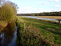
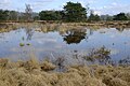
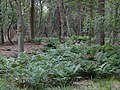
{{nl|Afbeeldingen van de Pannenhoef, een natuurgebied van circa 706 ha gelegen tussen Zundert, Etten-Leur en Rijsbergen in de provincie Noord-Brabant in het zuiden van Nederland. De Pannenhoef is eigendom van de Stichting Brabants Landschap. (bron [1];[2])
_-_Aerial_photograph.jpg) | |||||
| Upload media | |||||
| Instance of | |||||
|---|---|---|---|---|---|
| Location | Breda, North Brabant, Netherlands | ||||
| Area |
| ||||
 | |||||
Nederlands: Pannenhoef, Brabants Landschap, Etten-Leur, Zundert, Zundert (gemeente), Noord-Brabant, Nederland
Subcategories
This category has the following 4 subcategories, out of 4 total.
D
- De Werelddragers (4 F)
F
- Fauna Pannenhoef (23 F)
I
- Informatie Pannenhoef (17 F)
Z
- Zwarte Schuur Pannenhoef (25 F)
Media in category "Pannenhoef"
The following 85 files are in this category, out of 85 total.
-
 Bijloop Pannenhoef DSCF2694.JPG 2,816 × 2,112; 2.77 MB
-
 Bruggetje Pannenhoef DSCF6198.JPG 2,816 × 2,112; 2.89 MB
-
 Jachtopzienerswoning , Landgoed de Pannenhoef, Bestanddeelnr 192-0194.jpg 3,283 × 2,502; 1.65 MB
-
 Natuur nabij Zwarte Schuur Pannenhoef P1110637.jpg 4,000 × 2,672; 5.18 MB
-
 Natuur Pannenhoef DSCF0225.jpg 2,048 × 1,536; 1.55 MB
-
 Natuur Pannenhoef DSCF0226.jpg 1,536 × 2,048; 1.62 MB
-
 Natuur Pannenhoef DSCF0228.jpg 2,048 × 1,536; 1.52 MB
-
 Natuur Pannenhoef DSCF0231.jpg 2,048 × 1,536; 1.55 MB
-
 Natuur Pannenhoef DSCF0232.jpg 2,048 × 1,536; 1.53 MB
-
 Natuur Pannenhoef P1110641.jpg 4,000 × 2,672; 5.22 MB
-
 Natuur Pannenhoef P1110647.jpg 2,672 × 4,000; 5.31 MB
-
 Natuur Pannenhoef P1110649.jpg 4,000 × 2,672; 4.93 MB
-
 Pannehoef Rijsbergen Zundert DSCF4996.JPG 4,000 × 3,000; 4.89 MB
-
 Pannenhoef (De Lokker) - Aerial photograph.jpg 2,080 × 1,376; 539 KB
-
 Pannenhoef DSCF0213.jpg 1,536 × 2,048; 1.53 MB
-
 Pannenhoef DSCF2687.JPG 2,112 × 2,816; 2.69 MB
-
 Pannenhoef DSCF2688.JPG 2,816 × 2,112; 2.91 MB
-
 Pannenhoef DSCF2689.JPG 2,816 × 2,112; 2.71 MB
-
 Pannenhoef DSCF2690.JPG 2,816 × 2,112; 2.79 MB
-
 Pannenhoef DSCF2693.JPG 2,816 × 2,112; 2.77 MB
-
 Pannenhoef DSCF2695.JPG 2,816 × 2,112; 2.95 MB
-
 Pannenhoef DSCF2696.JPG 2,816 × 2,112; 2.83 MB
-
 Pannenhoef DSCF2697.JPG 2,816 × 2,112; 2.67 MB
-
 Pannenhoef DSCF2698.JPG 2,816 × 2,112; 2.62 MB
-
 Pannenhoef DSCF2703.JPG 2,112 × 2,816; 2.89 MB
-
 Pannenhoef DSCF2704.JPG 2,816 × 2,112; 2.54 MB
-
 Pannenhoef DSCF6119.JPG 2,816 × 2,112; 2.74 MB
-
 Pannenhoef DSCF6121.JPG 2,816 × 2,112; 2.71 MB
-
 Pannenhoef DSCF6122.JPG 2,112 × 2,816; 2.72 MB
-
 Pannenhoef DSCF6123.JPG 2,816 × 2,112; 2.76 MB
-
 Pannenhoef DSCF6124.JPG 2,816 × 2,112; 2.87 MB
-
 Pannenhoef DSCF6125.JPG 2,816 × 2,112; 2.77 MB
-
 Pannenhoef DSCF6149.JPG 2,816 × 2,112; 2.9 MB
-
 Pannenhoef DSCF6150.JPG 2,816 × 2,112; 2.91 MB
-
 Pannenhoef DSCF6151.JPG 2,112 × 2,816; 2.74 MB
-
 Pannenhoef DSCF6152.JPG 2,816 × 2,112; 2.93 MB
-
 Pannenhoef DSCF6153.JPG 2,816 × 2,112; 2.89 MB
-
 Pannenhoef DSCF6154.JPG 2,816 × 2,112; 2.89 MB
-
 Pannenhoef DSCF6155.JPG 2,816 × 2,112; 2.87 MB
-
 Pannenhoef DSCF6157.JPG 2,816 × 2,112; 2.73 MB
-
 Pannenhoef DSCF6159.JPG 2,816 × 2,112; 2.97 MB
-
 Pannenhoef DSCF6160.JPG 2,816 × 2,112; 2.92 MB
-
 Pannenhoef DSCF6161.JPG 2,816 × 2,112; 2.99 MB
-
 Pannenhoef DSCF6163.JPG 2,816 × 2,112; 2.87 MB
-
 Pannenhoef DSCF6167.JPG 2,816 × 2,112; 2.89 MB
-
 Pannenhoef DSCF6169.JPG 2,816 × 2,112; 2.82 MB
-
 Pannenhoef DSCF6170.JPG 2,112 × 2,816; 2.76 MB
-
 Pannenhoef DSCF6172.JPG 2,816 × 2,112; 2.91 MB
-
 Pannenhoef DSCF6174.JPG 2,816 × 2,112; 2.83 MB
-
 Pannenhoef DSCF6175.JPG 2,816 × 2,112; 2.87 MB
-
 Pannenhoef DSCF6199.JPG 2,112 × 2,816; 2.83 MB
-
 Pannenhoef DSCF6200.JPG 2,816 × 2,112; 2.93 MB
-
 Pannenhoef DSCF6201.JPG 2,816 × 2,112; 2.68 MB
-
 Pannenhoef DSCF6203.JPG 2,816 × 2,112; 2.6 MB
-
 Pannenhoef DSCF6208.JPG 2,816 × 2,112; 2.9 MB
-
 Pannenhoef DSCF6209.JPG 2,112 × 2,816; 2.81 MB
-
 Pannenhoef DSCF6211.JPG 2,816 × 2,112; 2.85 MB
-
 Pannenhoef DSCF6212.JPG 2,816 × 2,112; 2.59 MB
-
 Pannenhoef DSCF6214.JPG 2,816 × 2,112; 2.73 MB
-
 Pannenhoef DSCF6225.JPG 2,816 × 2,112; 2.87 MB
-
 Pannenhoef DSF7294.JPG 4,896 × 3,264; 6.12 MB
-
 Pannenhoef DSF7295.JPG 4,896 × 3,264; 6.28 MB
-
 Pannenhoef DSF7302.JPG 4,896 × 3,264; 6.9 MB
-
 Pannenhoef DSF7304.JPG 4,896 × 3,264; 5.97 MB
-
 Pannenhoef P1070388.JPG 3,264 × 2,448; 3.99 MB
-
 Pannenhoef P1070389.JPG 3,264 × 2,448; 3.61 MB
-
 Pannenhoef P1070390.JPG 3,264 × 2,448; 3.76 MB
-
 Pannenhoef P1070393.JPG 3,264 × 2,448; 4.03 MB
-
 Pannenhoef P1110628.jpg 4,000 × 2,672; 5.38 MB
-
 Pannenhoef P1110633.jpg 4,000 × 2,672; 5.16 MB
-
 Pannenhoef P1110635.jpg 4,000 × 2,672; 5.23 MB
-
 Pannenhoef P1110651.jpg 2,672 × 4,000; 4.99 MB
-
 Pannenhoef Rijsbergen Zundert DSCF4997.JPG 4,000 × 3,000; 4.69 MB
-
 Pannenhoef Rijsbergen Zundert DSCF4999 - kopie.JPG 4,000 × 3,000; 4.42 MB
-
 Pannenhoef Rijsbergen Zundert DSCF5001.JPG 3,767 × 2,694; 3.66 MB
-
 Pannenhoef Rijsbergen Zundert DSCF5002.JPG 3,406 × 2,264; 2.83 MB
-
 Pannenhoef Rijsbergen Zundert DSCF5003 - kopie.JPG 3,059 × 2,045; 2.27 MB
-
 Pannenhoef Rijsbergen Zundert DSCF5003.JPG 4,000 × 3,000; 4.7 MB
-
 Pannenhoef Rijsbergen Zundert DSCF5004.JPG 4,000 × 3,000; 4.68 MB
-
 Pannenhoef Rijsbergen Zundert DSCF5005.JPG 4,000 × 3,000; 4.61 MB
-
 Pannenhoef Rijsbergen Zundert DSCF5006.JPG 4,000 × 3,000; 4.8 MB
-
 Pannenhoef Rijsbergen Zundert DSCF5007.JPG 4,000 × 3,000; 4.83 MB
-
 Pannenhoef Rijsbergen Zundert DSCF5008.JPG 4,000 × 3,000; 4.86 MB
-
 Turfvaart Rijsbergen Zundert DSCF4998.JPG 4,000 × 3,000; 4.78 MB
-
 Varens Pannenhoef P1110643.jpg 4,000 × 2,672; 4.88 MB


