Category:Pan Chung Road
Jump to navigation
Jump to search
| Object location | | View all coordinates using: OpenStreetMap |
|---|
road in Tai Po  | |||||
| Upload media | |||||
| Instance of | |||||
|---|---|---|---|---|---|
| Location | Tai Po District, New Territories, Hong Kong, PRC | ||||
 | |||||
中文:泮涌路
Subcategories
This category has the following 4 subcategories, out of 4 total.
2
- 2023 in Pan Chung Road (5 F)
E
- Entrance gate of Pan Chung (12 F)
P
- Pan Chung Village Office (3 F)
- Pan Chung Village, Tai Po (5 F)
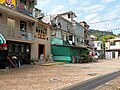
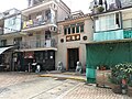
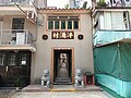
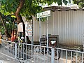
Media in category "Pan Chung Road"
The following 14 files are in this category, out of 14 total.
-
 HK PanChung.JPG 2,848 × 2,136; 1.57 MB
-
 HK TPD 大埔 Tai Po 泮涌路 Pan Chung Road tunnel December 2023 R12S 01.jpg 4,000 × 3,000; 5.26 MB
-
 HK TPD 大埔 Tai Po 泮涌路 Pan Chung Road tunnel December 2023 R12S 05.jpg 4,000 × 3,000; 6.28 MB
-
 HK TPD 大埔 Tai Po 泮涌路 Pan Chung Road village December 2023 R12S 02.jpg 4,000 × 3,000; 3.93 MB
-
 HK TPD 大埔 Tai Po 泮涌路 Pan Chung Road village December 2023 R12S 03.jpg 3,000 × 4,000; 4.94 MB
-
 HK TPD 大埔 Tai Po 泮涌路 Pan Chung Road village December 2023 R12S 04.jpg 3,000 × 4,000; 3.23 MB
-
 Pan Chung 01.jpg 2,592 × 1,944; 1.16 MB
-
 Pan Chung 02.jpg 3,315 × 2,486; 2.16 MB
-
 Pan Chung 03.jpg 4,000 × 3,000; 3.73 MB
-
 Pan Chung 04.jpg 4,000 × 3,000; 4.09 MB
-
 Pan Chung 05.jpg 4,000 × 3,000; 3.81 MB
-
 Pan Chung 06.jpg 4,000 × 3,000; 3 MB
-
 Pan Chung 07.jpg 4,000 × 3,000; 4.63 MB
-
 Pan Chung 17.jpg 4,000 × 3,000; 3.65 MB


