Category:Pamir Alpine Desert and Tundra Ecoregion
Jump to navigation
Jump to search
Ecoregion (WWF) _(31745603164).jpg)  | |||||
| Upload media | |||||
| Instance of | |||||
|---|---|---|---|---|---|
| Location |
| ||||
| Area |
| ||||
 | |||||
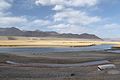
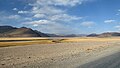
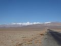
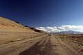
The Pamir Alpine Desert and Tundra Ecoregion is a designated ecoregion by WWF and One Earth. It is classified as a Montane Grasslands & Shrublands Biome. It is one of eight ecoregions in the Tibetan-Pamir Alpine Steppes, Shrublands & Mountain Forests Bioregion.
Subcategories
This category has the following 9 subcategories, out of 9 total.
*
A
- Ak-Baital Pass (9 F)
B
- Bulunkul (4 F)
C
- Chukurkul Lake (2 F)
K
- Karakul lake (1 P, 53 F)
R
- Rangkul (1 F)
S
- Sasikul (4 F)
Media in category "Pamir Alpine Desert and Tundra Ecoregion"
The following 71 files are in this category, out of 71 total.
-
 Afghan peasants (32214816410).jpg 4,000 × 3,000; 4.79 MB
-
 Ak Balyk (1) (32441222652).jpg 3,410 × 2,315; 3.77 MB
-
 Ak Balyk (2) (32471159501).jpg 3,365 × 2,384; 4.16 MB
-
 Along the road (1) (31782006683).jpg 3,236 × 2,008; 3.61 MB
-
 Along the road (2) (32553339546).jpg 3,410 × 2,245; 3.69 MB
-
 Along the road north of Ak-Baital (1) (32302472051).jpg 3,344 × 2,141; 4.75 MB
-
 Along the road north of Ak-Baital (2) (31611769323).jpg 3,344 × 2,141; 4.84 MB
-
 Along the road north of Ak-Baital (3) (32302447461).jpg 3,249 × 2,158; 4.15 MB
-
 Along the road north of Ak-Baital (4) (32383385056).jpg 3,184 × 2,116; 3.85 MB
-
 Along the road north of Ak-Baital (5) (32383369626).jpg 3,270 × 2,094; 3.33 MB
-
 Along the road north of Ak-Baital (6) (32423282055).jpg 2,673 × 1,533; 1.69 MB
-
 Along the road north of Ak-Baital (7) (32423277255).jpg 3,350 × 2,157; 4.84 MB
-
 Border crossing (1) (31745676774).jpg 3,410 × 2,558; 4.21 MB
-
 By Sassyk Kul (1) (31781986343).jpg 3,410 × 2,558; 5 MB
-
 By Sassyk Kul (2) (32441060302).jpg 3,406 × 2,249; 4.83 MB
-
 By the border to China (31777396853).jpg 3,406 × 2,202; 4.53 MB
-
 Close to the border (1) (32466392581).jpg 3,410 × 2,558; 4.86 MB
-
 Close to the border (2) (32548773076).jpg 2,704 × 1,685; 1.91 MB
-
 Close to the border (3) (32436472542).jpg 3,327 × 2,153; 3.85 MB
-
 Close to the border (4) (31745603164).jpg 3,410 × 2,091; 3.6 MB
-
 Country road (31750101394).jpg 3,410 × 2,558; 4.99 MB
-
 Grazing animals (32214623800).jpg 3,356 × 1,940; 3.92 MB
-
 High mountain plateau (1) (31781903513).jpg 3,410 × 2,174; 3.64 MB
-
 High mountain plateau (2) (32214595400).jpg 3,234 × 2,146; 2.98 MB
-
 High mountain plateau (3) (32440973162).jpg 3,311 × 1,984; 3.25 MB
-
 High mountain plateau (4) (32214570010).jpg 2,868 × 1,534; 3.11 MB
-
 High mountain plateau (5) (32553177486).jpg 3,303 × 2,032; 3.36 MB
-
 High mountain plateau (6) (32553157486).jpg 3,092 × 1,752; 3.41 MB
-
 High mountain plateau (7) (31749994524).jpg 3,410 × 2,234; 3.95 MB
-
 High mountain plateau (8) (32553125676).jpg 3,410 × 2,558; 5.21 MB
-
 Hindu Kush mountains (32152360881).jpg 3,410 × 2,558; 4.37 MB
-
 Horses on the afghan side (31781806403).jpg 3,740 × 2,595; 8.42 MB
-
 Leaving Wakhan valley (31749902534).jpg 3,251 × 1,937; 3.64 MB
-
 Lk Karakol - panoramio.jpg 1,600 × 1,200; 805 KB
-
 Meandering river (1) (31749866124).jpg 3,410 × 2,558; 4.52 MB
-
 Meandering river (2) (32470743391).jpg 3,410 × 2,558; 4.73 MB
-
 Mountain valley (1) (31781717183).jpg 3,410 × 2,267; 3.02 MB
-
 Mountain valley (2) (32552951366).jpg 3,410 × 2,235; 3.95 MB
-
 Mountains of China (32589269515).jpg 3,196 × 2,064; 3.24 MB
-
 On the road (32589248325).jpg 3,228 × 1,851; 4.03 MB
-
 P1020443 (32470688751).jpg 4,000 × 3,000; 4.76 MB
-
 Pamir highway (1) (32589227285).jpg 3,410 × 2,558; 3.99 MB
-
 Pamir highway (2) (32589203445).jpg 3,410 × 2,558; 3.57 MB
-
 Pamir highway (3) (32548656056).jpg 3,410 × 2,558; 4.36 MB
-
 Pamir Highway (32440758982).jpg 3,270 × 2,334; 5.54 MB
-
 Pamir highway (4) (32210102480).jpg 3,410 × 2,558; 4.52 MB
-
 Pamir highway near karakul.JPG 3,456 × 2,304; 3.32 MB
-
 Roof of the world (1) (32436728082).jpg 3,410 × 2,134; 3.97 MB
-
 Roof of the world (2) (32549056356).jpg 3,410 × 2,558; 4.94 MB
-
 Roof of the world (3) (32436709552).jpg 3,405 × 2,239; 3.48 MB
-
 Roof of the world (4) (32436698292).jpg 3,410 × 2,176; 3.9 MB
-
 Tajik chinese border karakul.jpg 3,931 × 2,620; 3.47 MB
-
 The first snow has arrived (1) (32548989996).jpg 3,410 × 2,558; 5.34 MB
-
 The first snow has arrived (2) (32548967426).jpg 3,410 × 2,558; 5.82 MB
-
 The first snow has arrived (3) (32589504345).jpg 3,406 × 2,150; 4.29 MB
-
 The first snow has arrived (4) (32210376820).jpg 3,410 × 2,558; 5.17 MB
-
 The first snow has arrived (5) (31777507603).jpg 3,410 × 2,558; 5.5 MB
-
 The lonely cyclist (1) (31749732974).jpg 3,181 × 1,883; 4.32 MB
-
 The lonely cyclist (2) (32440685022).jpg 3,000 × 2,250; 4.69 MB
-
 The lonely cyclist (32214235040).jpg 2,076 × 1,203; 1.89 MB
-
 The Pamir Highway (1) (32470556671).jpg 3,410 × 2,140; 4.83 MB
-
 The Pamir Highway (2) (32593500355).jpg 3,399 × 2,278; 4.3 MB
-
 The Pamir Highway (3) (32214207460).jpg 3,410 × 2,195; 4.08 MB
-
 The road and the plains (31749611934).jpg 3,410 × 2,245; 4.12 MB
-
 Towards the chinese border (31781509483).jpg 4,000 × 3,000; 4.53 MB
-
 Wakhan Langar.jpg 1,024 × 576; 129 KB
-
 Wakhan Valley (2) (32381993991).jpg 3,399 × 2,243; 3.45 MB
-
 White Fish Lake near Alichur.jpg 4,326 × 2,883; 4.69 MB
-
 Jan Kwiatowski & Iwona Jasser - Wyprawa po sine runo - 07.jpg 2,768 × 1,836; 3.78 MB
-
 Jan Kwiatowski & Iwona Jasser - Wyprawa po sine runo - 09.jpg 2,873 × 1,836; 3.71 MB
-
 Чуруркуль.jpg 4,433 × 2,955; 3.79 MB
.jpg)
_(32441222652).jpg)
_(32471159501).jpg)
_(31782006683).jpg)
_(32553339546).jpg)
_(32302472051).jpg)
_(31611769323).jpg)
_(32302447461).jpg)
_(32383385056).jpg)
_(32383369626).jpg)
_(32423282055).jpg)
_(32423277255).jpg)
_(31745676774).jpg)
_(31781986343).jpg)
_(32441060302).jpg)
.jpg)
_(32466392581).jpg)
_(32548773076).jpg)
_(32436472542).jpg)
.jpg)
.jpg)
_(31781903513).jpg)
_(32214595400).jpg)
_(32440973162).jpg)
_(32214570010).jpg)
_(32553177486).jpg)
_(32553157486).jpg)
_(31749994524).jpg)
_(32553125676).jpg)
.jpg)
.jpg)
.jpg)

_(31749866124).jpg)
_(32470743391).jpg)
_(31781717183).jpg)
_(32552951366).jpg)
.jpg)
.jpg)
.jpg)
_(32589227285).jpg)
_(32589203445).jpg)
_(32548656056).jpg)
.jpg)
_(32210102480).jpg)

_(32436728082).jpg)
_(32549056356).jpg)
_(32436709552).jpg)
_(32436698292).jpg)

_(32548989996).jpg)
_(32548967426).jpg)
_(32589504345).jpg)
_(32210376820).jpg)
_(31777507603).jpg)
_(31749732974).jpg)
_(32440685022).jpg)
.jpg)
_(32470556671).jpg)
_(32593500355).jpg)
_(32214207460).jpg)
.jpg)
.jpg)

_(32381993991).jpg)


Categories:
- Tibetan-Pamir Alpine Steppes, Shrublands & Mountain Forests Bioregion
- Montane Grasslands & Shrublands Biome (One Earth)
- Ecoregions of Tajikistan (One Earth)
- Ecoregions of China (One Earth)
- Ecoregions of Kyrgyzstan (One Earth)
- Ecoregions of Afghanistan (One Earth)
- Ecoregions of Uzbekistan (One Earth)
- Terrestrial Ecoregions of Eastern Eurasia (One Earth)
- WWF ecoregions by name