Category:Palling
Jump to navigation
Jump to search
municipality of Germany    | |||||
| Upload media | |||||
| Instance of |
| ||||
|---|---|---|---|---|---|
| Part of |
| ||||
| Location | Traunstein, Upper Bavaria, Bavaria, Germany | ||||
| Head of government |
| ||||
| Population |
| ||||
| Area |
| ||||
| Elevation above sea level |
| ||||
| official website | |||||
 | |||||
Subcategories
This category has the following 4 subcategories, out of 4 total.
Media in category "Palling"
The following 19 files are in this category, out of 19 total.
-
 Abschnittsbefestigung Palling.PNG 608 × 368; 496 KB
-
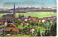
 AK - Palling - 1908.jpg 1,600 × 1,065; 380 KB
-
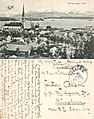
 AK - Palling gegen Süden - 1914.jpg 1,600 × 1,009; 388 KB
-
 AK - Palling gegen Süden - 1917.jpg 1,600 × 2,030; 2.72 MB
-
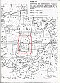
 Amt Palling des Pflegegerichtes Tittmoning von Heinrich Held 1909.jpg 1,626 × 1,418; 618 KB
-
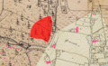
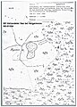
 Bayern, Uraufnahme (1808-1864), Toteisverlandungen, östlich Harpfetsham.png 1,393 × 644; 1.79 MB
-
 Bayern, Uraufnahme (1808-1864), Verlandeter See bei Heigermoos.jpg 696 × 517; 158 KB
-
 DEU Palling COA.svg 512 × 484; 78 KB
-
 Drei Toteisverlandungen östlich Harpfetsham Amtsblatt.jpg 1,700 × 1,525; 554 KB
-
 Grenzmarkierung Rupertiwinkel Chiemgau 03.jpg 1,518 × 2,024; 879 KB
-
 Hochmoor östlich Harpfetsham Amtsblatt.jpg 1,700 × 2,338; 1.27 MB
-
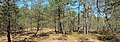 Hochmoor östlich Harpfetsham.jpg 4,895 × 1,727; 11.17 MB
-
 Mariä Geburt (Palling) 3.jpg 3,024 × 3,024; 2.28 MB
-
 ND Haigermoos.jpg 4,895 × 1,727; 10.13 MB
-
 ND Heigermoos Amtsblatt.jpg 810 × 1,127; 328 KB
-
 Palling in TS.svg 652 × 820; 1.35 MB
-
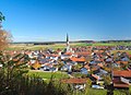 Palling vom Kalvarienberg.jpg 2,000 × 1,448; 2.07 MB
-
 Toteisloch östlich Harpfetsham.jpg 4,896 × 2,760; 19.75 MB
-
 Wappen Palling.png 158 × 170; 4 KB


,_Toteisverlandungen,_%C3%B6stlich_Harpfetsham.png)
,_Verlandeter_See_bei_Heigermoos.jpg)


_3.jpg)


