Category:Palestine Open Maps
Jump to navigation
Jump to search
website devoted to comparing current OpenStreetMaps with maps of Palestine from 1940s  | |||||
| Upload media | |||||
| Instance of |
| ||||
|---|---|---|---|---|---|
| Subclass of | |||||
| Owned by |
| ||||
| Inception |
| ||||
| official website | |||||
| |||||
Media in category "Palestine Open Maps"
The following 7 files are in this category, out of 7 total.
-
 Ashkelon 2020 street map overlaid on Survey of Palestine map from 1942.png 619 × 738; 1.13 MB
-

-
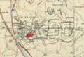
 El'ad 2020 street map overlaid on Survey of Palestine map from 1941.gif 677 × 492; 611 KB
-
 El'ad 2020 street map overlaid on Survey of Palestine map from 1941.png 727 × 493; 698 KB
-
 Nesher 2018 street map overlaid on Survey of Palestine map from 1932.png 1,116 × 682; 1.77 MB
-

-
 Safed 2020 street map overlaid on Survey of Palestine map from 1942.png 1,090 × 785; 1.9 MB

.png)


.png)
