Category:Paleogene volcanism of Scotland
Jump to navigation
Jump to search
| Preceded by Proterozoic Eon | Phanerozoic Eon | |||||||||||
|---|---|---|---|---|---|---|---|---|---|---|---|---|
| Paleozoic Era | Mesozoic Era | Cenozoic Era | ||||||||||
| Cambrian | Ordovician | Silurian | Devonian | Carboniferous | Permian | Triassic | Jurassic | Cretaceous | Paleogene | Neogene | 4ry | |
| Paleogene | Neogene | Quaternary | ||||
|---|---|---|---|---|---|---|
| Paleocene | Eocene | Oligocene | Miocene | Pliocene | Pleistocene | Holocene |
Subcategories
This category has the following 29 subcategories, out of 29 total.
*
A
- Ardnamurchan ring dike (8 F)
B
- Beinn na Caillich (Red Hills) (20 F)
C
E
I
- Iorcail (8 F)
K
L
M
N
P
- Preshal Beg (5 F)
R
S
- Skye Lava Group (2 F)
U
Media in category "Paleogene volcanism of Scotland"
The following 60 files are in this category, out of 60 total.
-

-
 Achnaha in volcanic ring.jpg 3,284 × 533; 249 KB
-
 Ardnamurchan Ring Dyke - geograph.org.uk - 850232.jpg 640 × 480; 34 KB
-
 Ardnamurchan Ring Dyke - geograph.org.uk - 850245.jpg 640 × 480; 100 KB
-
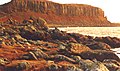
 Basalt cliffs, Isle of Canna - geograph.org.uk - 304048.jpg 1,600 × 1,067; 652 KB
-
 Basalt dyke, Calgary Bay - geograph.org.uk - 1312246.jpg 640 × 480; 114 KB
-
 Basalt Rock Formation - geograph.org.uk - 180882.jpg 640 × 480; 132 KB
-
 British Tertiary Volcanic Province.png 1,200 × 1,840; 1.29 MB
-
 Canna (Canaigh) Cliffs 2.jpg 5,184 × 3,456; 13.91 MB
-
 Cliffs at Blackwaterfoot, Arran.JPG 2,498 × 1,624; 1.3 MB
-
 Cliffs lying beneath Compass Hill, Canna - geograph.org.uk - 1452827.jpg 640 × 426; 105 KB
-
 Cliffs near Kildonan - geograph.org.uk - 125583.jpg 480 × 640; 173 KB
-
 Cnoc Ghreannabric, Sanday - geograph.org.uk - 902152.jpg 640 × 480; 95 KB
-
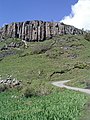
 Columnar basalt on Preshal Beag - geograph.org.uk - 798506.jpg 640 × 461; 209 KB
-
 Cone Sheet Mingary Ardnamurchan 01.jpg 640 × 480; 491 KB
-
 Creag Brimishgan - Flickr - Graham Grinner Lewis.jpg 2,048 × 1,536; 615 KB
-
 Dolerite cone-sheets - geograph.org.uk - 902837.jpg 640 × 480; 97 KB
-
 Drumadoon Point - geograph.org.uk - 9039.jpg 640 × 381; 196 KB
-
 Dyke from the shore - geograph.org.uk - 1213426.jpg 600 × 450; 345 KB
-
 Dyke in schist - geograph.org.uk - 902854.jpg 480 × 640; 105 KB
-
 Dyke Mull ss 2007.JPG 1,600 × 1,200; 971 KB
-
 Dyke on the beach - geograph.org.uk - 756682.jpg 480 × 640; 63 KB
-
 Dyke on the cliffs of Sron Vourlinn - geograph.org.uk - 1266672.jpg 480 × 640; 109 KB
-
 Dyke on the shore - geograph.org.uk - 1213416.jpg 640 × 480; 113 KB
-
 Gabbro from Rum in Scotland - Thin Section.jpg 1,024 × 655; 391 KB
-
 Glendrian - geograph.org.uk - 439634.jpg 640 × 480; 109 KB
-
 Granophyre screes - geograph.org.uk - 403664.jpg 640 × 480; 108 KB
-
 Igneous Dyke at Meall Breac on Rum in Scotland - Geograph 2506575.jpg 800 × 531; 175 KB
-

-
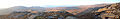
 Isle of Skye - panorama from Knoydart.jpg 4,288 × 2,848; 10.17 MB
-
 Layered Gabbro in Ardnamurchan in Scotland - geograph 3656877.jpg 640 × 480; 505 KB
-
 Layered Gabbro in Ardnamurchan in Scotland - geograph 3656890.jpg 640 × 425; 457 KB
-
 Layered Gabbro in Ardnamurchan in Scotland - geograph 3656953.jpg 480 × 640; 152 KB
-
 Looking over Loch Eishort (8016226661).jpg 4,752 × 3,168; 8.6 MB
-
 Meall an Fhìr-eòin - geograph.org.uk - 439637.jpg 640 × 480; 101 KB
-
 Near Tianavaig Bay on Isle of Skye in Scotland - (Flickr 31865525608).jpg 5,751 × 3,834; 10.18 MB
-
 Part of Judds Dykes - geograph.org.uk - 1154119.jpg 640 × 480; 79 KB
-
 Rainbow at Lion Rock - geograph.org.uk - 360390.jpg 640 × 480; 55 KB
-
 Road to Kilchoan - geograph.org.uk - 1804659.jpg 3,264 × 2,448; 1.77 MB
-
 Sailing past Lion Rock Cumbrae (3603673292).jpg 1,600 × 1,290; 594 KB
-
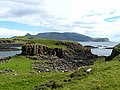
 Sanday (Sandaigh) Dun Mor 1.jpg 5,184 × 3,456; 12.2 MB
-
 Sanday (Sandaigh) Dun Mor 2.jpg 5,184 × 3,456; 12.5 MB
-
 Sanday (Sandaigh) Dun Mor 3.jpg 5,184 × 3,456; 12.03 MB
-
 Sanna Bay - geograph.org.uk - 1804456.jpg 3,264 × 2,448; 1.81 MB
-
 Scotland, Isle of Arran, Kildonan, Dykes.JPG 1,424 × 2,144; 1.77 MB
-
 Sea cave by Dun Mor - geograph.org.uk - 880064.jpg 640 × 419; 216 KB
-
 Sgurr of Eigg in Scotland 20060517 B.jpg 3,264 × 2,448; 3.5 MB
-
 Sgurr of Eigg in Scotland 20060517 C.jpg 3,264 × 2,448; 3.24 MB
-
 Sgurr of Eigg in Scotland 20060517 D.jpg 3,264 × 2,448; 3.64 MB
-
 Sgurr of Eigg in Scotland 20060517 E.jpg 3,264 × 2,448; 3.54 MB
-
 Skye Geology.png 971 × 1,068; 296 KB
-
 Staffa NE 14673.JPG 1,600 × 1,200; 1.13 MB
-
 The Lion Rock, Millport, Great Cumbrae - geograph.org.uk - 1700022.jpg 640 × 427; 143 KB
-
 Track to Glendrian - geograph.org.uk - 743323.jpg 640 × 360; 63 KB
-
 Volcanic dyke - geograph.org.uk - 264711.jpg 640 × 480; 44 KB
-

-
-
 Cone sheet at Mingary - geograph.org.uk - 4378.jpg 640 × 435; 93 KB
-
 Fishing boat in Loch Dunvegan - geograph.org.uk - 759506.jpg 640 × 427; 119 KB
-
 Sandy beach by Sanday roadbridge - geograph.org.uk - 304179.jpg 640 × 427; 104 KB


_Cliffs_2.jpg)


.jpg)

.jpg)


.jpg)
_Dun_Mor_1.jpg)
_Dun_Mor_2.jpg)
_Dun_Mor_3.jpg)


