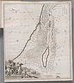
Category:Palaestina ex Monumentis Veteribus Illustrata
Jump to navigation
Jump to search
Media in category "Palaestina ex Monumentis Veteribus Illustrata"
The following 8 files are in this category, out of 8 total.
-
Palaestinae quatuor facies - per Hadrian Relandum.jpg 9,446 × 11,498; 18.09 MB
-
Reland four historical maps of Palestine.jpg 1,500 × 1,822; 251 KB
-
Reland map of Palestine (Biblical triangulation).jpg 4,591 × 5,212; 5.75 MB
-
Reland map of Palestine (color).jpg 1,500 × 1,755; 393 KB
-
Reland map of Palestine.jpg 13,274 × 14,932; 40.66 MB
-
Reland's Longditudes and Latitudes of Places in Palestine.jpg 4,670 × 5,742; 2.25 MB
-
Reland's topographic map of Maundrell's journey in Palestine.jpg 6,467 × 10,068; 15.57 MB


