Category:Pakhuis Utrecht-Verviers-Veere (Amsterdam)
Jump to navigation
Jump to search
| Object location | | View all coordinates using: OpenStreetMap |
|---|
building in Amsterdam, Netherlands  | |||||
| Upload media | |||||
| Instance of | |||||
|---|---|---|---|---|---|
| Part of |
| ||||
| Named after | |||||
| Location | Amsterdam, North Holland, Netherlands | ||||
| Heritage designation |
| ||||
 | |||||
|
This is a category about rijksmonument number 1079
|
| Address |
|
Media in category "Pakhuis Utrecht-Verviers-Veere (Amsterdam)"
The following 16 files are in this category, out of 16 total.
-
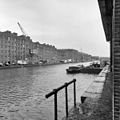
 Amsterdam - Entrepotdok - Utrecht en Verviers en Veere.JPG 3,056 × 4,592; 5.68 MB
-
 Amsterdam - Entrepotdok - Veere.JPG 3,056 × 4,592; 5.48 MB
-
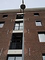
 Dak - Amsterdam - 20011333 - RCE.jpg 1,200 × 805; 196 KB
-
 Entrepotdok - Amsterdam (14).JPG 2,048 × 1,536; 1.25 MB
-
 Entrepotdok - Amsterdam (20).JPG 1,536 × 2,048; 1.42 MB
-
 Entrepotdok - Amsterdam (21).JPG 1,536 × 2,048; 1.3 MB
-
 Entrepotdok - Amsterdam (22).JPG 1,536 × 2,048; 1.38 MB
-
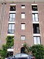
 Overzicht - Amsterdam - 20011304 - RCE.jpg 1,198 × 1,200; 272 KB
-
 Overzicht 35-37 - Amsterdam - 20011306 - RCE.jpg 1,188 × 1,200; 289 KB
-
 Overzicht 51-84 - Amsterdam - 20011312 - RCE.jpg 1,178 × 1,200; 278 KB
-
 Overzicht 68-79 - Amsterdam - 20011315 - RCE.jpg 1,193 × 1,200; 286 KB
-
 Overzicht 71-81 - Amsterdam - 20011317 - RCE.jpg 1,181 × 1,200; 283 KB
-
 Overzicht verbouwing pakhuizen tot woningen. - Amsterdam - 20011338 - RCE.jpg 1,200 × 782; 207 KB
-
 Rm1079-1.JPG 3,648 × 2,736; 2.44 MB
-
 Rm1079-2.JPG 2,736 × 3,648; 2.09 MB
-
 Rm1079-3.JPG 2,736 × 3,648; 1.98 MB


.JPG)
.JPG)
.JPG)
.JPG)


