Category:Paisley Road West, Glasgow
Paisley Road West is a main road through the south-west of Glasgow, Scotland. As its name suggests, it was the ancient thoroughfare between Glasgow and the town of Paisley, though much of the traffic between these areas is now carried by the M8 motorway.
From its start point under the Kingston Bridge near central Glasgow it is referred to as Paisley Road until reaching a historic toll point at Kinning Park, and is part of the A8 road for about two miles before the designation splits off near Ibrox Stadium. Paisley Road West is part of the A761 road for the remainder of its length; this route continues through central Paisley and all the way through Renfrewshire, eventually meeting up with the A8 again at Port Glasgow after 15 miles.
Subcategories
This category has the following 6 subcategories, out of 6 total.
Media in category "Paisley Road West, Glasgow"
The following 50 files are in this category, out of 50 total.
-
 252 Paisley Road West, Glasgow, Scotland.jpg 4,032 × 3,024; 2.42 MB
-
 A761 overbridge, M8 - geograph.org.uk - 2778075.jpg 640 × 430; 42 KB
-
 Before demolition - geograph.org.uk - 111934.jpg 423 × 640; 57 KB
-
 Bellahouston Park - geograph.org.uk - 573907.jpg 640 × 430; 103 KB
-
 BP car wash, Paisley Road West - geograph.org.uk - 1322234.jpg 640 × 480; 138 KB
-
 Cardonald Medical Centre - geograph.org.uk - 1188926.jpg 640 × 480; 119 KB
-
 Communities United - geograph.org.uk - 977938.jpg 640 × 359; 85 KB
-
 Corner of Barfillan Drive and Paisley Road West (geograph 5454985).jpg 1,600 × 1,200; 422 KB
-
 Corner of Paisley Road West ^ Copland Road, Glasgow - geograph.org.uk - 3581932.jpg 5,184 × 3,456; 6.98 MB
-
 Crest on tenement on Paisley Road West - geograph.org.uk - 1094068.jpg 480 × 640; 127 KB
-
 Edwin Street and Paisley Road West - geograph.org.uk - 977962.jpg 640 × 359; 64 KB
-
 Former Bellahouston Academy - geograph.org.uk - 787036.jpg 640 × 384; 74 KB
-
 Former Bellahouston School - geograph.org.uk - 733705.jpg 640 × 480; 56 KB
-
 Garden off Paisley Road West - geograph.org.uk - 573890.jpg 640 × 480; 108 KB
-
 Glasgow City - Kinning Park, 25-27 Paisley Road West - 20210729084813.jpg 4,896 × 3,264; 6.72 MB
-
 Glasgow Road, Oldhall, Paisley (geograph 2677535).jpg 1,600 × 1,200; 626 KB
-
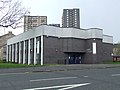
 Govan Police Office (geograph 4641243).jpg 1,320 × 990; 678 KB
-
 Hillington Trade Centre - geograph.org.uk - 1188956.jpg 640 × 480; 117 KB
-
 Houses on Paisley Road West - geograph.org.uk - 1188929.jpg 640 × 480; 115 KB
-
 Ibrox Library - geograph.org.uk - 763840.jpg 640 × 480; 92 KB
-
 Ibrox Park from Paisley Road West - geograph.org.uk - 1322224.jpg 640 × 480; 115 KB
-
 Ibrox Stadium Glasgow. Home Of Rangers FC - panoramio.jpg 3,072 × 2,304; 2.32 MB
-
 Kensington Bar, Paisley Road West, Glasgow - geograph.org.uk - 3582249.jpg 5,184 × 3,456; 7.62 MB
-
 Looking east on Paisley Road West - geograph.org.uk - 693430.jpg 640 × 480; 63 KB
-
 Looking up Dunellan Street (geograph 5454996).jpg 1,600 × 1,200; 323 KB
-
 M8 from Dumbreck Road - geograph.org.uk - 1322220.jpg 640 × 480; 122 KB
-
 Massive advertising board in Ibrox - geograph.org.uk - 1093876.jpg 640 × 480; 123 KB
-
 Mohammad Sarwar MP Constituency Office - geograph.org.uk - 1093899.jpg 640 × 480; 120 KB
-
 Now leaving Glasgow - geograph.org.uk - 1188959.jpg 640 × 480; 115 KB
-
 Paisley Rd West 2023.jpg 4,000 × 3,000; 3.59 MB
-
 Paisley Road West (A8) - geograph.org.uk - 1114535.jpg 640 × 480; 73 KB
-
 Paisley Road West - geograph.org.uk - 1744736.jpg 640 × 359; 93 KB
-
 Paisley Road West - geograph.org.uk - 573883.jpg 640 × 480; 92 KB
-
 Paisley Road West - geograph.org.uk - 763773.jpg 640 × 418; 84 KB
-
 Paisley Road West - geograph.org.uk - 909225.jpg 640 × 480; 130 KB
-
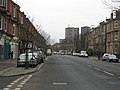
 Paisley Road West - geograph.org.uk - 977950.jpg 640 × 359; 81 KB
-
 Paisley Road West at Cessnock Eastern view.jpg 2,304 × 3,072; 2.69 MB
-
 Paisley Road West shops - geograph.org.uk - 1188930.jpg 640 × 480; 123 KB
-
 Paisley Road West Western View.jpg 2,304 × 3,072; 2.6 MB
-
 Paisley Road West, Glasgow (geograph 3581900).jpg 5,184 × 3,456; 7.6 MB
-
 Police office - geograph.org.uk - 573876.jpg 640 × 401; 69 KB
-
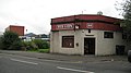 Red Lion - geograph.org.uk - 977971.jpg 640 × 359; 57 KB
-
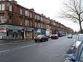 Shops on Paisley Road West - geograph.org.uk - 1093889.jpg 640 × 480; 141 KB
-
 Signature on 252 Paisley Road West, Glasgow, Scotland.jpg 1,860 × 1,395; 837 KB
-
 The A761 to Paisley (geograph 3447850).jpg 4,149 × 3,084; 4.04 MB
-
 The Clachan Bar - geograph.org.uk - 1739046.jpg 640 × 359; 71 KB
-
 The District Bar, Paisley Road West, Glasgow (geograph 3582384).jpg 3,456 × 5,184; 6.9 MB
-
 The Grapes Bar, Paisley Road West, Glasgow (geograph 3582407).jpg 5,184 × 3,456; 7.44 MB
-
 Towards The Toll - geograph.org.uk - 733800.jpg 640 × 480; 45 KB
-
 Westbound view on Paisley Road West - geograph.org.uk - 909221.jpg 640 × 480; 148 KB


.jpg)


.jpg)
.jpg)


.jpg)


_-_geograph.org.uk_-_1114535.jpg)


.jpg)


.jpg)

.jpg)
.jpg)

