Category:Pahvant Range
Jump to navigation
Jump to search
mountain range in Millard and Sevier counties in Utah, United States  | |||||
| Upload media | |||||
| Instance of | |||||
|---|---|---|---|---|---|
| Location |
| ||||
| Width |
| ||||
| Elevation above sea level |
| ||||
 | |||||
English: Media related to the Pahvant Range (also Pavant Range), a mountain range that runs northeast-southwest between the Pahvant Valley (also Pavant Valley) on the west and the Sevier and Round vallies on the east and is located on eastern edge of Millard County, extending into the southwest corner of Sevier County, in Utah, United States.
Media in category "Pahvant Range"
The following 8 files are in this category, out of 8 total.
-
 AspenOverview0172.JPG 1,600 × 1,200; 981 KB
-
 East at SR-99 & SR 100 junction, Filmore, Utah, Oct 16.jpg 2,592 × 1,944; 2.43 MB
-
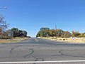
 East on W 850 S, Fillmore, Utah, Oct 16.jpg 2,592 × 1,944; 2.42 MB
-
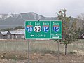 Interstates and US 50 directional sign in Holden, Utah.jpg 4,320 × 3,240; 5.45 MB
-
 Looking towards Fillmore, Utah with Interstate 15 in the foreground.JPG 5,184 × 3,456; 6.7 MB
-
 Mountains to the southeast of FIllmore, Utah.JPG 5,184 × 3,456; 7.31 MB
-
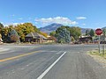
 South at SR-99 & SR 100 junction, Filmore, Utah, Oct 16.jpg 2,592 × 1,944; 2.42 MB
-
 West at SR-99 & SR 100 junction, Filmore, Utah, Oct 19.jpg 2,592 × 1,944; 2.41 MB


