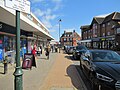
Category:Paddock Wood
Jump to navigation
Jump to search
town and civil parish in Kent, United Kingdom  | |||||
| Upload media | |||||
| Instance of | |||||
|---|---|---|---|---|---|
| Location | Tunbridge Wells, Kent, South East England, England | ||||
| Population |
| ||||
 | |||||
English: Paddock Wood is a small town in Kent, England, about eight miles south west of Maidstone. It is the centre for hop growing in Kent. The town featured in Charles Dickens' novel Dombey and Son, and is mentioned (in passing) in David Nobbs' novel The Fall and Rise of Reginald Perrin.
Nederlands: Paddock Wood is een plaats en civil parish in het bestuurlijke gebied Tunbridge Wells, in het Engelse graafschap Kent. De plaats telt 8.263 inwoners.
Polski: Paddock Wood - małe miasto w hrabstwie Kent w Anglii, około 8 mil na południowy zachód od Maidstone.
Română: Paddock Wood este un oraş în comitatul Kent, regiunea South East, Anglia. Oraşul aparţine districtului Tunbridge Wells.
Subcategories
This category has the following 7 subcategories, out of 7 total.
Media in category "Paddock Wood"
The following 200 files are in this category, out of 969 total.
(previous page) (next page)-
 3663 warehouse, Paddock Wood - geograph.org.uk - 1506605.jpg 640 × 384; 55 KB
-
 3663 warehouse, Paddock Wood - geograph.org.uk - 1506612.jpg 640 × 430; 56 KB
-
 7 ^ 9, Station Road - geograph.org.uk - 3853997.jpg 1,138 × 880; 192 KB
-
 7 ^ 9, Station Road - geograph.org.uk - 3854005.jpg 1,175 × 881; 173 KB
-

-
 A fallow field on a misty day - geograph.org.uk - 3434836.jpg 640 × 430; 31 KB
-
 A field of wheat - geograph.org.uk - 2956142.jpg 640 × 430; 47 KB
-
 A former church - geograph.org.uk - 3393873.jpg 640 × 430; 91 KB
-
 A fox on Chantler's Hill - geograph.org.uk - 3193543.jpg 640 × 480; 107 KB
-
 A lonesome cow - geograph.org.uk - 2429128.jpg 640 × 476; 38 KB
-
 A small pony - geograph.org.uk - 3307148.jpg 640 × 430; 100 KB
-
 A small pony - geograph.org.uk - 3373117.jpg 640 × 430; 64 KB
-
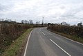
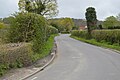
 A wet B2160 - geograph.org.uk - 6003137.jpg 1,024 × 681; 113 KB
-
 Active Digital, Transfesa Road - geograph.org.uk - 2303900.jpg 640 × 480; 52 KB
-
 Aggregates yard at Old Hay - geograph.org.uk - 4488761.jpg 6,734 × 2,564; 3.76 MB
-
 Apple Court - geograph.org.uk - 2589033.jpg 640 × 430; 77 KB
-
 Apple Court - geograph.org.uk - 2984573.jpg 640 × 430; 72 KB
-

-
 Approaching Mascall's Court Rd - geograph.org.uk - 5614961.jpg 640 × 426; 72 KB
-
 Approaching the level crossing on Wagon Lane - geograph.org.uk - 3615138.jpg 4,000 × 3,000; 4.11 MB
-
 Autocar P111 CAP abandoned in Paddock Wood (27585277080).jpg 985 × 897; 184 KB
-
 B2017 - geograph.org.uk - 3307155.jpg 640 × 430; 70 KB
-
 B2017 - geograph.org.uk - 3957180.jpg 640 × 430; 68 KB
-
 B2017 - geograph.org.uk - 5614987.jpg 640 × 426; 68 KB
-
 B2017 heading westwards - geograph.org.uk - 2403829.jpg 640 × 430; 48 KB
-
 B2017 out of Paddock Wood - geograph.org.uk - 2403826.jpg 640 × 430; 67 KB
-
 B2160 - B2017 junction - geograph.org.uk - 6003136.jpg 1,024 × 681; 124 KB
-
 B2160 - geograph.org.uk - 3292328.jpg 640 × 430; 74 KB
-
 B2160 - geograph.org.uk - 5614988.jpg 640 × 426; 82 KB
-
 B2160 - geograph.org.uk - 6003138.jpg 1,024 × 681; 175 KB
-
 B2160 - geograph.org.uk - 6003155.jpg 1,024 × 681; 112 KB
-
 B2160 - geograph.org.uk - 6551236.jpg 1,024 × 684; 202 KB
-
 B2160 - geograph.org.uk - 6551567.jpg 1,024 × 684; 236 KB
-
 B2160 at Paddock Wood - geograph.org.uk - 3916378.jpg 3,328 × 2,224; 4.05 MB
-
 B2160 heading south - geograph.org.uk - 2375523.jpg 640 × 495; 43 KB
-
 B2160 near Paddock Wood Garden Centre - geograph.org.uk - 3916405.jpg 3,248 × 2,168; 3.38 MB
-
 B2160 south of Paddock wood - geograph.org.uk - 3837174.jpg 2,398 × 1,468; 2.81 MB
-
 B2160, north Paddock Wood - geograph.org.uk - 3916400.jpg 3,368 × 2,248; 3.94 MB
-
 Back Street, Paddock Wood - geograph.org.uk - 2951099.jpg 640 × 430; 46 KB
-
 Badsall Rd - geograph.org.uk - 3437173.jpg 640 × 430; 46 KB
-
 Badsell Rd - geograph.org.uk - 2970813.jpg 640 × 430; 69 KB
-
 Badsell Rd - geograph.org.uk - 4243092.jpg 640 × 430; 69 KB
-
 Badsell Road, Paddock Wood - geograph.org.uk - 3017620.jpg 4,320 × 3,240; 4.46 MB
-
 Barclays Bank - geograph.org.uk - 3308826.jpg 640 × 430; 66 KB
-
 Barclays Bank - geograph.org.uk - 3373153.jpg 640 × 430; 59 KB
-
 Barclays, Paddock Wood - geograph.org.uk - 4243115.jpg 640 × 430; 65 KB
-
 Barn - geograph.org.uk - 5451477.jpg 640 × 426; 43 KB
-
 Barn at Durrant's Farm - geograph.org.uk - 2303894.jpg 640 × 480; 77 KB
-
 Barn at Park Farm - geograph.org.uk - 5364750.jpg 4,000 × 3,000; 2.08 MB
-
 Barn at Park Farm - geograph.org.uk - 5364752.jpg 4,000 × 3,000; 2.85 MB
-
 Barn, Knells Farm - geograph.org.uk - 2395339.jpg 640 × 359; 72 KB
-
 Barns, Upper Knowle Hall Farm - geograph.org.uk - 6556773.jpg 1,024 × 684; 97 KB
-
 Barsley's, Commercial Rd - geograph.org.uk - 2589094.jpg 640 × 430; 73 KB
-
 Barsleys - geograph.org.uk - 3308834.jpg 640 × 430; 74 KB
-
 Bend, Churn Lane - geograph.org.uk - 5089933.jpg 640 × 426; 54 KB
-
 Bidfood, Paddock Wood - geograph.org.uk - 6790141.jpg 1,024 × 684; 125 KB
-

-
 Birch Road, Paddock Wood - geograph.org.uk - 4917268.jpg 3,264 × 2,448; 2.26 MB
-
 Birkby, Paddock Wood - geograph.org.uk - 4837291.jpg 640 × 410; 57 KB
-
 Botanix - geograph.org.uk - 2951042.jpg 640 × 409; 62 KB
-
 Bowls Place, Paddock Wood - geograph.org.uk - 4660380.jpg 2,272 × 1,704; 812 KB
-
 Brick barn by Joys Cottages - geograph.org.uk - 4069740.jpg 1,024 × 768; 322 KB
-
 Brick barn by Joys Cottages - geograph.org.uk - 4321768.jpg 1,024 × 768; 267 KB
-
 Brick barn off Mile Oak Rd - geograph.org.uk - 2400309.jpg 640 × 388; 77 KB
-
 Bridge over a ditch - geograph.org.uk - 3515779.jpg 4,000 × 3,000; 4.42 MB
-
 Bridge over drain - geograph.org.uk - 2726898.jpg 3,072 × 2,304; 2.53 MB
-

-
 Bridleway to Park Farm - geograph.org.uk - 1357013.jpg 640 × 480; 90 KB
-
 British Car Auctions - geograph.org.uk - 2945373.jpg 640 × 400; 86 KB
-
 British Car Auctions, Paddock Wood - geograph.org.uk - 2429117.jpg 640 × 430; 68 KB
-
 British Car Auctions, Paddock Wood - geograph.org.uk - 3943856.jpg 640 × 430; 95 KB
-
 British Red Cross, Wheatfield House - geograph.org.uk - 3418262.jpg 640 × 430; 79 KB
-
 John Brunt new sign.JPG 2,736 × 3,648; 2.1 MB
-

-
 Burnside - geograph.org.uk - 3418343.jpg 640 × 430; 113 KB
-
 Bus stop - geograph.org.uk - 3292320.jpg 640 × 430; 76 KB
-
 Buttercup Close - geograph.org.uk - 4916023.jpg 640 × 426; 77 KB
-
 Buttercup meadow - geograph.org.uk - 6551568.jpg 1,024 × 684; 295 KB
-
 C J Enterprises site - geograph.org.uk - 3496964.jpg 946 × 709; 175 KB
-
 Car park off Commercial Rd - geograph.org.uk - 4911479.jpg 640 × 426; 49 KB
-
 Cass Court - geograph.org.uk - 3820722.jpg 640 × 430; 59 KB
-
 Castle Hill Farm - geograph.org.uk - 5092873.jpg 640 × 420; 52 KB
-
 Catts Place - geograph.org.uk - 5997002.jpg 1,024 × 681; 191 KB
-
 Catts Place Cottages, Mile Oak Rd - geograph.org.uk - 2395868.jpg 640 × 430; 51 KB
-
 Chantler's Hill - geograph.org.uk - 3393967.jpg 640 × 430; 53 KB
-
 Chantler's Hill - geograph.org.uk - 3406844.jpg 640 × 430; 47 KB
-
 Chantler's Hill - geograph.org.uk - 5614960.jpg 640 × 426; 84 KB
-

-
 Chiropractic Centre - geograph.org.uk - 3308821.jpg 640 × 430; 78 KB
-
 Chiropractic Centre - geograph.org.uk - 5619764.jpg 640 × 425; 71 KB
-
 Christmas lights, Commercial Road - geograph.org.uk - 4808345.jpg 2,214 × 2,214; 1.07 MB
-
 Church Oast - geograph.org.uk - 3418281.jpg 640 × 430; 100 KB
-
 Church Oast, Church Road, Paddock Wood - geograph.org.uk - 6490369.jpg 6,000 × 4,000; 6.89 MB
-
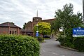
 Church of St Andrew - geograph.org.uk - 3366673.jpg 640 × 430; 89 KB
-
 Church of St Andrew - geograph.org.uk - 3393880.jpg 640 × 430; 76 KB
-
 Church of St Andrew - geograph.org.uk - 3820748.jpg 640 × 430; 67 KB
-
 Church of St Andrew - geograph.org.uk - 3957184.jpg 640 × 430; 55 KB
-
 Church of St Andrew - geograph.org.uk - 4230083.jpg 640 × 430; 83 KB
-
 Church of St Andrew - geograph.org.uk - 4243104.jpg 640 × 430; 114 KB
-
 Church of St Andrew - geograph.org.uk - 4837290.jpg 640 × 426; 53 KB
-
 Church of St Andrew - geograph.org.uk - 4916683.jpg 640 × 411; 62 KB
-
 Church of St Andrew - geograph.org.uk - 5619737.jpg 640 × 426; 95 KB
-
 Church of St Andrew - geograph.org.uk - 5619738.jpg 640 × 426; 89 KB
-
 Church of St Andrew - geograph.org.uk - 5619782.jpg 640 × 426; 85 KB
-
 Church of St Andrew - geograph.org.uk - 6003149.jpg 1,024 × 681; 176 KB
-
 Church of St Andrew - geograph.org.uk - 6003150.jpg 1,024 × 681; 174 KB
-
 Church of St Andrew - geograph.org.uk - 6003151.jpg 1,024 × 681; 166 KB
-
 Church of St Andrew - geograph.org.uk - 6551218.jpg 1,024 × 684; 219 KB
-
 Church of St Andrew - geograph.org.uk - 6551221.jpg 1,024 × 684; 234 KB
-
 Church of St Andrew - geograph.org.uk - 6556672.jpg 1,024 × 684; 244 KB
-
 Church of St Andrew, fairtrade shop - geograph.org.uk - 3393887.jpg 640 × 430; 51 KB
-
 Church Rd - geograph.org.uk - 3418235.jpg 640 × 430; 59 KB
-
 Church Rd - geograph.org.uk - 3418263.jpg 640 × 430; 78 KB
-
 Church Rd - geograph.org.uk - 3418271.jpg 640 × 430; 57 KB
-
 Church Rd - geograph.org.uk - 3418330.jpg 640 × 430; 71 KB
-
 Church Rd - geograph.org.uk - 3421706.jpg 640 × 430; 59 KB
-
 Church Rd - geograph.org.uk - 3943897.jpg 640 × 430; 70 KB
-
 Church Rd - geograph.org.uk - 3947398.jpg 640 × 430; 65 KB
-
 Church Rd - geograph.org.uk - 4911477.jpg 640 × 426; 70 KB
-
 Church Rd - geograph.org.uk - 5996987.jpg 1,024 × 681; 193 KB
-
 Church Rd - geograph.org.uk - 5996994.jpg 1,024 × 681; 202 KB
-
 Church remains - geograph.org.uk - 3943890.jpg 640 × 430; 135 KB
-
 Church Road, Paddock Wood - geograph.org.uk - 1386346.jpg 640 × 480; 61 KB
-
 Church Road, Paddock Wood - geograph.org.uk - 4660385.jpg 2,272 × 1,704; 806 KB
-
 Churn Lane - geograph.org.uk - 5089937.jpg 640 × 426; 76 KB
-
 City Cottage - geograph.org.uk - 3437075.jpg 640 × 430; 50 KB
-
 City Cottage, Mascall's Court Rd - geograph.org.uk - 2390847.jpg 640 × 430; 80 KB
-
 Clear footpath to Queen St - geograph.org.uk - 2956140.jpg 640 × 430; 42 KB
-
 Clear route across the field - geograph.org.uk - 2956137.jpg 640 × 430; 39 KB
-
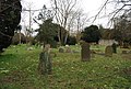 Closed Churchyard - geograph.org.uk - 3418252.jpg 640 × 430; 112 KB
-
 Closed Churchyard - geograph.org.uk - 3418255.jpg 640 × 430; 111 KB
-
 Closed Churchyard - geograph.org.uk - 3418257.jpg 640 × 430; 106 KB
-
 Closed churchyard - geograph.org.uk - 5996991.jpg 1,024 × 681; 277 KB
-
 Closed churchyard - geograph.org.uk - 5996992.jpg 1,024 × 681; 289 KB
-
 Closed churchyard - geograph.org.uk - 5996993.jpg 1,024 × 681; 261 KB
-
 Commerce Parade - geograph.org.uk - 4230050.jpg 640 × 430; 74 KB
-
 Commercial Motor Services (Kent) Ltd - geograph.org.uk - 3495669.jpg 1,011 × 758; 153 KB
-
 Commercial Rd - geograph.org.uk - 3957189.jpg 640 × 430; 55 KB
-
 Commercial Rd - geograph.org.uk - 4837417.jpg 640 × 426; 48 KB
-
 Commercial Rd - geograph.org.uk - 5619754.jpg 640 × 426; 58 KB
-
 Commercial Rd - geograph.org.uk - 5619766.jpg 640 × 426; 73 KB
-

-
 Commercial Rd, Maidstone Rd junction - geograph.org.uk - 6003158.jpg 1,024 × 681; 143 KB
-
 Commercial Rd, Maidstone Rd junction - geograph.org.uk - 6559129.jpg 1,024 × 660; 153 KB
-
 Commercial Rd, Paddock Wood, April 2021.jpg 5,184 × 3,888; 4.33 MB
-
 Commercial Road - geograph.org.uk - 2217444.jpg 640 × 480; 104 KB
-
 Commercial Road, Paddock Wood - geograph.org.uk - 1386339.jpg 640 × 480; 66 KB
-
 Commercial Road, Paddock Wood - geograph.org.uk - 1386356.jpg 640 × 480; 78 KB
-
 Commercial Road, Paddock Wood - geograph.org.uk - 4660365.jpg 2,272 × 1,704; 778 KB
-
 Compagne Fruitiere, Paddock Wood - geograph.org.uk - 2429119.jpg 640 × 430; 47 KB
-
 Compagnie Fruitiere - geograph.org.uk - 4011277.jpg 640 × 323; 44 KB
-
 Converted cartshed, Mascall's Court - geograph.org.uk - 2390869.jpg 640 × 430; 66 KB
-
 Costa Coffee - geograph.org.uk - 3292193.jpg 640 × 430; 72 KB
-
 Cottage, Chantler's Hill - geograph.org.uk - 3217148.jpg 640 × 430; 54 KB
-
 Cottage, Chantler's Hill - geograph.org.uk - 3217149.jpg 640 × 430; 58 KB
-
 Cottage, Mile Oak Rd - geograph.org.uk - 3421784.jpg 640 × 430; 78 KB
-
 Cottage, Warrington Rd - geograph.org.uk - 2984569.jpg 640 × 430; 105 KB
-
 Cottage, Warrington Rd - geograph.org.uk - 6556671.jpg 1,024 × 684; 139 KB
-
 Cottages on Chantler's Hill - geograph.org.uk - 2588899.jpg 640 × 430; 83 KB
-
 Cottages on Church Rd - geograph.org.uk - 5996998.jpg 1,024 × 681; 219 KB
-
 Cottages, Chantler's Hill - geograph.org.uk - 2970674.jpg 640 × 430; 89 KB
-
 Cottages, Chantler's Hill - geograph.org.uk - 3292349.jpg 640 × 430; 65 KB
-
 Cottages, Chantler's Hill - geograph.org.uk - 3406846.jpg 640 × 430; 50 KB
-
 Countryside near Queen Street - geograph.org.uk - 2945499.jpg 640 × 430; 56 KB
-
 Cowl of Church Oast - geograph.org.uk - 6490374.jpg 3,947 × 3,947; 4.23 MB
-
 Cowls of Stace Farm Oast - geograph.org.uk - 6490385.jpg 6,000 × 4,000; 6.61 MB
-
 Cowls of Stace Farm Oast - geograph.org.uk - 6490386.jpg 6,000 × 4,000; 6.78 MB
-
 Crescent, Green Lane - geograph.org.uk - 4916024.jpg 640 × 426; 81 KB
-
 Crossing keeper's cottage and level crossing on Wagon Lane - geograph.org.uk - 3615108.jpg 4,000 × 3,000; 4.27 MB
-
 Day Centre - geograph.org.uk - 6556678.jpg 1,024 × 685; 153 KB
-
 Depot on Transfesa Industrial Estate - geograph.org.uk - 2953982.jpg 640 × 430; 54 KB
-
 Derelict railwayn building, Paddock Wood - geograph.org.uk - 1515452.jpg 640 × 430; 126 KB
-
 Distribution Warehouse, Paddock Wood - geograph.org.uk - 2945478.jpg 640 × 326; 51 KB
-
 Ditch filled with water - geograph.org.uk - 2951046.jpg 640 × 430; 139 KB
-
 Diversification at Pearson's Green Farm - geograph.org.uk - 3558383.jpg 1,118 × 809; 185 KB
-
 Dover train at Paddock Wood - geograph.org.uk - 2984590.jpg 640 × 430; 78 KB
-
 Dowding House - geograph.org.uk - 2589057.jpg 640 × 430; 59 KB
-
 Dowding House - geograph.org.uk - 6003161.jpg 1,024 × 681; 138 KB
-

-
 Drainage ditch by Lucks Lane - geograph.org.uk - 4069737.jpg 1,024 × 768; 266 KB
-
 Driveway off Mascall's Court Rd - geograph.org.uk - 5614984.jpg 640 × 426; 82 KB
-
 Durrant's Farmhouse - geograph.org.uk - 2953754.jpg 640 × 430; 59 KB
-
 East of Paddock Wood Station - geograph.org.uk - 5230375.jpg 640 × 426; 40 KB
-
 Eldon Way - geograph.org.uk - 2951059.jpg 640 × 430; 61 KB
-
 Eldon Way Industrial Estate - geograph.org.uk - 2951050.jpg 640 × 430; 76 KB
-
 Electricity pylon - geograph.org.uk - 3947387.jpg 640 × 430; 64 KB
-
 Entering Paddock Wood - geograph.org.uk - 3193514.jpg 640 × 480; 137 KB
-
 Entering Paddock Wood - geograph.org.uk - 3957169.jpg 430 × 640; 68 KB
-
 Entering Paddock Wood - geograph.org.uk - 5614963.jpg 640 × 426; 79 KB
-
 Entering Paddock Wood, B2160 - geograph.org.uk - 2403823.jpg 640 × 430; 78 KB
-
 Entrance to Elm Tree Playing Fields - geograph.org.uk - 3553390.jpg 1,011 × 758; 183 KB
-
 Entrance to Foal Hurst Wood - geograph.org.uk - 1436297.jpg 640 × 480; 152 KB
-
 Entrance to Paddock Wood - geograph.org.uk - 3615245.jpg 4,000 × 3,000; 4.28 MB
-
 Entrance, Paddock Wood Cemetery - geograph.org.uk - 3947380.jpg 640 × 430; 129 KB
-
 ESSO filling station - geograph.org.uk - 2589047.jpg 640 × 430; 59 KB
-
 ESSO Filling Station - geograph.org.uk - 2984577.jpg 640 × 430; 60 KB
-
 ESSO filling station - geograph.org.uk - 3308781.jpg 640 × 430; 66 KB
-
 ESSO Filling Station - geograph.org.uk - 3373144.jpg 640 × 430; 52 KB
-
 ESSO Filling Station - geograph.org.uk - 3437183.jpg 640 × 430; 47 KB
-
 ESSO filling station - geograph.org.uk - 3957186.jpg 640 × 430; 53 KB


_Station_Road,_Paddock_Wood_-_geograph.org.uk_-_3193591.jpg)


.jpg)


_Ltd_-_geograph.org.uk_-_3495669.jpg)


