Category:Padbury Brook
Jump to navigation
Jump to search

stream in Oxfordshire and Buckinghamshire, England | |||||
| Upload media | |||||
| Instance of | |||||
|---|---|---|---|---|---|
| Location |
| ||||
 | |||||
Padbury Brook rises near w:Steeple Claydon, Buckinghamshire, and is a tributary of the Great Ouse, which it joins to the east of Buckingham town.
Subcategories
This category has only the following subcategory.
Media in category "Padbury Brook"
The following 12 files are in this category, out of 12 total.
-
 King's Bridge - geograph.org.uk - 949287.jpg 640 × 480; 115 KB
-

-
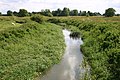 Padbury Brook - geograph.org.uk - 715548.jpg 640 × 425; 112 KB
-
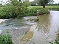
 Padbury Brook - geograph.org.uk - 717369.jpg 640 × 425; 104 KB
-

-
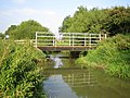
 Padbury Brook, King's Bridge - geograph.org.uk - 949267.jpg 640 × 480; 127 KB
-
 Padbury Brook, King's Bridge 2 - geograph.org.uk - 949276.jpg 480 × 640; 127 KB
-
 Padbury Viaduct - geograph.org.uk - 448203.jpg 640 × 480; 117 KB
-
 Padbury ^ Claydon Brook - geograph.org.uk - 2113798.jpg 1,600 × 1,200; 516 KB
-
 The Flosh - geograph.org.uk - 449542.jpg 640 × 480; 117 KB
-
 The Flosh. - geograph.org.uk - 449534.jpg 640 × 480; 101 KB
-
 Thornborough Bridge looking North - geograph.org.uk - 992291.jpg 640 × 480; 101 KB


