Category:Pabbay, Harris
Jump to navigation
Jump to search
island southwest of Harris, in Outer Hebrides, Scotland, UK  | |||||
| Upload media | |||||
| Instance of | |||||
|---|---|---|---|---|---|
| Location |
| ||||
| Located in or next to body of water | |||||
 | |||||
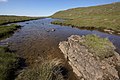
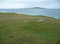
Pabbay (Scottish Gaelic: Pabaigh) is an uninhabited island in the Sound of Harris between Harris and North Uist, in the Outer Hebrides of Scotland
Media in category "Pabbay, Harris"
The following 40 files are in this category, out of 40 total.
-
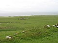 A former settlement on Pabbay - geograph.org.uk - 1963164.jpg 2,048 × 1,536; 748 KB
-
 An Corran, Pabbay - geograph.org.uk - 883368.jpg 640 × 428; 29 KB
-
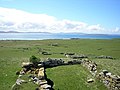 Baile Lingay - geograph.org.uk - 628666.jpg 640 × 479; 97 KB
-
 Baile Na Ceal, Pabbay - geograph.org.uk - 883709.jpg 640 × 428; 88 KB
-
 Beinn a'Charnain, Pabbay - geograph.org.uk - 883647.jpg 640 × 428; 86 KB
-
 Berneray Beach Pabbay 1.jpg 640 × 480; 56 KB
-
 Berneray Beach Pabbay.jpg 640 × 480; 56 KB
-
 Berneray Rubha Bhoisnis Pabbay.jpg 640 × 415; 52 KB
-
 Berneray Sheeps Pabbay.jpg 640 × 408; 73 KB
-
 Chilling out on Roisinis - geograph.org.uk - 2063914.jpg 3,264 × 2,448; 1.52 MB
-
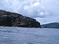 Cliffs at Alanais - geograph.org.uk - 2062204.jpg 3,264 × 2,448; 1.45 MB
-
 Coast North Pabbay - geograph.org.uk - 883620.jpg 640 × 428; 100 KB
-
 Coastline Northeast Pabbay - geograph.org.uk - 883599.jpg 640 × 428; 90 KB
-
 Coastline, Eastern Pabbay - geograph.org.uk - 883593.jpg 640 × 428; 96 KB
-
 Geos shape the northern rocks of Pabaigh - geograph.org.uk - 3536525.jpg 1,024 × 678; 109 KB
-
 Island of Pabbay, Sound of Harris - geograph.org.uk - 205395.jpg 640 × 424; 71 KB
-

-
 Loch Heddal More - geograph.org.uk - 883671.jpg 640 × 428; 83 KB
-
 Lower slopes of Beinn Shlèibhe - geograph.org.uk - 1437382.jpg 640 × 476; 150 KB
-
 North coast of Pabbay (Pabaigh) - geograph.org.uk - 2557948.jpg 800 × 534; 162 KB
-
 North coast of Pabbay - geograph.org.uk - 2062195.jpg 3,260 × 1,632; 906 KB
-
 Ordnance Survey One-inch Sheet 17 North Uist, Published 1959.jpg 8,264 × 9,882; 7.13 MB
-
 Pabbay (Sound of Harris) OH.svg 1,083 × 1,424; 2.36 MB
-
 Pabbay (Sound of Pabbay) OH.svg 1,083 × 1,424; 2.36 MB
-
 Pabbay - Pabaigh - geograph.org.uk - 2591698.jpg 2,560 × 1,920; 2.08 MB
-
 Pabbay - unnamed lochan - geograph.org.uk - 883691.jpg 640 × 428; 93 KB
-
 Pabbay and boat.jpg 2,592 × 1,944; 585 KB
-
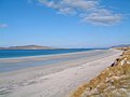
 Pabbay Beach Scene - geograph.org.uk - 883356.jpg 640 × 428; 46 KB
-
 Pabbay, Sound of Harris, OH.svg 388 × 236; 3.92 MB
-
 Rockpools at Rubha Bhreins, Pabbay - geograph.org.uk - 883603.jpg 640 × 428; 99 KB
-
 Rubh' an t-Seana-chaisteil - geograph.org.uk - 883381.jpg 640 × 428; 88 KB
-
 Rubha Bhreins, Pabbay - geograph.org.uk - 883610.jpg 640 × 428; 102 KB
-
 Rubha Thaltois, Pabbay - geograph.org.uk - 883717.jpg 640 × 428; 73 KB
-
 Ròisinis off Pabaigh - geograph.org.uk - 3558478.jpg 1,024 × 554; 106 KB
-
 Seana Chaisteal on Pabbay - geograph.org.uk - 626764.jpg 640 × 479; 90 KB
-
 Sgeir Sine, Sound of Harris. - geograph.org.uk - 506783.jpg 640 × 359; 34 KB
-

-

-
 Traigh Baile Fo Thuath, Pabbay - geograph.org.uk - 883583.jpg 640 × 428; 83 KB
-
 Views from Beinn a' Charnain - geograph.org.uk - 883627.jpg 640 × 428; 86 KB


_-_geograph.org.uk_-_2557948.jpg)


_OH.svg)
_OH.svg)


_-_geograph.org.uk_-_2553199.jpg)
_-_geograph.org.uk_-_2557916.jpg)

