Category:PNG created with Adobe Illustrator:Maps
Jump to navigation
Jump to search
Media in category "PNG created with Adobe Illustrator:Maps"
The following 81 files are in this category, out of 81 total.
-
 12 племен Ізраїля.png 2,713 × 4,000; 942 KB
-
 Afghanistan Provinces’s Demographic status.jpg 828 × 626; 166 KB
-
 Amiens plan vert.png 485 × 1,000; 163 KB
-
 Antarctica de.png 2,842 × 2,834; 1.29 MB
-
 Antietam Overview.png 4,800 × 6,000; 16.42 MB
-
 Arounud the Tsu Station in 2015.png 1,071 × 592; 138 KB
-
 Bahnstrecke Haller-Willelm.png 1,200 × 849; 885 KB
-
 Beijing-Subway-Plan en.png 2,900 × 2,300; 859 KB
-
 Beijing-Subway-Plan zh-hant.png 2,900 × 2,300; 858 KB
-
 Canada-map-blank (white).png 1,002 × 462; 84 KB
-
 CH Kantone.png 2,560 × 1,642; 550 KB
-
 Chinese Wikipedian meetups 2013 map.png 737 × 591; 267 KB
-
 Duomo Siena interior.png 1,348 × 1,588; 75 KB
-
 Extertalbahn.jpg 621 × 621; 407 KB
-
 First Sino-Japanese War - Chinese version.jpg 2,000 × 2,615; 407 KB
-
 Frankreich 12. Jh (ohne Süd).png 2,607 × 2,640; 2.41 MB
-
 Frankreich 12. Jh 2021-08-03.png 2,607 × 2,640; 2.47 MB
-
 FrontRoyalToWinchester.png 1,344 × 1,878; 444 KB
-
 Germany (+districts +municipalities) location map.png 5,000 × 5,888; 1.15 MB
-
 Ghana in its region.png 336 × 189; 24 KB
-
 Gilman-school-map-06-24-09.jpg 2,200 × 1,700; 1.4 MB
-
 Glacis Minden cropped neu.jpg 363 × 410; 238 KB
-
 Glacis Minden cropped.jpg 363 × 410; 235 KB
-
 Hessen Kreise Namen.png 1,466 × 2,048; 5.72 MB
-
 Iran–Saudi Arabia proxy conflict.png 1,280 × 872; 168 KB
-
 Ise Jingu Geku Mikakiuchi, Mishikichi East Side Version.png 2,363 × 2,482; 201 KB
-
 Ise Jingu Geku Mikakiuchi, Mishikichi West Side Version.png 2,363 × 2,482; 201 KB
-
 Ise Jingu Naiku Mikakiuchi, Mishikichi East Side Version.png 2,033 × 2,482; 211 KB
-
 Ise Jingu Naiku Mikakiuchi, Mishikichi West Side Version.png 2,033 × 2,482; 210 KB
-
 Ise-nishi IC Map in 2016.png 2,373 × 1,289; 521 KB
-
 Islam in Europe-2010.png 1,178 × 1,024; 221 KB
-
 Kernstown1862.png 5,232 × 5,307; 844 KB
-
 Kreis Gütersloh - nature reserves.png 1,334 × 1,304; 1.87 MB
-
 LarnakaDistrict.png 1,782 × 1,068; 94 KB
-
 LarnakaDistrict2.png 532 × 352; 7 KB
-
 LGS-Route.png 800 × 540; 518 KB
-
 Licence plates area in Osaka prefecture.png 489 × 679; 42 KB
-
 Map of Toba Port, Mie.jpg 1,007 × 964; 133 KB
-
 Maryland Campaign.png 1,601 × 1,809; 576 KB
-
 Mie Prefectural route 26 Yokkaichi-Tado Line.png 647 × 941; 54 KB
-
 Mie Prefectural route 27 Kambe-Nagasawa Line.png 647 × 941; 54 KB
-
 Mie Prefectural route 28 Kameyama-Hakusan Line.png 647 × 941; 55 KB
-
 Mie Prefectural route 29 Matsusaka-Aoyama Line.png 647 × 941; 55 KB
-
 Miyazaki beef map based on 2016.png 2,381 × 2,344; 395 KB
-
 Münsterland topo.jpg 4,000 × 3,157; 3.77 MB
-
 Naiku Map in Japanese.png 2,085 × 2,390; 649 KB
-

-
 Nordrhein-Westfalen, administrative divisions - de - colored (full featured).png 2,801 × 2,751; 3.83 MB
-
 North Rhine-Westphalia topographic map 01.jpg 2,500 × 2,455; 1,011 KB
-
 North Rhine-Westphalia topographic map 02.jpg 2,036 × 2,000; 2.22 MB
-
 North Rhine-Westphalia topographic map 03.png 2,036 × 2,000; 1.65 MB
-
 North-Rhine-Westphalia-topographic-map-04.jpg 800 × 786; 631 KB
-
 Oceania UN Geoscheme - Map of Melanesia uk.png 823 × 466; 89 KB
-
 Oceania UN Geoscheme - Map of Micronesia uk.png 872 × 424; 58 KB
-
 Oceania UN Geoscheme - Map of Polynesia uk.png 1,220 × 1,104; 128 KB
-
 Oceania UN Geoscheme Regions uk.png 2,000 × 1,156; 232 KB
-
 Oceania UN Geoscheme Regions with Zones uk.png 2,000 × 1,156; 297 KB
-
 Pontigny1180.png 2,664 × 2,456; 4.11 MB
-
 Religion in Poland.png 2,000 × 1,944; 390 KB
-
 SCL ga map.png 1,500 × 2,250; 667 KB
-
 Senne-Bahn.png 1,400 × 1,685; 1.48 MB
-
 Shadow picture of Shima city.png 523 × 580; 25 KB
-
 Shimazu village, Mie.png 2,449 × 2,725; 192 KB
-
 SkmSukumaland.png 188 × 139; 14 KB
-
 SkmSukumalandArusha.png 281 × 147; 19 KB
-
 SkmSukumalandKigoma.png 270 × 247; 22 KB
-
 Sugari village map.png 2,020 × 2,940; 185 KB
-
 Swedish Empire (1560-1815) en2.png 1,802 × 2,213; 350 KB
-
 Taihangshan Location.png 1,461 × 1,248; 2.19 MB
-
 Territorio Insular Nacional in Dominican Republic.png 932 × 757; 126 KB
-
 Toba Municipal Ship Line.png 681 × 624; 102 KB
-
 Tobaminami-Shiraki IC map.png 2,864 × 2,344; 467 KB
-
 Usa edcp (+HI +AK) relief location map.png 2,000 × 1,238; 2.03 MB
-
 Vietnam Railway Map.png 750 × 1,463; 259 KB
-
 Vlotho Übersichtskarte.png 1,800 × 1,496; 1.63 MB
-
 Wasserstraßenkreuz Minden.png 1,234 × 853; 398 KB
-
 Wasserstrassenkreuz-Minden.png 1,178 × 792; 324 KB
-
 Western schism 1378–1417 de.png 2,000 × 1,540; 859 KB
-
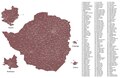
 Zimbabwe constituency map 2023 v1.png 4,404 × 2,874; 2.82 MB
-
 Zimbabwe constituency map 2023.pdf 8,962 × 5,825; 7.16 MB
-
 Übersichtskarte Dörentrup.png 2,000 × 1,640; 1 MB


.png)


_location_map.png)


.jpg)
.png)


_en2.png)


_relief_location_map.png)


.png)