Category:PD USBR
Jump to navigation
Jump to search
Media in category "PD USBR"
The following 200 files are in this category, out of 328 total.
(previous page) (next page)-
 "5 ft. and 6 ft. gate valves, 220 ft. head." - NARA - 294545.jpg 3,000 × 2,278; 3.07 MB
-
 "5 ft. and 6 ft. gate valves, 220 ft. head." - NARA - 294545.tif 3,000 × 2,278; 6.52 MB
-
 1940YumaProjectDamage.jpg 675 × 510; 89 KB
-
 Aerial view of Alcova Dam (C144-600-2002).jpg 700 × 477; 127 KB
-
 Aerial view of Alcova Dam (C144-600-2003).jpg 700 × 477; 114 KB
-
 Aerial view of Alcova Dam (CN144-600-2002).jpg 700 × 431; 104 KB
-
 Aerial view of Alcova Dam and Reservoir (C144-600-2000).jpg 700 × 477; 109 KB
-
 Aerial view of Alcova Dam and Reservoir (C144-600-2001).jpg 700 × 477; 102 KB
-
 Aerial view of Alcova Dam and Reservoir (C144-600-2004).jpg 1,027 × 700; 226 KB
-
 Aerial view of Alcova Dam and Reservoir (CN144-600-2000).jpg 700 × 431; 107 KB
-
 Aerial view of Alcova Dam and Reservoir (CN144-600-2001).jpg 700 × 431; 101 KB
-
 Aerial view of the Glen Canyon Dam, 1965, US Bureau of Reclamation.jpg 2,048 × 1,601; 844 KB
-
 Agate Dam.jpg 350 × 230; 52 KB
-
 Agate Lake Map.png 1,700 × 1,103; 1.77 MB
-

-

-
 Agency Valley Dam and Beulah Reservoir, aerial view (CN126-100-398).jpg 700 × 432; 166 KB
-
 Agency Valley Dam and Beulah Reservoir, aerial view (CN126-100-400).jpg 700 × 432; 125 KB
-
 Agency Valley Dam.jpg 350 × 233; 10 KB
-
 Alcova Dam WY1.jpg 350 × 230; 60 KB
-
 Alcova Dam.jpg 350 × 239; 29 KB
-
 Altus Dam 2.jpg 350 × 230; 99 KB
-
 Altus Dam.jpg 350 × 230; 42 KB
-
 Amer-falls-dam-id-1947.jpg 682 × 480; 78 KB
-
 American Falls Dam Power House.jpg 682 × 480; 78 KB
-
 American Falls Dam.jpg 350 × 233; 21 KB
-
 American River CA.jpg 1,500 × 997; 457 KB
-
 Anchor Dam 1.jpg 350 × 230; 93 KB
-
 Anchor Dam 2.jpg 264 × 209; 26 KB
-
 Anderson Ranch Dam.jpeg 800 × 537; 70 KB
-
 Anderson-Rose Diversion Dam.jpeg 353 × 236; 28 KB
-
 Angostura Diversion Dam.jpg 375 × 230; 84 KB
-
 Angosturadam.jpg 350 × 232; 18 KB
-
 Anita Dam.jpg 350 × 238; 77 KB
-
 Arbuckle Dam.jpg 349 × 232; 18 KB
-
 Arizona cap canal.jpg 664 × 830; 109 KB
-
 Arizonaspillway.jpg 1,600 × 1,280; 262 KB
-
 Arrowrock Dam.jpg 298 × 245; 24 KB
-
 Arthur R. Bowman Dam, near Prineville, Oregon.jpg 301 × 245; 32 KB
-
 Arthur V. Watkins Dam and Willard Bay Utah.jpg 350 × 231; 28 KB
-
 Avalon Dam.jpg 350 × 243; 22 KB
-
 B247-800-14 Boca Dam 9-9-2016 (47843790601).jpg 3,600 × 2,400; 737 KB
-
 B247-800-18 Boca Reservoir 9-9-2016 (47791655232).jpg 3,600 × 2,400; 728 KB
-
 B247-800-19 Boca Reservoir 9-9-2016 (33966340238).jpg 3,600 × 2,400; 734 KB
-
 B247-800-20 Boca Reservoir 9-9-2016 (46927482655).jpg 3,600 × 2,400; 684 KB
-
 B247-800-21 Boca Dam 9-9-2016 (33966340128).jpg 3,600 × 2,400; 679 KB
-
 B247-800-22 Boca Dam 9-9-2016 (33966340118).jpg 3,600 × 2,400; 774 KB
-
 B247-800-23 Boca Dam 9-9-2016 (47791655072).jpg 3,600 × 2,400; 638 KB
-
 BarberDam1979.jpg 700 × 536; 70 KB
-
 BartlettDam.jpg 1,600 × 1,280; 310 KB
-
 BartlettDam1.jpg 1,600 × 1,280; 339 KB
-
 BartlettDam2.jpg 1,600 × 1,280; 356 KB
-
 BartlettDamLastPour.jpg 1,425 × 1,080; 363 KB
-
 BartlettDamNewSpilway.jpg 350 × 284; 30 KB
-
 BartlettDamUC.jpg 1,425 × 1,080; 473 KB
-
 BartlettDamUC1.jpg 1,425 × 1,080; 422 KB
-
 BartlettDamUC2.jpg 1,425 × 1,080; 352 KB
-
 BartlettDamUC3.jpg 1,425 × 1,080; 345 KB
-
 BartlettDamUC4.jpg 1,425 × 1,080; 416 KB
-
 BartlettDamUC5.jpg 1,080 × 1,425; 269 KB
-
 Belle Fourche Dam.jpg 350 × 232; 14 KB
-
 Biennial report of the Board of State Harbor Commissioners for (1936) (14778552865).jpg 2,976 × 2,220; 1.19 MB
-
 Boca Dam (33966340388).jpg 1,500 × 996; 1.03 MB
-
 Boca Dam (33966340478).jpg 1,500 × 996; 1.25 MB
-
 Boca Dam (46927482905).jpg 1,500 × 996; 949 KB
-

-
 Boca Dam.jpg 347 × 232; 21 KB
-
 Boca Dam2.jpg 830 × 545; 126 KB
-
 BoiseRiverDiversionDam.jpg 352 × 252; 18 KB
-
 BoiseRiverDiversionDam2.jpg 1,036 × 662; 79 KB
-
 BoiseRiverDiversionDamPowerPlant.jpg 958 × 641; 67 KB
-
 BoR-HungryHorseProject-P447-100-366.jpg 800 × 636; 115 KB
-
 BoR-HungryHorseProject-P447-100-575.jpg 602 × 478; 185 KB
-

-
 Boulderdambrochure.jpg 496 × 1,159; 251 KB
-
 Bull Lake Dam and Reservoir.jpg 350 × 230; 38 KB
-
 Bully Creek Dam, Malheur County, Oregon.jpg 350 × 230; 24 KB
-
 Bureau of Reclamation logo.png 200 × 90; 10 KB
-
 Bureau of Reclamation regions.png 1,428 × 1,514; 103 KB
-
 Burnt River dam.jpg 350 × 230; 104 KB
-
 Camp Dyer Diversion Dam.jpg 265 × 180; 21 KB
-
 Camp Dyer Diversion Dam.png 265 × 180; 35 KB
-
 CanyonFerryDam2.jpg 352 × 235; 17 KB
-
 CanyonFerryDamclose.jpg 350 × 230; 33 KB
-
 CanyonFerryDamHPP.jpg 735 × 507; 45 KB
-
 CanyonFerryDamoverhead.jpg 352 × 235; 16 KB
-
 Carpinteria Dam-0.jpg 349 × 242; 29 KB
-
 Carpinteria Dam-1.jpg 350 × 254; 36 KB
-
 Carpinteria Dam-2.jpg 351 × 262; 25 KB
-
 Cascade-dam-id-us.png 800 × 537; 648 KB
-
 Casitas Dam.jpg 350 × 230; 16 KB
-
 CAST For Kids 15 APR 2017 (33931566243).jpg 1,920 × 1,080; 236 KB
-
 Cedar Bluff Dam.jpg 350 × 230; 64 KB
-
 Central Valley Project Map from USBR 2016-07-05.jpg 2,242 × 2,553; 374 KB
-
 Charles Walcott.jpg 619 × 825; 53 KB
-
 Cheney Dam.jpg 350 × 230; 58 KB
-
 Cibola Whiteware pots, Roosevelt Lake.jpg 610 × 475; 67 KB
-
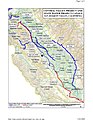
 Colorado River Basin - NARA - 6050554 (page 1).jpg 6,016 × 6,606; 3.75 MB
-
 Colorado River Basin - NARA - 6050554 (page 2).pdf 3,006 × 3,302; 3.76 MB
-
 Columbia basin project.JPG 520 × 823; 92 KB
-
 Concreteworkers.jpg 1,600 × 1,280; 348 KB
-
 Contra Costa Canal Fish Screen USBR.jpg 4,288 × 2,848; 5.72 MB
-
 Contralomdm1b.jpg 801 × 518; 67 KB
-
 Crane Prairie Dam.jpg 350 × 230; 33 KB
-
 CVPSouthernCanalsUSBR.jpg 1,224 × 1,584; 1.58 MB
-
 Damforms.jpg 1,600 × 1,280; 330 KB
-
 Damupstream.jpg 1,600 × 1,280; 359 KB
-
 Delta-Mendota Canal.jpg 350 × 240; 20 KB
-
 Derby Diversion Dam north.jpg 1,424 × 1,049; 325 KB
-
 Derby Diversion Dam.jpg 350 × 231; 26 KB
-
 Eastcanyondam.jpg 320 × 230; 121 KB
-
 Easton Diversion Dam.jpg 365 × 245; 32 KB
-
 Elephant butte dike.jpg 1,591 × 1,993; 439 KB
-
 ElVadoDam.jpeg 350 × 232; 29 KB
-
 Elwood-mead.jpg 578 × 794; 49 KB
-
 Ethel Edwards (cropped).jpg 140 × 187; 9 KB
-
 Ethel Edwards.jpg 482 × 318; 36 KB
-

-
 Fish Lake Oregon.jpg 350 × 230; 27 KB
-
 Flaming Gorge dam.jpg 350 × 230; 54 KB
-
 Flaminggorge.jpeg 650 × 476; 147 KB
-
 Floyd Dominy.jpg 539 × 756; 78 KB
-
 Folsom Dam 1953.jpg 1,800 × 1,200; 1.99 MB
-
 Folsom dam spillway failure.jpg 376 × 250; 18 KB
-
 Folsom dam usbr.jpg 348 × 232; 21 KB
-
 Fontenelle Dam.jpg 350 × 209; 92 KB
-
 Frank Crowe.jpg 352 × 477; 17 KB
-
 FrankCrowe.jpg 1,280 × 1,600; 207 KB
-
 Fresno Dam 2.jpg 545 × 357; 50 KB
-
 Fresno Dam 3.jpg 350 × 233; 34 KB
-
 Fresno Dam.jpeg 350 × 233; 35 KB
-
 Friant Dam 2.jpg 265 × 171; 17 KB
-
 Funks dam.jpg 350 × 228; 24 KB
-
 FutureGrandCouleeDamSite.jpg 1,218 × 1,002; 200 KB
-
 GCDam.gif 450 × 574; 107 KB
-

-
 Gianelli power plant.jpg 735 × 502; 48 KB
-
 Gibsondam.jpg 350 × 239; 34 KB
-
 Glen Canyon Dam 1962.jpg 439 × 550; 408 KB
-
 Glen Canyon Dam 2013 High Flow Experimental Release (10860594654).jpg 1,280 × 720; 63 KB
-
 Glen Canyon Dam From River.jpeg 350 × 225; 140 KB
-
 Glen Canyon Dam HFE.jpg 600 × 400; 53 KB
-
 Glen Canyon Spillway Gates.jpg 300 × 207; 24 KB
-
 Glen Elder Dam.jpg 350 × 232; 20 KB
-
 Glencanyonrelease.jpg 350 × 235; 21 KB
-
 Granby Dam BuRec CO1.jpeg 346 × 232; 27 KB
-
 Grand Coulee Dam.jpg 1,024 × 825; 247 KB
-
 Grand Lake, Colorado.jpg 600 × 414; 32 KB
-
 GrandCouleeDam10USBORJune2011.jpg 800 × 531; 120 KB
-
 GrandCouleeDam11USBORJune2011.jpg 531 × 800; 79 KB
-
 GrandCouleeDam12USBORJune2011.jpg 531 × 800; 90 KB
-
 GrandCouleeDam13USBORJune2011.jpg 800 × 531; 88 KB
-
 GrandCouleeDam1USBORJune2011.jpg 531 × 800; 129 KB
-
 GrandCouleeDam2USBORJune2011.jpg 800 × 531; 110 KB
-
 GrandCouleeDam3USBORJune2011.jpg 531 × 800; 103 KB
-
 GrandCouleeDam4USBORJune2011.jpg 531 × 800; 131 KB
-
 GrandCouleeDam5USBORJune2011.jpg 800 × 531; 123 KB
-
 GrandCouleeDam6USBORJune2011.jpg 800 × 531; 97 KB
-
 GrandCouleeDam7USBORJune2011.jpg 800 × 531; 85 KB
-
 GrandCouleeDam8USBORJune2011.jpg 800 × 531; 95 KB
-
 GrandCouleeDam9USBORJune2011.jpg 531 × 800; 119 KB
-
 Grandvalleydam.jpg 350 × 231; 27 KB
-
 Granite Reef Diversion Dam.jpeg 314 × 250; 21 KB
-
 Grassy Lake Dam WY1.jpg 350 × 230; 25 KB
-
 GreenMountainDam.jpg 350 × 236; 31 KB
-
 Guernseydam.jpg 1,200 × 773; 283 KB
-
 Hancock-homestead-settler.jpg 1,392 × 937; 189 KB
-
 Hdamface.jpg 1,600 × 1,280; 260 KB
-
 Hngryh.jpg 944 × 705; 106 KB
-
 Hngryh2.jpg 1,239 × 970; 144 KB
-
 Hoover Dam and Arizona Spillway, 1983.jpg 1,425 × 1,050; 309 KB
-
 Hoover Dam Diagram.jpg 2,603 × 2,003; 1.64 MB
-
 Hoover Dam Diagram.png 2,517 × 1,986; 944 KB
-
 Hoover Dam with Bypass from Reclamation.tif 3,000 × 2,401; 20.63 MB
-
 Hoover-Dam-Needle-Test-c1940s-Cliff-Segerblom.jpg 800 × 534; 61 KB
-
 Hooveratdam.jpg 1,066 × 1,425; 202 KB
-
 Hooverdam100.jpg 100 × 81; 4 KB
-
 HooverDamFrontWater.jpg 593 × 758; 52 KB
-
 HooverDamPolice.jpg 2,048 × 1,536; 514 KB
-
 HooverDamPoliceBadge.JPG 206 × 319; 64 KB
-
 Hooverstarmap.jpg 1,600 × 1,280; 239 KB
-
 Hoovertourgroup1947.jpg 1,074 × 1,425; 231 KB
-
 Horseshoe Dam 2.jpeg 350 × 280; 94 KB
-
 Horseshoe Dam.jpeg 350 × 280; 88 KB
-
 HungryHorseDamSpillway.jpg 662 × 479; 48 KB
-
 Ickestalk.jpg 1,600 × 1,280; 189 KB
-
 Imperial Dam.jpg 523 × 442; 243 KB
-
 Jamstwn1.jpg 350 × 235; 31 KB
-
 JohnSavage.jpg 620 × 677; 33 KB
-
 Kansas Lakes -- Bureau of Reclamation.gif 550 × 261; 23 KB
-
 Kaplan Turbine schematic.png 664 × 884; 42 KB
-
 Kaufmanndam.jpg 469 × 324; 82 KB
-
 Keswick Dam.gif 265 × 175; 38 KB
-
 Keswick Dam.jpg 454 × 300; 15 KB
-
 Keyhole Reservoir.jpg 350 × 232; 17 KB
-
 Kirwin Reservoir aerial.jpg 350 × 232; 15 KB
-
 Klamath Project Mapic.jpg 1,688 × 1,036; 345 KB
-
 Kortesdam.jpg 800 × 1,200; 307 KB
-
 LagunaDamArizonaSluiceGate.jpg 1,425 × 1,046; 203 KB
-
 LagunaDiversionDamoh.jpg 350 × 280; 98 KB


.jpg)
.jpg)
.jpg)
.jpg)
.jpg)
.jpg)
.jpg)
.jpg)


.jpg)
.jpg)
.jpg)
.jpg)


.jpg)
.jpg)
.jpg)
.jpg)
.jpg)
.jpg)
.jpg)


_(14778552865).jpg)
.jpg)
.jpg)
.jpg)
.jpg)


.jpg)


.jpg)


.jpg)


.jpg)


