Category:Péter-hegy
Jump to navigation
Jump to search
Magyar: Péter-hegy, Budapest III. kerület és Üröm határán
| Object location | | View all coordinates using: OpenStreetMap |
|---|
| Upload media | |||||
| Instance of | |||||
|---|---|---|---|---|---|
| Part of | |||||
| Location | |||||
| Elevation above sea level |
| ||||
| Different from | |||||
 | |||||
Subcategories
This category has the following 3 subcategories, out of 3 total.
C
P
- Péter-hegyi No 1 Pothole (6 F)
- Péter-hegyi No 2 Pothole (2 F)
Media in category "Péter-hegy"
The following 4 files are in this category, out of 4 total.
-
 Aussicht nach Csúcs-Berg von Kishegy, 2023 Üröm.jpg 2,221 × 1,665; 695 KB
-
 Aussicht nach NW Péter-Hügel von Kishegy, 2023 Üröm.jpg 2,272 × 1,704; 993 KB
-
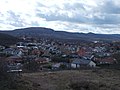
 Aussicht nach Péter-Hügel von Kishegy, 2023 Üröm.jpg 2,272 × 1,704; 937 KB
-
 Péter Hügel und Hármashatárberg, N, 2023 Üröm.jpg 2,272 × 1,704; 945 KB


