Category:Oxton, Nottinghamshire
Jump to navigation
Jump to search
English: Oxton is a village in Nottinghamshire, England, with a little over 500 residents.
village and civil parish in Newark and Sherwood, Nottinghamshire, England  | |||||
| Upload media | |||||
| Instance of | |||||
|---|---|---|---|---|---|
| Location | Newark and Sherwood, Nottinghamshire, East Midlands, England | ||||
| Population |
| ||||
 | |||||
Subcategories
This category has only the following subcategory.
P
Media in category "Oxton, Nottinghamshire"
The following 200 files are in this category, out of 362 total.
(previous page) (next page)-
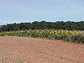 A field of Sunflowers - geograph.org.uk - 40775.jpg 640 × 480; 111 KB
-
 A long span - geograph.org.uk - 6543328.jpg 1,280 × 960; 290 KB
-
 A view along a hedge - geograph.org.uk - 2831885.jpg 4,000 × 3,000; 2.39 MB
-
 A6097 Oxton Bypass - geograph.org.uk - 4810217.jpg 1,024 × 635; 210 KB
-

-
 A614 near Haywood Oaks - geograph.org.uk - 3338227.jpg 2,256 × 1,504; 2.05 MB
-
 A641 road junction - geograph.org.uk - 3579471.jpg 640 × 480; 74 KB
-
 Adjusted footpath above Oxton Grange - geograph.org.uk - 6546415.jpg 1,280 × 960; 383 KB
-
 Arable land, near Oxton Grange - geograph.org.uk - 2830850.jpg 4,000 × 3,000; 2.51 MB
-
 Arriving at Oxton from Southwell - geograph.org.uk - 3794145.jpg 640 × 391; 76 KB
-
 B6386 road towards Southwell - geograph.org.uk - 4808842.jpg 3,696 × 2,448; 2.29 MB
-
 B6386 Southwell Road - geograph.org.uk - 4808847.jpg 3,696 × 2,448; 2.26 MB
-
 B6386 Southwell Road east of Oxton - geograph.org.uk - 4237207.jpg 1,024 × 768; 166 KB
-
 B6386 to Oxton, near Deer Leap - geograph.org.uk - 3794128.jpg 640 × 242; 50 KB
-
 Bean Ford - geograph.org.uk - 5803122.jpg 800 × 600; 170 KB
-
 Bean Ford - geograph.org.uk - 6132650.jpg 5,376 × 3,024; 5.17 MB
-
 Bean Ford - geograph.org.uk - 6546016.jpg 1,280 × 960; 563 KB
-
 Bean Ford - geograph.org.uk - 6546019.jpg 1,280 × 960; 532 KB
-
 Bean Ford, Oxton - geograph.org.uk - 2822215.jpg 3,872 × 2,592; 2.35 MB
-
 Bean Ford, Oxton, Notts. - geograph.org.uk - 4302790.jpg 3,628 × 2,432; 1.6 MB
-
 Bean Ford, Oxton, Notts. - geograph.org.uk - 4302819.jpg 3,165 × 2,684; 1.47 MB
-
 Bean Ford, Oxton, Notts. - geograph.org.uk - 4302843.jpg 2,682 × 4,030; 1.68 MB
-
 Bean Ford, Oxton, Notts. - geograph.org.uk - 4302877.jpg 3,399 × 2,558; 1.67 MB
-
 Beanford Lane - geograph.org.uk - 1759524.jpg 640 × 480; 100 KB
-
 Beanford Lane - geograph.org.uk - 6546015.jpg 1,280 × 960; 528 KB
-
 Bench mark at Oxton Hill Farm - geograph.org.uk - 6542870.jpg 960 × 1,280; 482 KB
-
 Bench mark, Greaves Lane - geograph.org.uk - 6546027.jpg 1,280 × 1,280; 775 KB
-
 Bench mark, St Peter ^ St Paul Church, Oxton - geograph.org.uk - 6543256.jpg 1,280 × 1,280; 792 KB
-
 Blind Lane - geograph.org.uk - 1629221.jpg 640 × 479; 78 KB
-
 Blind Lane, Oxton, Notts. - geograph.org.uk - 4302106.jpg 3,043 × 2,606; 1.71 MB
-
 Blind Lane, Oxton, Notts. - geograph.org.uk - 4302743.jpg 3,748 × 2,531; 1.66 MB
-
 Bridleway to Thurgarton - geograph.org.uk - 1759593.jpg 640 × 480; 94 KB
-
 Buff-tailed bumblebee on elecampane - geograph.org.uk - 6543296.jpg 1,280 × 1,280; 358 KB
-
 Burial mound from Robin Hood Hill - geograph.org.uk - 4788175.jpg 2,014 × 1,510; 784 KB
-
 Byway north of Hartswell Farm (1) - geograph.org.uk - 5143988.jpg 1,024 × 768; 330 KB
-
 Byway north of Hartswell Farm (2) - geograph.org.uk - 5143993.jpg 1,024 × 768; 313 KB
-
 Byway off Greaves Lane west of Wood Farm - geograph.org.uk - 5143983.jpg 1,024 × 768; 348 KB
-
 Cart shed at Hartswell Farm - geograph.org.uk - 6241569.jpg 1,024 × 768; 192 KB
-
 Church Farmhouse, Oxton.jpg 1,280 × 960; 443 KB
-
 Church of St Peter ^ St Paul, Oxton - geograph.org.uk - 6543259.jpg 1,280 × 960; 526 KB
-
 Church of St Peter ^ St Paul, Oxton - geograph.org.uk - 6543261.jpg 1,280 × 960; 490 KB
-
 Church of St Peter ^ St Paul, Oxton - geograph.org.uk - 6543267.jpg 1,280 × 960; 577 KB
-
 Church of St Peter ^ St Paul, Oxton - geograph.org.uk - 6543275.jpg 1,280 × 960; 301 KB
-
 Church of St Peter ^ St Paul, Oxton - geograph.org.uk - 6543302.jpg 1,280 × 1,280; 637 KB
-
 Church of St. Peter and St. Paul, Oxton - geograph.org.uk - 6241531.jpg 1,024 × 768; 145 KB
-
 Church View, Oxton - geograph.org.uk - 2830764.jpg 4,000 × 3,000; 2.39 MB
-
 Coach House, Oxton.jpg 1,280 × 960; 465 KB
-
 Concessionary path off bridleway - geograph.org.uk - 2830809.jpg 4,000 × 3,000; 2.68 MB
-
 Cottages, Oxton - geograph.org.uk - 2830783.jpg 4,000 × 3,000; 2.66 MB
-
 Diamond Jubilee Permissive Footpath - geograph.org.uk - 6543379.jpg 1,280 × 960; 466 KB
-
 Diamond Jubilee Permissive Footpath - geograph.org.uk - 6543381.jpg 1,280 × 960; 403 KB
-
 Diamond Jubilee Permissive Footpath - geograph.org.uk - 6543387.jpg 1,280 × 960; 348 KB
-
 Diamond Jubilee Permissive Footpath - geograph.org.uk - 6543393.jpg 1,280 × 960; 360 KB
-
 Disused stables, Oxton Hill Farm - geograph.org.uk - 5140854.jpg 1,024 × 768; 179 KB
-

-
 Dover Beck below Bean Ford - geograph.org.uk - 6546021.jpg 1,280 × 960; 468 KB
-
 Driveway to the Spinney, east of Oxton Hill Farm - geograph.org.uk - 5140896.jpg 1,024 × 768; 275 KB
-
 Dual carriageway central reservation - geograph.org.uk - 5803123.jpg 800 × 600; 104 KB
-
 East end of Sandy Lane, Oxton - geograph.org.uk - 4237203.jpg 1,024 × 768; 198 KB
-
 Eastern access to Park Farm - geograph.org.uk - 4237214.jpg 1,024 × 768; 292 KB
-
 Elecampane (Inula helenium) - geograph.org.uk - 6543292.jpg 960 × 1,280; 561 KB
-
 Entrance to Haywood Oaks - geograph.org.uk - 3579466.jpg 640 × 480; 97 KB
-
 Entrance to Oakmere Park Golf Club - geograph.org.uk - 6132685.jpg 5,141 × 2,893; 2.71 MB
-
 Ewood Farmhouse, Greaves Lane - geograph.org.uk - 6547297.jpg 1,280 × 960; 429 KB
-
 Farm track east of Oxton Hill Farm - geograph.org.uk - 5140869.jpg 1,024 × 768; 195 KB
-
 Farm Track off Southwell Road - geograph.org.uk - 1759568.jpg 640 × 480; 97 KB
-
 Farm track on Loath Hill - geograph.org.uk - 5144037.jpg 1,024 × 768; 220 KB
-
 Farm track on Loath Hill - geograph.org.uk - 6546029.jpg 1,280 × 960; 429 KB
-
 Farm track to Oxton Grange - geograph.org.uk - 6241550.jpg 1,024 × 768; 182 KB
-
 Farmland east of Oxton (1) - geograph.org.uk - 4237210.jpg 1,024 × 768; 105 KB
-
 Farmland east of Oxton (2) - geograph.org.uk - 4237211.jpg 1,024 × 768; 137 KB
-
 Farmland East off the A6097 - geograph.org.uk - 1762016.jpg 640 × 480; 81 KB
-
 Farmland near Oxton - geograph.org.uk - 4150087.jpg 640 × 399; 111 KB
-

-
 Farmland off Beanford Lane - geograph.org.uk - 1759528.jpg 640 × 480; 81 KB
-
 Farmland off Oaks Lane - geograph.org.uk - 1762039.jpg 640 × 480; 57 KB
-
 Farmland off Southwell Road - geograph.org.uk - 1759577.jpg 640 × 480; 79 KB
-
 Farmland off Southwell Road - geograph.org.uk - 4810235.jpg 4,888 × 3,032; 6.3 MB
-
 Field corner, north of Oxton - geograph.org.uk - 2830817.jpg 4,000 × 3,000; 2.52 MB
-
 Field footpath near Combs Wood - geograph.org.uk - 6546947.jpg 1,280 × 960; 479 KB
-
 Field near Oakmere Park Golf Club - geograph.org.uk - 6132682.jpg 5,376 × 3,024; 3.52 MB
-
 Field next to Robin Hood Hill - geograph.org.uk - 4787362.jpg 1,366 × 1,024; 442 KB
-
 Field, track, plantation - geograph.org.uk - 4787282.jpg 2,048 × 1,536; 874 KB
-
 Fields next to Robin Hood Hill - geograph.org.uk - 4787409.jpg 2,048 × 1,536; 745 KB
-
 Fields west of Loath Hill - geograph.org.uk - 5144047.jpg 1,024 × 768; 153 KB
-
 Fine pile of muck on Robin Hood's Way - geograph.org.uk - 2831800.jpg 4,000 × 3,000; 2.45 MB
-
 Flush bracket, Loath Hill trig pillar - geograph.org.uk - 6546034.jpg 1,280 × 1,269; 817 KB
-
 Fly tipping near Oxton - geograph.org.uk - 6318740.jpg 1,024 × 768; 380 KB
-

-
 Following an ancient hollow way - geograph.org.uk - 5094308.jpg 3,072 × 1,728; 4.62 MB
-
 Footbridge across the Bean Ford - geograph.org.uk - 4228835.jpg 640 × 427; 113 KB
-
 Footbridge at Bean Ford - geograph.org.uk - 6319304.jpg 1,024 × 768; 315 KB
-
 Footpath junction at the top of Windmill Hill - geograph.org.uk - 6543368.jpg 1,280 × 960; 519 KB
-
 Footpath to Oxton - geograph.org.uk - 6241554.jpg 1,024 × 768; 205 KB
-
 Footpath to Oxton - geograph.org.uk - 6543365.jpg 1,280 × 960; 462 KB
-
 Footpath to Oxton - geograph.org.uk - 6543366.jpg 1,280 × 960; 381 KB
-
 Footpath waymarker - geograph.org.uk - 6543385.jpg 960 × 1,280; 549 KB
-
 For determined walkers only - geograph.org.uk - 4788120.jpg 1,338 × 1,004; 388 KB
-
 Ford and footbridge, Oxton - geograph.org.uk - 4237200.jpg 1,024 × 768; 242 KB
-
 Ford on New Road, Oxton - geograph.org.uk - 6543297.jpg 1,280 × 960; 575 KB
-
 Forest Road - north west of Oxon - geograph.org.uk - 5864099.jpg 4,855 × 3,573; 4.61 MB
-
 Forest Villas - geograph.org.uk - 1629040.jpg 640 × 479; 74 KB
-
 Former Methodist Chapel - geograph.org.uk - 1629047.jpg 640 × 479; 98 KB
-
 Former village garage, Oxton - geograph.org.uk - 3081766.jpg 640 × 480; 111 KB
-
 From Oxton to Robin Hood Hill - geograph.org.uk - 1100454.jpg 640 × 427; 67 KB
-
 From Robin Hood Hill to Oxton - geograph.org.uk - 1100431.jpg 640 × 427; 94 KB
-
 From Robin Hood Hill to Oxton - geograph.org.uk - 1100434.jpg 640 × 427; 59 KB
-
 Garden House, Oxton.jpg 1,280 × 960; 560 KB
-
 Gated farm track off the A6097 - geograph.org.uk - 1762032.jpg 640 × 480; 129 KB
-
 Gatekeeper (Pyronia tithonus) on Loath Hill - geograph.org.uk - 6546414.jpg 1,280 × 1,280; 353 KB
-
 Godson's Plantation - geograph.org.uk - 6543388.jpg 1,280 × 960; 614 KB
-
 Going up Windmill Hill - geograph.org.uk - 2830791.jpg 4,000 × 3,000; 2.53 MB
-
 Gorse Covert Vicinity, Near Oxton Bogs, Notts. - geograph.org.uk - 4301628.jpg 2,992 × 2,083; 1.44 MB
-
 Gorse Covert, North West of Oxton Bogs, Notts. - geograph.org.uk - 4301645.jpg 2,882 × 4,032; 2.75 MB
-
 Gorse Covert, Oxton, Notts. - geograph.org.uk - 4301666.jpg 2,142 × 2,776; 1.22 MB
-
 Graveyard in Oxton Parish Church - geograph.org.uk - 5803127.jpg 800 × 600; 114 KB
-
 Great Willowherb alongside the track - geograph.org.uk - 6543323.jpg 1,280 × 960; 635 KB
-
 Greaves Lane - geograph.org.uk - 1104137.jpg 640 × 427; 101 KB
-
 Greaves Lane - geograph.org.uk - 1762024.jpg 640 × 480; 69 KB
-
 Greaves Lane - geograph.org.uk - 4810032.jpg 4,928 × 3,264; 6.09 MB
-
 Greaves Lane along Rough Wood - geograph.org.uk - 4809996.jpg 4,521 × 2,986; 5.65 MB
-
 Greaves Lane and Rough Wood - geograph.org.uk - 1104144.jpg 640 × 427; 104 KB
-
 Greaves Lane north of Robin Hood Hill - geograph.org.uk - 5144031.jpg 1,024 × 768; 195 KB
-
 Greaves Lane towards Ollerton Road (A6097) - geograph.org.uk - 4810004.jpg 3,696 × 2,448; 2.28 MB
-
 Green Dragon Cottage, Oxton - geograph.org.uk - 6241524.jpg 1,024 × 768; 170 KB
-
 Green lane above Oxton - geograph.org.uk - 6543317.jpg 1,280 × 960; 492 KB
-
 Grey Day on the Nottingham road - geograph.org.uk - 2693142.jpg 640 × 441; 68 KB
-
 Hartswell Farm, Greaves Lane - geograph.org.uk - 1104125.jpg 640 × 427; 83 KB
-
 Heading towards Robin Hood Hill - geograph.org.uk - 1100402.jpg 640 × 427; 46 KB
-
 Hedge and verge on Oaks Lane - geograph.org.uk - 5803135.jpg 800 × 600; 178 KB
-
 Hedgerow beside Oaks Lane - geograph.org.uk - 1762042.jpg 640 × 480; 71 KB
-
 Hill fort, south of Robin Hood Hill - geograph.org.uk - 2830841.jpg 4,000 × 3,000; 2.29 MB
-
 Home Court - geograph.org.uk - 1629225.jpg 640 × 479; 114 KB
-
 Home Farm House - geograph.org.uk - 1629228.jpg 640 × 457; 103 KB
-

-

-
 Housing off Main Street, Oxton - geograph.org.uk - 4237197.jpg 1,024 × 768; 167 KB
-
 Jasmine Cottage in Oxton - geograph.org.uk - 5864088.jpg 5,067 × 3,609; 4.79 MB
-
 Journey to Halam C of E Primary School - geograph.org.uk - 5698303.jpg 1,600 × 1,197; 412 KB
-
 Junction of Epperstone Road and Southwell Road - geograph.org.uk - 4810229.jpg 1,600 × 1,054; 493 KB
-
 Layby on Southwell Road east of Oxton Hill Farm - geograph.org.uk - 5140881.jpg 1,024 × 768; 168 KB
-
 Leaving Oxton - geograph.org.uk - 6132675.jpg 5,376 × 3,024; 5.75 MB
-

-
 Left behind - geograph.org.uk - 6543339.jpg 1,280 × 960; 466 KB
-
 Loath Hill - geograph.org.uk - 2830844.jpg 4,000 × 3,000; 2.38 MB
-
 Loath Hill trig pillar - geograph.org.uk - 6546032.jpg 1,280 × 960; 451 KB
-
 Loath Hill trig pillar - geograph.org.uk - 6546040.jpg 960 × 1,280; 593 KB
-
 Loath Hill trig point - geograph.org.uk - 1629345.jpg 480 × 640; 126 KB
-
 Lock Down at Bean Ford - geograph.org.uk - 6439234.jpg 4,032 × 3,024; 4.72 MB
-
 Looking down Blind Lane, Oxton - geograph.org.uk - 5864094.jpg 5,066 × 3,576; 3.79 MB
-
 Looking down on Oxton Grange - geograph.org.uk - 6546953.jpg 1,280 × 960; 509 KB
-

-
 Main Street - geograph.org.uk - 1629230.jpg 640 × 479; 141 KB
-
 Main Street, Oxton - geograph.org.uk - 1629039.jpg 640 × 479; 78 KB
-
 Main Street, Oxton - geograph.org.uk - 4237199.jpg 1,024 × 768; 133 KB
-
 Main Street, Oxton, Notts. - geograph.org.uk - 4301750.jpg 3,707 × 2,142; 1.77 MB
-
 Main Street, Oxton, Notts. - geograph.org.uk - 4302096.jpg 3,672 × 2,313; 1.67 MB
-
 Main Street, Oxton, Notts. - geograph.org.uk - 4302103.jpg 4,032 × 3,024; 2.71 MB
-
 Meadow Brown butterfly - geograph.org.uk - 6543263.jpg 1,280 × 960; 246 KB
-
 Millennium footpath above Oxton - geograph.org.uk - 6543325.jpg 1,280 × 960; 359 KB
-
 Millennium Mile Stone - geograph.org.uk - 36807.jpg 480 × 640; 130 KB
-
 Moorfield Farm, Mound - geograph.org.uk - 1104173.jpg 640 × 427; 55 KB
-
 Moorfields Farm - geograph.org.uk - 4787382.jpg 2,008 × 1,506; 791 KB
-
 Mown field near Combs Farm - geograph.org.uk - 6546930.jpg 1,280 × 960; 448 KB
-
 Mudstone landscape - geograph.org.uk - 6546945.jpg 1,280 × 960; 453 KB
-
 Mudstone landscape - geograph.org.uk - 6546950.jpg 1,280 × 960; 390 KB
-
 Nether Field - geograph.org.uk - 2767213.jpg 640 × 427; 77 KB
-
 Nether Field Farmland - geograph.org.uk - 1759552.jpg 640 × 480; 74 KB
-
 Notice on Windmill Hill, Oxton - geograph.org.uk - 6543307.jpg 1,280 × 1,280; 480 KB
-

-
 Oaks Lane approaching Old Rufford Road - geograph.org.uk - 6132697.jpg 5,145 × 2,893; 2.85 MB
-
 Oil seed rape fields, Loath Hill - geograph.org.uk - 641995.jpg 640 × 480; 112 KB
-
 Old direction sign in Oxton - geograph.org.uk - 6542923.jpg 1,280 × 828; 478 KB
-
 Old Ox hill fort - geograph.org.uk - 4788193.jpg 2,048 × 1,536; 686 KB
-
 Old Ox hill fort - geograph.org.uk - 4788222.jpg 2,048 × 1,536; 647 KB
-
 Old road sign in Oxton - geograph.org.uk - 4092190.jpg 1,280 × 960; 370 KB
-
 Old School, Oxton, Notts - geograph.org.uk - 6132666.jpg 5,177 × 2,913; 2.64 MB
-
 Oldox Iron Age fort - geograph.org.uk - 6543334.jpg 1,280 × 829; 290 KB
-
 Oldox Iron Age fort - geograph.org.uk - 6543337.jpg 1,280 × 960; 373 KB
-
 Oldox Iron Age fort - geograph.org.uk - 6543341.jpg 1,280 × 960; 513 KB
-
 Oldox Iron Age fort - geograph.org.uk - 6543343.jpg 1,280 × 960; 508 KB
-
 Oldox Iron Age fort - geograph.org.uk - 6543344.jpg 1,280 × 960; 373 KB
-
 Oldox Iron Age fort - geograph.org.uk - 6543354.jpg 1,280 × 960; 355 KB
-
 Ordnance Survey Cut Mark - geograph.org.uk - 3189971.jpg 3,264 × 2,448; 2.01 MB
-
 Ordnance Survey Rivet Cut Mark - geograph.org.uk - 3190995.jpg 3,264 × 2,448; 2.29 MB
-
 Oxton , former school - geograph.org.uk - 2830774.jpg 4,000 × 3,000; 2.39 MB
-
 Oxton Bogs - geograph.org.uk - 6319307.jpg 1,024 × 768; 295 KB
-
 Oxton Bogs, Oxton, Notts. - geograph.org.uk - 4301571.jpg 4,022 × 2,792; 2.41 MB
-
 Oxton Bogs, Oxton, Notts. - geograph.org.uk - 4301611.jpg 3,400 × 2,727; 1.53 MB
-
 Oxton Bronze Age Settlement - geograph.org.uk - 1100422.jpg 640 × 427; 35 KB
-
 Oxton Bypass heading south - geograph.org.uk - 4810052.jpg 1,600 × 1,090; 557 KB
-
 Oxton Ford - geograph.org.uk - 1629041.jpg 640 × 479; 120 KB
-
 Oxton Ford - geograph.org.uk - 2822207.jpg 3,872 × 2,592; 2.41 MB
-
 Oxton Grange - geograph.org.uk - 5864201.jpg 4,971 × 3,682; 3.92 MB
-
 Oxton Hill - geograph.org.uk - 2767232.jpg 640 × 427; 91 KB
-
 Oxton Hill Farm - geograph.org.uk - 6542873.jpg 1,280 × 960; 324 KB
-
 Oxton open space - geograph.org.uk - 1629226.jpg 640 × 479; 107 KB
-
 Oxton open space - geograph.org.uk - 1629227.jpg 640 × 479; 111 KB
-
 Oxton Pond - geograph.org.uk - 1629044.jpg 640 × 479; 143 KB
-
 Oxton Post Office - geograph.org.uk - 1629052.jpg 640 × 479; 95 KB


_-_geograph.org.uk_-_5143988.jpg)
_-_geograph.org.uk_-_5143993.jpg)


_-_geograph.org.uk_-_6543292.jpg)


_-_geograph.org.uk_-_4237210.jpg)
_-_geograph.org.uk_-_4237211.jpg)


_on_Loath_Hill_-_geograph.org.uk_-_6546414.jpg)


_-_geograph.org.uk_-_4810004.jpg)


_near_Combs_Farm_-_geograph.org.uk_-_6546926.jpg)
_near_Combs_Farm_-_geograph.org.uk_-_6546927.jpg)


