Category:Owsthorpe
Jump to navigation
Jump to search
English: Owsthorpe is a small hamlet in the East Riding of Yorkshire, England. It is situated approximately 6 miles (9.7 km) north east of Goole and lies 1 mile (1.6 km) north of the M62 motorway.
village in the United Kingdom  | |||||
| Upload media | |||||
| Instance of | |||||
|---|---|---|---|---|---|
| Location | Eastrington, East Riding of Yorkshire, Yorkshire and the Humber, England | ||||
 | |||||
Media in category "Owsthorpe"
The following 17 files are in this category, out of 17 total.
-
 A Crawler Tractor - geograph.org.uk - 219621.jpg 640 × 480; 104 KB
-
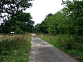
 Almost A Private Drive - geograph.org.uk - 218681.jpg 640 × 480; 96 KB
-
 Barmby Lane to Bloomhill Farm - geograph.org.uk - 1365069.jpg 640 × 480; 103 KB
-
 Bridleway to Gilberdyke - geograph.org.uk - 173627.jpg 640 × 480; 74 KB
-
 Four Houses Lane - geograph.org.uk - 217748.jpg 640 × 480; 99 KB
-
 Hive Lane corner - geograph.org.uk - 1168693.jpg 640 × 480; 182 KB
-
 New Carr Lane - geograph.org.uk - 217713.jpg 640 × 480; 95 KB
-
 Owsthorpe Lane to Mill Lane - geograph.org.uk - 1365077.jpg 640 × 480; 79 KB
-
 Reeds, A Crop And Trees - geograph.org.uk - 218678.jpg 640 × 480; 101 KB
-
 Roe Deer Crossing - geograph.org.uk - 1199797.jpg 640 × 332; 76 KB
-
 Salad Crop - geograph.org.uk - 173635.jpg 640 × 480; 78 KB
-
 Sleights Lane to Greaves End - geograph.org.uk - 1365074.jpg 640 × 480; 109 KB
-
 The Track From Greaves End - geograph.org.uk - 247964.jpg 640 × 480; 98 KB
-
 The Track To Greaves End - geograph.org.uk - 217750.jpg 640 × 480; 97 KB
-
 Track to Common Wood - geograph.org.uk - 1365126.jpg 640 × 480; 72 KB
-
 Track to Owsthorpe.jpg 640 × 480; 123 KB
-
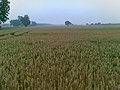 Wheat in the morning - geograph.org.uk - 1168685.jpg 640 × 480; 187 KB


