Category:Ower
Jump to navigation
Jump to search
human settlement in United Kingdom  | |||||
| Upload media | |||||
| Instance of | |||||
|---|---|---|---|---|---|
| Location | Copythorne, New Forest, Hampshire, South East England, England | ||||
 | |||||
English: Ower is a hamlet in the civil parish of Copythorne, in the New Forest district of Hampshire, England.
Media in category "Ower"
The following 17 files are in this category, out of 17 total.
-

-
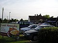 Lamb moussaka at the Vine Inn, Ower - geograph.org.uk - 184213.jpg 640 × 480; 265 KB
-
 McDonald's, Ower - geograph.org.uk - 2339920.jpg 640 × 480; 75 KB
-

-
 National Grid pylons at Ower - geograph.org.uk - 184206.jpg 480 × 640; 250 KB
-
 Owe.jpg 2,448 × 3,264; 614 KB
-
 Ower roundabout - geograph.org.uk - 184209.jpg 640 × 479; 284 KB
-
 Recently Cleaned Ditch Near Wigley - geograph.org.uk - 1567539.jpg 640 × 480; 138 KB
-
 Romsey Road (A36) - geograph.org.uk - 1144709.jpg 640 × 480; 58 KB
-
 Romsey Road, Ower - geograph.org.uk - 2515164.jpg 640 × 458; 64 KB
-
 Salisbury Road - geograph.org.uk - 1144151.jpg 640 × 480; 72 KB
-
 Shelley Farm - geograph.org.uk - 771596.jpg 640 × 480; 94 KB
-
 Shelley Lane, Ower - geograph.org.uk - 2894677.jpg 640 × 480; 117 KB
-
 Shelley Lane, Ower - geograph.org.uk - 2894680.jpg 640 × 480; 106 KB
-
 Sign for the Mortimer Arms - geograph.org.uk - 1671090.jpg 480 × 640; 161 KB
-
 The Mortimer Arms, Ower - geograph.org.uk - 1671084.jpg 640 × 480; 131 KB
-
 Whitemoor Road, Ower - geograph.org.uk - 2515180.jpg 640 × 480; 98 KB


_-_geograph.org.uk_-_1144709.jpg)


