Category:Overton-on-Dee
Jump to navigation
Jump to search
small town and community in Wrexham county borough, Wales    | |||||
| Upload media | |||||
| Instance of | |||||
|---|---|---|---|---|---|
| Location | Wrexham County Borough, Wales | ||||
 | |||||
Cymraeg: Mae Owrtyn ( Saesneg: Overton-on-Dee) yn bentref ar Afon Dyfrdwy ym mwrdeistref sirol Wrecsam. Saif ger cyffordd y priffyrdd A528 a'r A539. Un o Saith Rhyfeddod Cymru yw coed ywen Eglwys Owrtyn.
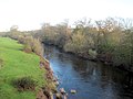
English: Overton or Overton-on-Dee is 7 miles (11 km) from the market town of Wrexham in north-east Wales. The village is situated on the edge of an escarpment which winds its way around the course of the River Dee which is where the name of Overton-on-Dee is derived from.
Subcategories
This category has the following 4 subcategories, out of 4 total.
P
S
Media in category "Overton-on-Dee"
The following 163 files are in this category, out of 163 total.
-
 A dozen turkeys at Little Cloy Farm - geograph.org.uk - 6366753.jpg 4,000 × 3,000; 2.84 MB
-
 A field of maize stubble near Overton - geograph.org.uk - 6365804.jpg 4,000 × 3,000; 2.89 MB
-
 A flock of sheep who've missed their shearing - geograph.org.uk - 6366759.jpg 4,000 × 3,000; 2.86 MB
-
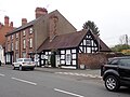
 A terrace of houses, Overton - geograph.org.uk - 6365800.jpg 3,913 × 2,572; 2.61 MB
-
 A528 and B5069 road junction - geograph.org.uk - 2172002.jpg 640 × 480; 85 KB
-
 A528 at Overton - geograph.org.uk - 2154167.jpg 640 × 480; 90 KB
-
 A528 nears Lower Lodge - geograph.org.uk - 3859644.jpg 640 × 481; 52 KB
-

-
 Argoed farmhouse - geograph.org.uk - 6365817.jpg 4,000 × 3,000; 2.89 MB
-
 Argoed Lodge - geograph.org.uk - 6365815.jpg 4,000 × 3,000; 2.89 MB
-
 Asney Park Farm - close up - geograph.org.uk - 1984171.jpg 640 × 428; 361 KB
-
 Asney Park Farm - geograph.org.uk - 1984162.jpg 640 × 428; 120 KB
-
 B5069 at Gwalia - geograph.org.uk - 2154275.jpg 640 × 480; 65 KB
-
 Bangor Road leaving Overton - geograph.org.uk - 3860778.jpg 640 × 481; 68 KB
-
 Bangor Road-Cloy Lane junction - geograph.org.uk - 3860795.jpg 640 × 481; 44 KB
-
 Beech tree among oilseed rape, Overton - geograph.org.uk - 1843877.jpg 800 × 534; 178 KB
-
 Beech tree among oilseed rape, Overton - geograph.org.uk - 1843881.jpg 800 × 533; 147 KB
-
 Bench mark on Overton Bridge - geograph.org.uk - 3455562.jpg 640 × 481; 225 KB
-
 Boat Inn at Erbistock - geograph.org.uk - 6010701.jpg 5,184 × 2,920; 6.98 MB
-
 Border landscape - geograph.org.uk - 1206133.jpg 640 × 427; 71 KB
-
 Borderlands, Little Pentre Farm - geograph.org.uk - 5853257.jpg 1,024 × 768; 1.29 MB
-
 Bridle Path Warning - geograph.org.uk - 4390711.jpg 800 × 508; 88 KB
-
 Brinapreece, in Flintshire, the Seat of Francis Parry Price, Esq.jpeg 900 × 656; 742 KB
-
 Building decorated with horse trappings on Musley Lane - geograph.org.uk - 6367546.jpg 4,000 × 3,000; 2.31 MB
-
 Cae-Dyah Bridge - geograph.org.uk - 6366680.jpg 4,000 × 3,000; 2.89 MB
-
 Cae-Dyah Lane - geograph.org.uk - 6366674.jpg 4,000 × 3,000; 2.86 MB
-
 Camouflaged Country Bridge - geograph.org.uk - 1189153.jpg 640 × 427; 105 KB
-
 Cattle grazing near Crab Mill Farm - geograph.org.uk - 249029.jpg 640 × 480; 74 KB
-

-
 Chapel House, Knolton - geograph.org.uk - 6120956.jpg 4,000 × 3,000; 2.52 MB
-
 Church and churchyard - geograph.org.uk - 2154236.jpg 640 × 480; 86 KB
-
 Church House, Overton - geograph.org.uk - 6120647.jpg 4,000 × 3,000; 2.43 MB
-
 Church of Our Lady and the Welsh Martyrs - geograph.org.uk - 6365796.jpg 4,000 × 3,000; 2.94 MB
-

-
 Cocoa and Reading Rooms - geograph.org.uk - 566994.jpg 640 × 480; 91 KB
-
 Commemorating the Battle of the Somme, Overton - geograph.org.uk - 5027203.jpg 5,184 × 3,456; 7.13 MB
-
 Country Assault Course - geograph.org.uk - 1212765.jpg 427 × 640; 143 KB
-
 Country Litter - geograph.org.uk - 1189160.jpg 427 × 640; 144 KB
-
 Country Sign - geograph.org.uk - 4377714.jpg 1,024 × 730; 168 KB
-
 Croeso i Gymru - Welcome to Wales - geograph.org.uk - 6120957.jpg 3,000 × 4,000; 2.17 MB
-
 Crossroads west of The Darlands - geograph.org.uk - 3928546.jpg 640 × 508; 55 KB
-
 Dark Lane - geograph.org.uk - 1240999.jpg 640 × 480; 110 KB
-
 Dispensary Row - geograph.org.uk - 1240883.jpg 640 × 480; 84 KB
-
 Dispensary Row, Overton - geograph.org.uk - 5853273.jpg 1,024 × 683; 1,011 KB
-

-
 Eastwick Plant Centre - geograph.org.uk - 6120955.jpg 4,000 × 3,000; 2.38 MB
-
 Farm buildings near Lightwood Green - geograph.org.uk - 6367543.jpg 4,000 × 3,000; 2.87 MB
-
 Farm buildings, Cae-Dyah Farm - geograph.org.uk - 6365823.jpg 4,000 × 3,000; 2.51 MB
-
 Field near Model Farm - geograph.org.uk - 4219011.jpg 800 × 600; 440 KB
-
 Footbridge on the Maelor Way - geograph.org.uk - 6366762.jpg 4,000 × 3,000; 2.87 MB
-
 Footpath across fields above the Dee - geograph.org.uk - 2839169.jpg 640 × 480; 86 KB
-

-
 Gwalia road junction - geograph.org.uk - 2154278.jpg 640 × 480; 124 KB
-
 H S Jones Family Butchers Shop - geograph.org.uk - 1241018.jpg 640 × 480; 63 KB
-
 Heifers near Pentre - geograph.org.uk - 4211045.jpg 800 × 600; 411 KB
-
 High Street, Overton - geograph.org.uk - 4143931.jpg 1,280 × 851; 308 KB
-
 High Street, Overton - geograph.org.uk - 4144024.jpg 851 × 1,280; 317 KB
-
 High Street, Overton - geograph.org.uk - 4144028.jpg 1,280 × 851; 279 KB
-
 High Street, Overton - geograph.org.uk - 5899998.jpg 1,024 × 768; 194 KB
-
 High Street, Overton-on-Dee - geograph.org.uk - 3859645.jpg 640 × 480; 65 KB
-

-
 House on Grange Road, A528 - geograph.org.uk - 6367549.jpg 4,000 × 3,000; 2.83 MB
-
 Houses in Church Lane - geograph.org.uk - 1240941.jpg 640 × 480; 159 KB
-
 Houses on Wrexham Road - geograph.org.uk - 5900004.jpg 1,024 × 768; 224 KB
-
 Jacob sheep sheltering from the sun under an apple tree - geograph.org.uk - 6367540.jpg 4,000 × 3,000; 2.86 MB
-
 Knolton Mill House - geograph.org.uk - 5185482.jpg 2,592 × 1,728; 1.43 MB
-
 Leaving Overton on B5069 - geograph.org.uk - 3928535.jpg 640 × 489; 42 KB
-
 Level fields between Overton on Dee ^ the R Dee - geograph.org.uk - 6010692.jpg 5,184 × 2,920; 5.61 MB
-
 Little Overton - geograph.org.uk - 5167807.jpg 5,108 × 3,405; 1.18 MB
-
 Little Overton Farm - geograph.org.uk - 4390719.jpg 1,024 × 590; 94 KB
-
 Lower Lodge Overton - geograph.org.uk - 2172008.jpg 640 × 480; 78 KB
-
 M E Evans, butchers - Overton - geograph.org.uk - 4144020.jpg 1,280 × 851; 390 KB
-
 Musley Lane, Overton - geograph.org.uk - 5211171.jpg 2,592 × 1,728; 4.54 MB
-
 Narrow country lane - geograph.org.uk - 6366668.jpg 4,000 × 3,000; 2.91 MB
-
 Nature's bounty - geograph.org.uk - 6365830.jpg 4,000 × 3,000; 2.86 MB
-
 Newal House - geograph.org.uk - 6367539.jpg 4,000 × 3,000; 2.81 MB
-
-
 Not just any tree House - geograph.org.uk - 1205958.jpg 427 × 640; 138 KB
-
 Old Milestone by the A359, Overton Parish - geograph.org.uk - 6045321.jpg 774 × 1,177; 337 KB
-

-
 One of the 7 Wonders of Wales - geograph.org.uk - 2154182.jpg 480 × 640; 118 KB
-
 Ordnance Survey Cut Mark - geograph.org.uk - 5142962.jpg 395 × 640; 83 KB
-
 Ordnance Survey Cut Mark - geograph.org.uk - 5142982.jpg 640 × 513; 114 KB
-
 Ordnance Survey Flush Bracket S0166 - geograph.org.uk - 5230875.jpg 3,825 × 2,869; 1.9 MB
-
 Ornate seat in St Mary's Churchyard - geograph.org.uk - 2154213.jpg 640 × 480; 113 KB
-
 Overton - La Murette Twinning Memorial - geograph.org.uk - 5670915.jpg 2,048 × 1,536; 551 KB
-
 Overton Bridge and a bench mark - geograph.org.uk - 3455567.jpg 640 × 480; 164 KB
-
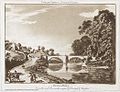
 Overton Bridge by T. Walmsley & F. Jukes (1129157).jpg 1,276 × 910; 796 KB
-
 Overton Bridge from the grounds of the nearby pub - geograph.org.uk - 5948518.jpg 4,000 × 3,000; 5.09 MB
-

-
-
 Overton Lodge, on Argoed Road - geograph.org.uk - 6365813.jpg 4,000 × 3,000; 2.97 MB
-
 Overton on Dee - Dispensary Row on A539 - geograph.org.uk - 6010698.jpg 5,184 × 2,920; 4.78 MB
-
 Overton on Dee - High St - geograph.org.uk - 6010690.jpg 5,184 × 2,920; 6.26 MB
-
 Overton parkland - geograph.org.uk - 5040099.jpg 5,184 × 3,456; 7.57 MB
-
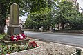
 Overton War Memorial - geograph.org.uk - 6120653.jpg 4,000 × 3,000; 2.53 MB
-
 Overton Yew information - geograph.org.uk - 2154210.jpg 480 × 640; 103 KB
-
 Overton-on-Dee - Owrtyn - geograph.org.uk - 1843843.jpg 800 × 534; 186 KB
-
 Overton-on-Dee High Street.jpg 1,024 × 768; 144 KB
-
 Overton01LB.jpg 2,048 × 1,536; 662 KB
-
 Part of the A539 near Overton-on-Dee - geograph.org.uk - 2839200.jpg 640 × 480; 75 KB
-
-

-
 Part of the Maelor Way below Overton - geograph.org.uk - 2838757.jpg 640 × 480; 66 KB
-

-

-

-
 Particularly muddy field at Cae-Dyah Farm - geograph.org.uk - 6365825.jpg 4,000 × 3,000; 2.9 MB
-

-
 Path to the greenhouses - geograph.org.uk - 6128784.jpg 1,080 × 810; 261 KB
-
 Pirate Ship - geograph.org.uk - 1205971.jpg 640 × 427; 106 KB
-
 Post Office - geograph.org.uk - 1241007.jpg 640 × 527; 78 KB
-
 Redundant Bridge - geograph.org.uk - 1206148.jpg 640 × 427; 79 KB
-
 Rhewl, Overton - geograph.org.uk - 5234269.jpg 2,525 × 1,683; 886 KB
-
-
 River Dee from Cross Foxes car park - geograph.org.uk - 2172010.jpg 640 × 480; 72 KB
-
 Riverside property in Erbistock - geograph.org.uk - 2838996.jpg 640 × 480; 107 KB
-
 Road with Bridge over Shell Brook near Pentre Farm - geograph.org.uk - 5231362.jpg 4,000 × 3,000; 4.45 MB
-
 Rural Archway - geograph.org.uk - 1212750.jpg 427 × 640; 98 KB
-
 Salop Road, Overton - geograph.org.uk - 4219007.jpg 800 × 600; 376 KB
-
 Secret Sign - geograph.org.uk - 4390767.jpg 800 × 520; 120 KB
-
 Shell Brook, Knolton Wood - geograph.org.uk - 5185481.jpg 5,279 × 3,602; 3.6 MB
-
 Silos at Trench Farm - geograph.org.uk - 5167805.jpg 5,184 × 3,456; 1.91 MB
-
 Springtime in Overton - geograph.org.uk - 4968237.jpg 5,184 × 3,456; 6.6 MB
-
 St Mary's Church Tower, Overton - geograph.org.uk - 6120654.jpg 2,879 × 3,837; 1.66 MB
-
 St Mary's Church, Overton - geograph.org.uk - 6120635.jpg 4,000 × 3,000; 2.85 MB
-

-

-
 Stile near a chicken farm, Musley Lane - geograph.org.uk - 6367548.jpg 4,000 × 3,000; 2.87 MB
-
 Stile near Llan-y-cefn above the Dee - geograph.org.uk - 2839180.jpg 640 × 480; 139 KB
-
 Strange Gatekeeper - geograph.org.uk - 4390761.jpg 1,024 × 709; 146 KB
-
 Sunlit Stroll - geograph.org.uk - 1212732.jpg 427 × 640; 73 KB
-
-
 Sylvan Setting - geograph.org.uk - 1200350.jpg 640 × 427; 91 KB
-
 The A539 at Lightwood Green - geograph.org.uk - 6367541.jpg 4,000 × 3,000; 2.86 MB
-

-
 The Cross Foxes at Overton Bridge - geograph.org.uk - 2172014.jpg 640 × 480; 98 KB
-
 The ivy way. - geograph.org.uk - 1205980.jpg 427 × 640; 79 KB
-

-
 The Old Yew tree in churchyard - geograph.org.uk - 2154230.jpg 480 × 640; 115 KB
-
 The Way is hard - geograph.org.uk - 4390773.jpg 800 × 514; 170 KB
-
 The White Horse Inn, Overton - geograph.org.uk - 5900010.jpg 768 × 1,024; 200 KB
-
 The White Horse Inn, Overton - geograph.org.uk - 6120630.jpg 4,000 × 3,000; 2.39 MB
-
 Their Little Devonshire home - geograph.org.uk - 4390723.jpg 800 × 533; 155 KB
-
 Tiny Tearaways - geograph.org.uk - 1206160.jpg 427 × 640; 95 KB
-

-
 Village shop Overton - geograph.org.uk - 2154239.jpg 640 × 480; 79 KB
-
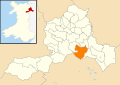 Wales Wrexham Community Overton map.svg 512 × 362; 495 KB
-
 War Memorial, Overton-on-Dee - geograph.org.uk - 567910.jpg 480 × 640; 133 KB
-
 Wat's Dyke Way, Overton - geograph.org.uk - 5031145.jpg 2,552 × 1,701; 1.3 MB
-
 White Horse Inn Overton - geograph.org.uk - 2154233.jpg 640 × 480; 78 KB
-
 Wrexham Road (A539) in Overton-Owrtyn - geograph.org.uk - 5230876.jpg 4,000 × 3,000; 2.97 MB
-
 Country lane with big trees - geograph.org.uk - 66165.jpg 640 × 480; 91 KB
-
 Dispensary Row, Overton-on-Dee - geograph.org.uk - 566926.jpg 640 × 480; 87 KB
-
 Firs Farm near Owrtyn - geograph.org.uk - 65944.jpg 640 × 480; 83 KB
-
 House and cottages at overton-on-Dee - geograph.org.uk - 46427.jpg 640 × 480; 120 KB
-
 Overton - geograph.org.uk - 6570.jpg 640 × 480; 101 KB
-
 Owrtyn - Overton Sign - geograph.org.uk - 566923.jpg 640 × 480; 155 KB
-
 Pond beside the road - geograph.org.uk - 66170.jpg 640 × 480; 124 KB
-
 Railway bridge now set amongst the fields - geograph.org.uk - 65948.jpg 640 × 480; 111 KB
-
 Redundant bridge used as a store - geograph.org.uk - 66174.jpg 640 × 480; 89 KB
-
 Redundant railway bridge - geograph.org.uk - 249060.jpg 640 × 480; 88 KB
-
 Rural lane at Musley - geograph.org.uk - 66179.jpg 640 × 480; 114 KB


.jpg)

.jpg)


_in_Overton-Owrtyn_-_geograph.org.uk_-_5230876.jpg)


