Category:Overbury Street tunnel
Jump to navigation
Jump to search
| Object location | | View all coordinates using: OpenStreetMap |
|---|
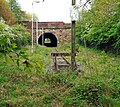
Tunnel, part of the disused Liverpool Crown Street goods branch carrying Overbury Street, Edge Hill, Liverpool, over the track. It is numbered LCS/5.2 on that line and EHW/3.2 on the Edge Hill to Park Lane goods branch (Wapping Branch). It is 1.78 miles from its datum at Olive Mount junction.
Media in category "Overbury Street tunnel"
The following 7 files are in this category, out of 7 total.
-
Disused Railway Tunnel - geograph.org.uk - 64494.jpg 640 × 480; 60 KB
-
Map of Liverpool and its Environs OS Map name 106-15, Ordnance Survey, 1874-1893 label.png 11,338 × 7,545; 35.97 MB
-
Map of Liverpool and its Environs OS Map name 106-15, Ordnance Survey, 1874-1893.png 11,338 × 7,545; 43.88 MB
-
Overbury Street bridge 1.jpg 4,104 × 3,648; 10.54 MB
-
Overbury Street bridge 2.jpg 4,524 × 3,696; 9.09 MB
-
Parapet of Overbury Street tunnel.jpg 4,784 × 2,744; 5.77 MB
-
Wapping Tunnel OSM.jpg 1,866 × 605; 536 KB


