Category:Overbury
Jump to navigation
Jump to search
village in the United Kingdom  | |||||
| Upload media | |||||
| Instance of | |||||
|---|---|---|---|---|---|
| Location | Wychavon, Worcestershire, West Midlands, England | ||||
| Population |
| ||||
| Area |
| ||||
 | |||||
Subcategories
This category has the following 2 subcategories, out of 2 total.
F
O
- Overbury Court (3 F)
Media in category "Overbury"
The following 200 files are in this category, out of 229 total.
(previous page) (next page)-
 1, Church Row, Overbury - geograph.org.uk - 5871076.jpg 2,837 × 2,587; 2.03 MB
-
 A bus shelter built before the first bus .... - geograph.org.uk - 5871983.jpg 3,334 × 2,202; 2.12 MB
-
 A field of peas - geograph.org.uk - 6469059.jpg 1,024 × 768; 430 KB
-
 A fine display of mistletoe^ - geograph.org.uk - 3794572.jpg 1,944 × 2,592; 1.99 MB
-
 A growing crop on Bredon Hill - geograph.org.uk - 6378224.jpg 1,024 × 768; 387 KB
-
 A jogger on Bredon Hill - geograph.org.uk - 4803739.jpg 800 × 600; 102 KB
-
 A wintery landscape, Bredon Hill - geograph.org.uk - 1159256.jpg 640 × 426; 57 KB
-
 After the harvest - geograph.org.uk - 3091248.jpg 1,024 × 680; 235 KB
-
 Arable land on Bredon Hill - geograph.org.uk - 4294412.jpg 800 × 451; 177 KB
-
 Arable land on Bredon Hill - geograph.org.uk - 895729.jpg 640 × 480; 89 KB
-
 Ash trees, Fiddlers Knap, Bredon Hill - geograph.org.uk - 3670648.jpg 3,648 × 2,736; 3.61 MB
-
 Bare winter trees - geograph.org.uk - 4826428.jpg 800 × 531; 119 KB
-
 Barn near Overbury - geograph.org.uk - 759640.jpg 640 × 426; 93 KB
-
 Barn on Bredon Hill - geograph.org.uk - 3091300.jpg 1,024 × 680; 244 KB
-
 Barn on Bredon Hill - geograph.org.uk - 524620.jpg 640 × 426; 125 KB
-
 Barn on Pigeon Lane - geograph.org.uk - 1817733.jpg 4,000 × 3,000; 3.65 MB
-
 Baron House, Overbury and the horse pond - geograph.org.uk - 5870740.jpg 3,658 × 2,006; 1.72 MB
-
 Beech trees beside Lalu Farm - geograph.org.uk - 6004893.jpg 1,024 × 768; 265 KB
-
 Beechwood belt - geograph.org.uk - 4294422.jpg 800 × 451; 216 KB
-
 Bench and wall - geograph.org.uk - 4729756.jpg 1,024 × 768; 283 KB
-
 Bench seat in Overbury - geograph.org.uk - 759642.jpg 640 × 426; 111 KB
-
 Berkeley Cottages, Overbury - geograph.org.uk - 5872103.jpg 3,323 × 2,209; 2.31 MB
-
 Berkeley House, Overbury - geograph.org.uk - 5870957.jpg 3,323 × 2,209; 1.43 MB
-
 Bredon Hill above Kemerton - geograph.org.uk - 526109.jpg 426 × 640; 118 KB
-
 Bredon Hill crest path, 6 - geograph.org.uk - 4295392.jpg 800 × 451; 207 KB
-
 Bridleway on Bredon Hill - geograph.org.uk - 2304661.jpg 2,680 × 1,790; 2.34 MB
-
 Bridleway to Kemerton - geograph.org.uk - 4728672.jpg 1,024 × 768; 231 KB
-
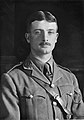 Captain J G Overbury (6789669827).jpg 537 × 766; 43 KB
-
 Cattle grid in Overbury Park - geograph.org.uk - 4728690.jpg 1,024 × 768; 203 KB
-
 Church Row and Overbury Court - geograph.org.uk - 5871451.jpg 3,407 × 2,155; 2.62 MB
-
 Church Row, Overbury - geograph.org.uk - 5871384.jpg 3,571 × 2,055; 2.48 MB
-
 Clumps of trees on Bredon Hill - geograph.org.uk - 4728622.jpg 1,024 × 768; 145 KB
-
 Conderton village - geograph.org.uk - 4626476.jpg 1,024 × 768; 135 KB
-
 Cotswold Stone Barn, Bredon Hill - geograph.org.uk - 66406.jpg 640 × 479; 79 KB
-
 Cotswold stone cottage, Overbury - geograph.org.uk - 760679.jpg 640 × 426; 97 KB
-
 Cotswold stone house in Overbury - geograph.org.uk - 760707.jpg 426 × 640; 92 KB
-
 Cotswold Stone Wall - geograph.org.uk - 300603.jpg 640 × 241; 163 KB
-
 Cotswold Stone Wall and Copse - geograph.org.uk - 300899.jpg 640 × 368; 229 KB
-
 Cottage in Overbury - geograph.org.uk - 760625.jpg 426 × 640; 93 KB
-
 Cottages and Overbury Court - geograph.org.uk - 760753.jpg 640 × 426; 90 KB
-
 Cottages in Overbury - geograph.org.uk - 4664828.jpg 1,024 × 768; 194 KB
-
 Cottages in Overbury - geograph.org.uk - 4826938.jpg 1,024 × 680; 279 KB
-
 Cottages in Overbury - geograph.org.uk - 760640.jpg 640 × 426; 86 KB
-
 Cottages in Overbury - geograph.org.uk - 760647.jpg 640 × 426; 87 KB
-
 Cottages in Overbury - geograph.org.uk - 760660.jpg 640 × 426; 85 KB
-
 Cottages in Overbury - geograph.org.uk - 760760.jpg 640 × 426; 77 KB
-
 Cottages in Overbury - geograph.org.uk - 762694.jpg 640 × 426; 62 KB
-
 Cottages on Pigeon Lane - geograph.org.uk - 4826948.jpg 1,024 × 680; 323 KB
-
 Court Lodge, 1 Church Row - geograph.org.uk - 4729776.jpg 1,024 × 768; 152 KB
-
 Crashmore Lane - geograph.org.uk - 3101119.jpg 1,200 × 676; 415 KB
-
 Crashmore Lane - geograph.org.uk - 3719594.jpg 800 × 600; 293 KB
-
 Crashmore Lane bridge over stream - geograph.org.uk - 4626488.jpg 1,024 × 768; 155 KB
-
 Crop of peas - geograph.org.uk - 3091275.jpg 1,024 × 680; 326 KB
-
 Dormay Cottages, Overbury - geograph.org.uk - 5873803.jpg 3,323 × 2,209; 1.93 MB
-
 Dormay Cottages, Overbury - geograph.org.uk - 5874179.jpg 3,216 × 2,282; 2.35 MB
-
 Drystone wall - geograph.org.uk - 4317998.jpg 1,024 × 680; 351 KB
-
 Drystone wall on Bredon Hill - geograph.org.uk - 4317527.jpg 800 × 531; 150 KB
-
 Drystone walling - geograph.org.uk - 4317521.jpg 800 × 531; 166 KB
-
 Dustbin day on Crashmore Lane - geograph.org.uk - 4626473.jpg 1,024 × 553; 169 KB
-
 Estate cottages, School Lane, Overbury - geograph.org.uk - 5872094.jpg 3,323 × 2,209; 2.06 MB
-
 Farm buildings on Conderton Hill - geograph.org.uk - 759618.jpg 640 × 426; 96 KB
-
 Farm track to Park Farm - geograph.org.uk - 4298908.jpg 800 × 531; 170 KB
-
 Farmland around Lalu Farm - geograph.org.uk - 4780169.jpg 1,024 × 680; 295 KB
-
 Farmland around Lalu Farm - geograph.org.uk - 6469068.jpg 1,024 × 577; 214 KB
-
 Farmland on Bredon Hill - geograph.org.uk - 3091213.jpg 1,024 × 680; 200 KB
-
 Farmland on Bredon Hill - geograph.org.uk - 4781046.jpg 1,024 × 680; 313 KB
-
 Fiddlers Knap on Bredon Hill - geograph.org.uk - 2366047.jpg 3,648 × 2,736; 3.45 MB
-
 Folding rake - agricultural machinery - on Bredon Hill - geograph.org.uk - 2366029.jpg 3,648 × 2,736; 3.71 MB
-
 Footpath meets bridleway - geograph.org.uk - 4664836.jpg 1,024 × 768; 319 KB
-
 Footpath to Kemerton - geograph.org.uk - 3092245.jpg 1,200 × 676; 406 KB
-
 Former Post Office and Stores, Overbury - geograph.org.uk - 5871950.jpg 3,323 × 2,209; 2.28 MB
-
 Former public house in Overbury - geograph.org.uk - 529497.jpg 640 × 480; 131 KB
-
 Former shop in Overbury - geograph.org.uk - 4803729.jpg 800 × 600; 122 KB
-
 Gable Row, Overbury - geograph.org.uk - 5872892.jpg 3,446 × 2,130; 1.93 MB
-
 Gable Row, Overbury - geograph.org.uk - 5873049.jpg 3,589 × 2,045; 2.83 MB
-
 Gate into Conderton farmland - geograph.org.uk - 4626462.jpg 1,024 × 768; 157 KB
-
 Gate on Bridleway near Sundial Farm, Bredon Hill - geograph.org.uk - 4949721.jpg 1,600 × 1,200; 565 KB
-
 Gate on the bridleway - geograph.org.uk - 4728655.jpg 1,024 × 768; 198 KB
-
 Georgian house in Overbury - geograph.org.uk - 760745.jpg 426 × 640; 75 KB
-
 Harrowed field on Bredon Hill - geograph.org.uk - 2366019.jpg 3,648 × 2,736; 3.15 MB
-
 Headland bridleway - geograph.org.uk - 6471507.jpg 1,024 × 683; 344 KB
-
 Houses in Overbury - geograph.org.uk - 4826436.jpg 800 × 531; 132 KB
-
 Houses on Crashmore Lane - geograph.org.uk - 4011930.jpg 1,600 × 1,064; 668 KB
-
 Huge tractor on Crashmore Lane - geograph.org.uk - 4626495.jpg 703 × 1,024; 116 KB
-
 Lalu Farm - geograph.org.uk - 4728651.jpg 1,024 × 768; 158 KB
-
 Lalu Farm - geograph.org.uk - 4803736.jpg 1,024 × 768; 376 KB
-
 Lalu Farm from The Belt, Bredon Hill - geograph.org.uk - 4949669.jpg 1,600 × 1,143; 258 KB
-
 Lalu Farm on Bredon Hill - geograph.org.uk - 4489014.jpg 1,600 × 1,200; 580 KB
-
 Lalu Farm, Bredon Hill - geograph.org.uk - 1159251.jpg 426 × 640; 15 KB
-
 Lalu farm, Bredon Hill - geograph.org.uk - 1164097.jpg 640 × 257; 15 KB
-
 Linseed plants - geograph.org.uk - 6378227.jpg 768 × 1,024; 285 KB
-
 Match at Overbury cricket club in late August 2013 - geograph.org.uk - 3694032.jpg 4,752 × 3,168; 2.57 MB
-
 Mill Bank Cottage, Overbury - geograph.org.uk - 5874638.jpg 3,323 × 2,209; 2.63 MB
-
 Nascent stream - geograph.org.uk - 4728680.jpg 1,024 × 768; 307 KB
-
 Next to Lalu Farm, Bredon Hill, Worcestershire - geograph.org.uk - 4489341.jpg 1,600 × 1,200; 616 KB
-
 Nindfield, Overbury - geograph.org.uk - 4729648.jpg 1,024 × 768; 241 KB
-
 Nindfield, Overbury - geograph.org.uk - 5874677.jpg 3,233 × 2,270; 2.17 MB
-
 Northland House, or The Norlands, Overbury - geograph.org.uk - 5873071.jpg 3,323 × 2,209; 2.18 MB
-
 Northland House, or The Norlands, Overbury - geograph.org.uk - 5873089.jpg 3,459 × 2,122; 1.92 MB
-
 Old quarry by Fiddlers Knap - geograph.org.uk - 2366071.jpg 3,648 × 2,736; 3.72 MB
-
 Old Toll House by High Street, Overbury (geograph 6114527).jpg 640 × 479; 118 KB
-
 On Bredon Hill - geograph.org.uk - 4728676.jpg 1,024 × 768; 160 KB
-
 Overbury - bridge and houses - geograph.org.uk - 4664808.jpg 1,024 × 768; 207 KB
-
 Overbury - geograph.org.uk - 2335124.jpg 1,024 × 680; 141 KB
-
 Overbury - geograph.org.uk - 3575460.jpg 1,024 × 768; 177 KB
-
 Overbury - geograph.org.uk - 672123.jpg 640 × 480; 51 KB
-
 Overbury Court - geograph.org.uk - 5871011.jpg 3,323 × 2,209; 2.07 MB
-
 Overbury Cricket Club - geograph.org.uk - 794415.jpg 640 × 426; 83 KB
-
 Overbury cricket field and pavilion - geograph.org.uk - 91451.jpg 640 × 426; 143 KB
-
 Overbury from the air - geograph.org.uk - 930060.jpg 640 × 426; 73 KB
-
 Overbury Park - geograph.org.uk - 4729795.jpg 1,024 × 768; 169 KB
-
 Overbury village school - geograph.org.uk - 5871991.jpg 3,323 × 2,209; 1.81 MB
-
 Overbury Village School - geograph.org.uk - 5871994.jpg 3,323 × 2,209; 2.37 MB
-
 Overbury Village School - geograph.org.uk - 5872064.jpg 3,323 × 2,209; 1.71 MB
-
 Overbury's cricket field - geograph.org.uk - 6683834.jpg 1,024 × 768; 369 KB
-
 Overbury, cottages and country house - geograph.org.uk - 3101169.jpg 1,200 × 676; 407 KB
-
 Park Lodge - geograph.org.uk - 4729639.jpg 1,024 × 768; 214 KB
-
 Park Lodge, Overbury - geograph.org.uk - 5873346.jpg 3,538 × 2,075; 2.06 MB
-
 Park Lodge, Overbury - geograph.org.uk - 5873349.jpg 3,323 × 2,209; 2.32 MB
-
 Park View - geograph.org.uk - 4729630.jpg 1,024 × 768; 203 KB
-
 Parkland in Overbury - geograph.org.uk - 3794564.jpg 2,592 × 1,944; 1.88 MB
-
 Permissive footpath, Bredon Hill - geograph.org.uk - 4788270.jpg 800 × 531; 107 KB
-
 Permissive path - geograph.org.uk - 1817722.jpg 4,000 × 3,000; 4.47 MB
-
 Permissive Path on Bredon Hill - geograph.org.uk - 3087979.jpg 1,024 × 680; 237 KB
-
 Permissive right of way - geograph.org.uk - 3091255.jpg 1,024 × 680; 235 KB
-
 Pigeon Lane, Overbury - geograph.org.uk - 1817727.jpg 4,000 × 3,000; 3.94 MB
-
 Pine trees and Lalu Farm, Bredon Hill - geograph.org.uk - 524716.jpg 640 × 253; 35 KB
-
 Pine trees on Bredon Hill - geograph.org.uk - 2195169.jpg 1,024 × 681; 242 KB
-
 Pine trees on Bredon Hill - geograph.org.uk - 4826392.jpg 800 × 531; 99 KB
-
 Pine trees on Bredon Hill - geograph.org.uk - 5650458.jpg 1,024 × 576; 207 KB
-
 Pine trees on Bredon Hill - geograph.org.uk - 6004889.jpg 1,024 × 683; 212 KB
-
 Poppy wreaths - geograph.org.uk - 6683842.jpg 1,024 × 768; 264 KB
-
 Post-Christmas walk on Bredon Hill - geograph.org.uk - 4294429.jpg 800 × 451; 135 KB
-
 Primary School, Overbury - geograph.org.uk - 4011911.jpg 1,600 × 1,064; 606 KB
-
 Private road on Bredon Hill - geograph.org.uk - 2197489.jpg 1,024 × 681; 163 KB
-
 Public bridleway at The Warren - geograph.org.uk - 1572691.jpg 640 × 480; 148 KB
-
 Rape crop on Bredon Hill - geograph.org.uk - 1570201.jpg 640 × 467; 133 KB
-
 Rape crop on Bredon Hill - geograph.org.uk - 1570217.jpg 640 × 465; 139 KB
-
 Road approaching Lalu Farm - geograph.org.uk - 3087976.jpg 1,024 × 680; 177 KB
-
 Road ascending Bredon Hill - geograph.org.uk - 3087969.jpg 680 × 1,024; 251 KB
-
 Road in Overbury - geograph.org.uk - 4803732.jpg 800 × 600; 90 KB
-
 Road into Overbury - geograph.org.uk - 762685.jpg 640 × 426; 76 KB
-
 Road through Overbury Park - geograph.org.uk - 3087966.jpg 1,024 × 680; 195 KB
-
 Road through Overbury Park - geograph.org.uk - 760655.jpg 640 × 426; 73 KB
-
 Road to Lalu Farm - geograph.org.uk - 2197484.jpg 681 × 1,024; 221 KB
-
 Rocky ground - geograph.org.uk - 6004902.jpg 1,024 × 768; 322 KB
-
 School House, Overbury - geograph.org.uk - 5872074.jpg 3,323 × 2,209; 2.33 MB
-
 Scots Pine on Bredon Hill - geograph.org.uk - 524725.jpg 640 × 426; 111 KB
-
 Scots Pine trees on Bredon Hill - geograph.org.uk - 524748.jpg 640 × 301; 45 KB
-
 Scots pine trees, Bredon Hill - geograph.org.uk - 895716.jpg 640 × 480; 87 KB
-
 Silver Pill House, Overbury - geograph.org.uk - 760700.jpg 640 × 426; 94 KB
-
 Silver Rill House - geograph.org.uk - 4729617.jpg 1,024 × 768; 176 KB
-
 Silver Rill House - geograph.org.uk - 5910994.jpg 3,840 × 2,160; 3.85 MB
-
 Someone's lost their hat^ - geograph.org.uk - 4294432.jpg 800 × 451; 182 KB
-
 St Faith, Overbury - geograph.org.uk - 5867513.jpg 2,209 × 3,323; 2.51 MB
-
 St Faith, Overbury - geograph.org.uk - 5867669.jpg 3,323 × 2,209; 2.75 MB
-
 St Faith, Overbury - geograph.org.uk - 5867700.jpg 3,077 × 2,385; 2.06 MB
-
 St Faith, Overbury - geograph.org.uk - 5867706.jpg 3,323 × 2,209; 1.98 MB
-
 St Faith, Overbury - geograph.org.uk - 5868544.jpg 2,209 × 3,323; 2.75 MB
-
 St Faith, Overbury - geograph.org.uk - 5868571.jpg 3,322 × 2,209; 2.56 MB
-
 St Faith, Overbury - geograph.org.uk - 5869354.jpg 2,209 × 3,323; 2.22 MB
-
 St Faith, Overbury - geograph.org.uk - 5869361.jpg 2,771 × 2,649; 1.91 MB
-
 St Faith, Overbury - geograph.org.uk - 5869374.jpg 2,487 × 2,951; 2.66 MB
-
 St Faith, Overbury - geograph.org.uk - 5869389.jpg 2,438 × 3,010; 2.34 MB
-
 St Faith, Overbury - geograph.org.uk - 5869392.jpg 2,209 × 3,323; 2.77 MB
-
 St Faith, Overbury - geograph.org.uk - 5870428.jpg 2,209 × 3,323; 1.77 MB
-
 St Faith, Overbury - geograph.org.uk - 5870567.jpg 2,209 × 3,323; 3.22 MB
-
 St Faith, Overbury - geograph.org.uk - 5870574.jpg 2,209 × 3,323; 2.18 MB
-
 Stubble fields and Lalu Farm - geograph.org.uk - 4728665.jpg 1,024 × 768; 178 KB
-
 Sunny Bank Cottage, Overbury - geograph.org.uk - 5873337.jpg 3,489 × 2,320; 2.64 MB
-
 The Belt - geograph.org.uk - 1570104.jpg 640 × 480; 151 KB
-
 The Brake swimming pool, Overbury 1952 - geograph.org.uk - 4414267.jpg 1,214 × 1,171; 169 KB
-
 The former Post Office and village stores, Overbury - geograph.org.uk - 5871965.jpg 3,256 × 2,254; 1.57 MB
-
 The heart of Bredon Hill - geograph.org.uk - 4295406.jpg 800 × 207; 94 KB
-
 The Lodge in Overbury Park - geograph.org.uk - 4826420.jpg 800 × 531; 128 KB
-
 The Norlands (Northland House) - geograph.org.uk - 4729770.jpg 1,024 × 768; 144 KB
-
 The Old Brewhouse, Overbury - geograph.org.uk - 5873888.jpg 3,424 × 2,144; 2.37 MB
-
 The Red House, Overbury - geograph.org.uk - 4729760.jpg 1,024 × 768; 238 KB
-
 The Red House, Overbury - geograph.org.uk - 5873179.jpg 3,323 × 2,209; 2.06 MB
-
 The road to Lalu Farm - geograph.org.uk - 2197487.jpg 1,024 × 681; 218 KB
-
 The Village Hall, Overbury - geograph.org.uk - 5872969.jpg 3,077 × 2,385; 2.35 MB
-
 The Village Hall, Overbury - geograph.org.uk - 5872978.jpg 3,650 × 2,011; 2.27 MB
-
 Track and bridleway - geograph.org.uk - 4318006.jpg 800 × 531; 130 KB
-
 Track and footpath - geograph.org.uk - 3101062.jpg 1,200 × 676; 391 KB
-
 Track approaching Lalu Farm - geograph.org.uk - 4156921.jpg 800 × 531; 125 KB
-
 Track approaching Lalu Farm - geograph.org.uk - 6179648.jpg 1,024 × 768; 248 KB
-
 Track descending Bredon Hill - geograph.org.uk - 3091280.jpg 1,024 × 680; 253 KB
-
 Track to Lalu Farm - geograph.org.uk - 1570242.jpg 640 × 480; 100 KB
-
 Track to Lalu Farm - geograph.org.uk - 4728659.jpg 1,024 × 768; 176 KB
-
 Track to Park Farm - geograph.org.uk - 4294283.jpg 800 × 451; 158 KB
-
 Track to Park Farm - geograph.org.uk - 4294411.jpg 800 × 451; 202 KB
-
 Tram-lines near Park Farm - geograph.org.uk - 4294419.jpg 800 × 451; 179 KB
-
 Trees and farmland - geograph.org.uk - 4779806.jpg 800 × 531; 146 KB
-
 Trees by a small pond, Overbury Park - geograph.org.uk - 4664815.jpg 1,024 × 768; 247 KB
-
 Trees on Bredon Hill - geograph.org.uk - 4779801.jpg 1,024 × 680; 288 KB
-
 Trees on Bredon Hill - geograph.org.uk - 4779899.jpg 1,024 × 680; 313 KB
-
 Triangular stand of trees above Lalu Farm, Bredon Hill - geograph.org.uk - 4489349.jpg 1,600 × 1,200; 369 KB
-
 View south from Bredon Hill - geograph.org.uk - 2197492.jpg 1,024 × 681; 113 KB
-
 View towards Lalu Farm - geograph.org.uk - 4664837.jpg 1,024 × 768; 144 KB
-
 Village cricket match at Overbury - geograph.org.uk - 529492.jpg 640 × 480; 146 KB


.jpg)


.jpg)


_-_geograph.org.uk_-_4729770.jpg)


