Category:Over Stowey
Jump to navigation
Jump to search
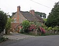
English: Over Stowey is a small village and civil parish in the Sedgemoor district of Somerset, South West England. It sits in the foothills of the Quantock Hills, just below Nether Stowey and north-west of Bridgwater. The parish includes the hamlets of Plainsfield, Aley, Adscombe, Friarn and Bincombe.
village in Somerset, England, UK  | |||||
| Upload media | |||||
| Instance of | |||||
|---|---|---|---|---|---|
| Location | Sedgemoor, Somerset, South West England, England | ||||
| Population |
| ||||
 | |||||
Subcategories
This category has the following 4 subcategories, out of 4 total.
A
- Adscombe Chapel (3 F)
- Aley, Somerset (2 F)
P
- Plainsfield, Somerset (3 F)
Media in category "Over Stowey"
The following 200 files are in this category, out of 407 total.
(previous page) (next page)-
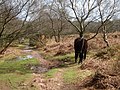
 A badger's path by the track in Quantock Combe - geograph.org.uk - 6084471.jpg 1,600 × 1,200; 1.07 MB
-
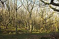
 A broadleaved wood - geograph.org.uk - 2374136.jpg 640 × 475; 368 KB
-
 A gap in the forest below Great Bear - geograph.org.uk - 5448361.jpg 6,000 × 4,000; 5.57 MB
-
 A glimpse of Marrow Hill - geograph.org.uk - 4054698.jpg 1,024 × 768; 305 KB
-
 Accommodation block at Quantock Lodge - geograph.org.uk - 5764052.jpg 1,024 × 768; 151 KB
-
 Adscombe - geograph.org.uk - 3015058.jpg 2,592 × 1,944; 1.57 MB
-
 Adscombe Farm - geograph.org.uk - 4431152.jpg 1,024 × 768; 221 KB
-
 Adventure activity group on the Quantock Hills - geograph.org.uk - 4057274.jpg 1,024 × 784; 200 KB
-
 Ash near Adscombe - geograph.org.uk - 1904389.jpg 640 × 480; 128 KB
-
 Ash tree, Adscombe - geograph.org.uk - 4390663.jpg 1,024 × 768; 207 KB
-
 Ashley Combe - geograph.org.uk - 5381335.jpg 3,072 × 2,048; 1.29 MB
-
 Ashley Combe - geograph.org.uk - 5648830.jpg 1,024 × 683; 517 KB
-
 Ashley Combe - geograph.org.uk - 5648834.jpg 1,024 × 683; 574 KB
-
 Ashley Combe - geograph.org.uk - 5648835.jpg 640 × 427; 99 KB
-
 At the brow of Castle Hill looking west - geograph.org.uk - 5118124.jpg 3,648 × 2,432; 4.13 MB
-
 Bincombe Cross - geograph.org.uk - 4057294.jpg 1,024 × 740; 172 KB
-
 Bincombe Farm Ford - geograph.org.uk - 5135041.jpg 1,440 × 960; 1.94 MB
-
 Bincombe House - geograph.org.uk - 4057295.jpg 1,024 × 800; 192 KB
-
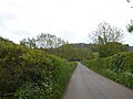
 Bincombe to Crowcombe road - geograph.org.uk - 1766882.jpg 640 × 480; 396 KB
-
 Birch wood, Great Bear - geograph.org.uk - 5648816.jpg 1,024 × 683; 610 KB
-
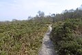
 Blocked footpath in Ramscombe - geograph.org.uk - 6084544.jpg 1,200 × 1,600; 1 MB
-
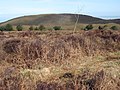
 Bracken on Great Bear - geograph.org.uk - 5448347.jpg 6,000 × 4,000; 6.37 MB
-
 Bridge over stream in Cockercombe - geograph.org.uk - 4391460.jpg 1,024 × 768; 245 KB
-
 Bridge over the stream at Ramscombe - geograph.org.uk - 6084503.jpg 1,600 × 1,200; 1.04 MB
-
 Bridleway above Rams Combe - geograph.org.uk - 5448871.jpg 6,000 × 4,000; 6.2 MB
-
 Bridleway above Rectory Wood - geograph.org.uk - 5448687.jpg 5,702 × 3,609; 5.83 MB
-
 Bridleway leaving Crowcombe Road - geograph.org.uk - 5448382.jpg 6,000 × 4,000; 6.37 MB
-
 Bridleway to Rectory Wood - geograph.org.uk - 5381354.jpg 3,072 × 2,048; 1.56 MB
-
 Bridleway, Govett's Wood - geograph.org.uk - 5381214.jpg 3,072 × 2,048; 1.77 MB
-
 Bridleway, Rectory Wood - geograph.org.uk - 5381367.jpg 2,048 × 3,072; 1.31 MB
-
 Bridleway, Seven Wells Wood - geograph.org.uk - 5381267.jpg 2,048 × 3,072; 1.46 MB
-
 Buggy-friendly paths, Ramscombe - geograph.org.uk - 6084521.jpg 1,600 × 1,200; 1.01 MB
-
 Car park and signpost. Dead Woman's Ditch - geograph.org.uk - 6551297.jpg 3,608 × 2,616; 1.04 MB
-
 Car park and tall trees, Ramscombe - geograph.org.uk - 6084506.jpg 1,200 × 1,600; 1.07 MB
-
 Car park by Crowcombe Road - geograph.org.uk - 5382068.jpg 1,959 × 1,825; 695 KB
-
 Church of St Peter and St Paul, Over Stowey - geograph.org.uk - 5763915.jpg 1,024 × 768; 239 KB
-
 Clearing south of Great Bear - geograph.org.uk - 5379980.jpg 3,072 × 2,048; 1.77 MB
-
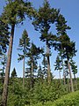
 Conifers, Quantock Forest - geograph.org.uk - 5648884.jpg 683 × 1,024; 525 KB
-
 Copse above Hack Lane - geograph.org.uk - 4057336.jpg 1,024 × 768; 175 KB
-
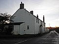 Cottage at Halsey Cross - geograph.org.uk - 3813398.jpg 1,024 × 768; 109 KB
-
 Cottages on Adscombe Lane - geograph.org.uk - 4390700.jpg 1,024 × 768; 161 KB
-
 Crossroads at Marsh Mills - geograph.org.uk - 4390710.jpg 1,024 × 824; 162 KB
-
 Crossroads, at Marsh Mills - geograph.org.uk - 2511861.jpg 1,024 × 768; 286 KB
-
 Crowcombe Combe Gate - geograph.org.uk - 6084559.jpg 1,200 × 1,600; 1.06 MB
-
 Crowcombe Road - geograph.org.uk - 5381457.jpg 3,072 × 2,048; 1.6 MB
-
 Dead Woman's Ditch - geograph.org.uk - 3015028.jpg 1,944 × 2,592; 2.32 MB
-
 Dead Woman's Ditch Crossroads - geograph.org.uk - 2880408.jpg 1,280 × 856; 173 KB
-
 Dead Woman's Ditch Crossroads - geograph.org.uk - 4057276.jpg 1,024 × 765; 159 KB
-
 Dead Women's Ditch, Quantock Hills - geograph.org.uk - 2019898.jpg 800 × 542; 114 KB
-
 Dibble's Elbow, Cockercombe - geograph.org.uk - 4390728.jpg 1,024 × 768; 294 KB
-
-
 Driveway, Pepper Mill - geograph.org.uk - 4390713.jpg 1,024 × 768; 253 KB
-
 Earthbank, Quantock Hills - geograph.org.uk - 5648808.jpg 1,024 × 683; 594 KB
-
 Entrance, Quantock Lodge - geograph.org.uk - 5764055.jpg 1,024 × 768; 246 KB
-
 Ewe near Plainsfield - geograph.org.uk - 1903925.jpg 640 × 480; 109 KB
-
 Farm at Nether Stowey - geograph.org.uk - 4057318.jpg 1,024 × 768; 204 KB
-
 Farm track, north of Broomland Hill - geograph.org.uk - 4391779.jpg 1,024 × 783; 258 KB
-
 Farmland near Aley - geograph.org.uk - 4721133.jpg 640 × 480; 60 KB
-
 Farmland near Plainsfield - geograph.org.uk - 4721146.jpg 640 × 452; 62 KB
-
 Farmland, south of Nether Stowey - geograph.org.uk - 5764038.jpg 1,024 × 789; 197 KB
-
 Ferns above Ramscombe - geograph.org.uk - 1904374.jpg 640 × 480; 142 KB
-
 Ferns, Ramscombe - geograph.org.uk - 1904257.jpg 480 × 640; 141 KB
-
 Field access and footpath to Cross Farm - geograph.org.uk - 5778782.jpg 1,600 × 1,200; 905 KB
-
 Field near Marsh Mills - geograph.org.uk - 1903761.jpg 640 × 475; 93 KB
-
 Fields at Crowcombe Park Gate - geograph.org.uk - 2610164.jpg 640 × 480; 74 KB
-
 Fire Beacon - geograph.org.uk - 4054500.jpg 1,024 × 769; 303 KB
-
 Footpath from Castle Hill brow - geograph.org.uk - 5118125.jpg 3,648 × 2,432; 4.26 MB
-
 Footpath in Ramscombe - geograph.org.uk - 6084538.jpg 1,600 × 1,200; 1.05 MB
-
 Ford for a path in Ramscombe - geograph.org.uk - 6084532.jpg 1,200 × 1,600; 1.09 MB
-
 Forest visitors' car park, Great Wood - geograph.org.uk - 6084467.jpg 1,600 × 1,200; 1.06 MB
-
 Frog Hill - geograph.org.uk - 5646366.jpg 1,024 × 576; 313 KB
-
 From Withyman's Pool car park - geograph.org.uk - 6551316.jpg 3,734 × 2,489; 1.86 MB
-
 Gate across track into The Slades - geograph.org.uk - 6084433.jpg 1,600 × 1,200; 1.11 MB
-
 Gate and stile, edge of West Hill - geograph.org.uk - 6084547.jpg 1,600 × 1,200; 1.04 MB
-
 Gate from The Slades to Aisholt Common - geograph.org.uk - 6083308.jpg 1,600 × 1,200; 1.07 MB
-
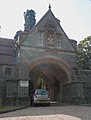 Gatehouse, Quantock Lodge. - geograph.org.uk - 2511890.jpg 778 × 1,024; 147 KB
-
 Gates, Govett's Wood - geograph.org.uk - 5381181.jpg 3,072 × 2,048; 1.73 MB
-
 Gates, Rectory Wood - geograph.org.uk - 5381363.jpg 2,043 × 2,896; 2.04 MB
-
 Gateway at Great Wood Warm Corner - geograph.org.uk - 6084444.jpg 1,200 × 1,600; 1.03 MB
-
 Gazebo, Cross Farm - geograph.org.uk - 3015064.jpg 1,944 × 2,592; 2.24 MB
-
 Going up - geograph.org.uk - 5648872.jpg 1,024 × 683; 538 KB
-
 Gorse and trees near Crowcombe Road - geograph.org.uk - 5381472.jpg 2,048 × 3,072; 1.44 MB
-
 Gorse and trees near Crowcombe Road - geograph.org.uk - 5382064.jpg 3,072 × 2,048; 1.32 MB
-
 Govett's Wood - geograph.org.uk - 5248616.jpg 3,072 × 2,048; 1.6 MB
-
 Govett's Wood - geograph.org.uk - 5381229.jpg 3,072 × 2,048; 1.56 MB
-
 Grazing ponies, near Dead Woman's Ditch - geograph.org.uk - 4057267.jpg 1,024 × 768; 217 KB
-
 Great Quantock Farm - geograph.org.uk - 2405865.jpg 640 × 428; 97 KB
-
 Great Quantock Farm seen from the Drove Road - geograph.org.uk - 6084582.jpg 1,600 × 1,200; 927 KB
-
 Great Wood Camp - geograph.org.uk - 4431161.jpg 1,024 × 768; 192 KB
-
 Halsey Cross - geograph.org.uk - 3813399.jpg 1,024 × 768; 159 KB
-
 Halsey Cross crossroads - geograph.org.uk - 5115755.jpg 3,648 × 2,432; 3.67 MB
-
 Hawthorn, Quantock Combe - geograph.org.uk - 1903458.jpg 480 × 640; 142 KB
-
 Head of Quantock Combe - geograph.org.uk - 5649659.jpg 1,024 × 683; 382 KB
-
 Homestead in Cockercombe Bottom - geograph.org.uk - 4391452.jpg 1,024 × 768; 242 KB
-
 Horse riders on road to Triscombe Stone - geograph.org.uk - 6084435.jpg 1,200 × 1,600; 1.1 MB
-
 House in Quantock Combe - geograph.org.uk - 4431037.jpg 1,024 × 768; 340 KB
-
 Houses on Hack Lane - geograph.org.uk - 4057330.jpg 1,024 × 768; 178 KB
-
 Information point and toilets, Great Wood - geograph.org.uk - 4431098.jpg 1,024 × 768; 276 KB
-
 Junction of paths in The Slades with a firebreak - geograph.org.uk - 6083312.jpg 1,600 × 1,200; 1.07 MB
-
 Junction of Tracks near Bin Combe - geograph.org.uk - 2831596.jpg 1,024 × 768; 172 KB
-
 Junction on Broomyland Hill - geograph.org.uk - 5778939.jpg 1,600 × 1,203; 830 KB
-

-
 Land-Rover, Bincombe - geograph.org.uk - 4057307.jpg 1,024 × 768; 172 KB
-
 Lane near Aley - geograph.org.uk - 1903207.jpg 480 × 640; 154 KB
-
 Lane to Tuxwell Farm - geograph.org.uk - 1904024.jpg 640 × 480; 113 KB
-
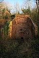 Limekiln above Hawkridge Reservoir - geograph.org.uk - 648343.jpg 427 × 640; 121 KB
-
 Looking towards Great Bear - geograph.org.uk - 4057286.jpg 1,024 × 768; 192 KB
-
 Marsh Mill - geograph.org.uk - 4431171.jpg 1,024 × 768; 242 KB
-
 Marsh Mills crossroads - geograph.org.uk - 5115749.jpg 3,648 × 2,432; 3.48 MB
-
 Meadow near Aley - geograph.org.uk - 1904400.jpg 640 × 480; 99 KB
-
 Meadow, Quantock Combe - geograph.org.uk - 1904316.jpg 640 × 480; 109 KB
-
 Meadowland above Triscombe - geograph.org.uk - 2059982.jpg 3,072 × 2,304; 1.86 MB
-
 Meeting room and toilet block, Ramscombe - geograph.org.uk - 6084499.jpg 1,200 × 1,600; 990 KB
-
 Metal sculpture - geograph.org.uk - 5764043.jpg 785 × 1,024; 221 KB
-
 Minor road near Crowcombe - geograph.org.uk - 6586137.jpg 1,024 × 768; 166 KB
-
 Minor road near Crowcombe - geograph.org.uk - 6586144.jpg 1,024 × 768; 136 KB
-
 Minor road to Nether Stowey - geograph.org.uk - 4057282.jpg 1,024 × 768; 206 KB
-
 Oak and holly wood - geograph.org.uk - 5648828.jpg 1,024 × 683; 604 KB
-

-
-
 Old sandstone quarry in Keeper's Combe - geograph.org.uk - 5413301.jpg 2,304 × 3,456; 862 KB
-
 Over Stowey from the South West - geograph.org.uk - 5413270.jpg 3,456 × 2,304; 361 KB
-
 Over Stowey village - geograph.org.uk - 1766872.jpg 640 × 480; 303 KB
-
 Paddocks near Great Quantock Farm - geograph.org.uk - 2405867.jpg 640 × 428; 95 KB
-
 Parish's Lodge - geograph.org.uk - 5764477.jpg 1,024 × 768; 195 KB
-

-
 Path and track in Ramscombe - geograph.org.uk - 6084526.jpg 1,600 × 1,200; 1.02 MB
-
 Path between conifers in The Slades - geograph.org.uk - 6083322.jpg 1,600 × 1,200; 1.03 MB
-
 Path on Robin Upright's Hill - geograph.org.uk - 4057265.jpg 1,024 × 768; 242 KB
-
-
 Path on the Quantock Hills, near Crowcombe - geograph.org.uk - 6584662.jpg 1,024 × 768; 272 KB
-
 Path out of Rams Combe - geograph.org.uk - 5448931.jpg 6,000 × 4,000; 6.33 MB
-
 Path to Great Quantock Farm - geograph.org.uk - 6084598.jpg 1,600 × 1,200; 1 MB
-
 Path towards Rams Combe - geograph.org.uk - 5449571.jpg 6,000 × 4,000; 6.93 MB
-
 Path, Great Bear - geograph.org.uk - 5648812.jpg 1,024 × 683; 407 KB
-
 Path, Great Bear - geograph.org.uk - 5648818.jpg 1,024 × 683; 614 KB
-
 Path, Quantocks - geograph.org.uk - 5646347.jpg 1,024 × 576; 484 KB
-
 Path, Quantocks - geograph.org.uk - 5646356.jpg 1,024 × 576; 403 KB
-
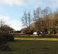
 Pavilion at Over Stowey Cricket Ground - geograph.org.uk - 131607.jpg 640 × 426; 137 KB
-
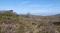
 Pepper Hill - geograph.org.uk - 5764060.jpg 1,024 × 853; 201 KB
-
 Pepper Hill near Over Stowey - geograph.org.uk - 5413307.jpg 3,456 × 2,304; 444 KB
-
 Picnic area in Rams Combe - geograph.org.uk - 4431136.jpg 1,024 × 768; 236 KB
-
 Picnic tables and open space, Ramscombe - geograph.org.uk - 6084501.jpg 1,600 × 1,200; 1.06 MB
-
 Pines, Ramscombe - geograph.org.uk - 1903243.jpg 480 × 640; 119 KB
-
 Plainsfield Court - geograph.org.uk - 2510531.jpg 1,024 × 784; 173 KB
-

-
 Pond near Aley - geograph.org.uk - 1903799.jpg 640 × 480; 146 KB
-
 Ponies in the forest - geograph.org.uk - 5448850.jpg 6,000 × 4,000; 5.77 MB
-
 Poplars near Adscombe - geograph.org.uk - 1903854.jpg 640 × 480; 118 KB
-
 Puddle, Frog Hill - geograph.org.uk - 6551318.jpg 2,848 × 4,288; 1.8 MB
-
 Quantock Combe - geograph.org.uk - 1903340.jpg 480 × 640; 111 KB
-
 Quantock Combe - geograph.org.uk - 1904323.jpg 640 × 480; 138 KB
-
 Quantock Combe - geograph.org.uk - 1904341.jpg 480 × 640; 113 KB
-
 Quantock Combe - geograph.org.uk - 5648893.jpg 1,024 × 683; 563 KB
-
 Quantock Farm - geograph.org.uk - 2405870.jpg 640 × 480; 97 KB
-
 Quantock heathland - geograph.org.uk - 5646360.jpg 1,024 × 576; 303 KB
-
 Quantock heathland - geograph.org.uk - 5648820.jpg 1,024 × 683; 344 KB
-
-
 Quantock Hills, Great Wood - geograph.org.uk - 5648874.jpg 1,024 × 683; 520 KB
-
 Quantock Hills, Head of Lady's Combe - geograph.org.uk - 5646342.jpg 1,024 × 576; 514 KB
-
 Quantock Hills, Rams Combe - geograph.org.uk - 5648869.jpg 1,024 × 683; 487 KB
-
 Quantock Hills, Road in Quantock Combe - geograph.org.uk - 5648889.jpg 1,024 × 683; 467 KB
-
 Quantock Hills, Side of Quantock Combe - geograph.org.uk - 5648881.jpg 1,024 × 683; 524 KB
-
 Quantock Hills, View towards Dowsborough - geograph.org.uk - 5646365.jpg 1,024 × 576; 316 KB
-
 Quantock Hills-Edge of the oak wood - geograph.org.uk - 5646346.jpg 1,024 × 576; 472 KB
-
 Quantock Hills-Edge of the woods - geograph.org.uk - 5646355.jpg 1,024 × 576; 358 KB
-
 Quantock Lodge gatehouse - geograph.org.uk - 5778930.jpg 1,600 × 1,066; 508 KB
-
 Quantock Lodge School - geograph.org.uk - 5413280.jpg 3,456 × 2,304; 871 KB
-
 Quantock Lodge School - geograph.org.uk - 5413287.jpg 3,456 × 2,304; 772 KB
-

-
 Quantock Sunset (223209827).jpeg 2,048 × 1,152; 729 KB
-
 Quantocks Drove Road above Triscombe - geograph.org.uk - 2059960.jpg 3,072 × 2,304; 2.93 MB
-
 Quantocks from the air - geograph.org.uk - 5296960.jpg 2,474 × 1,613; 592 KB
-
 Quarry Breach - geograph.org.uk - 4057291.jpg 1,024 × 768; 228 KB
-
 Rectory Wood - geograph.org.uk - 5248706.jpg 1,994 × 1,270; 772 KB
-
 Rectory Wood - geograph.org.uk - 5381355.jpg 3,072 × 2,048; 2.12 MB
-
 Rectory Wood - geograph.org.uk - 5381395.jpg 3,072 × 2,048; 1.48 MB
-
 Rectory Wood - geograph.org.uk - 5381396.jpg 2,048 × 3,072; 1.83 MB
-
 Rectory Wood - geograph.org.uk - 5381439.jpg 3,072 × 2,048; 1.44 MB
-
 Ride, Ramscombe - geograph.org.uk - 1903262.jpg 480 × 640; 124 KB
-
 Ride, Ramscombe - geograph.org.uk - 1903295.jpg 480 × 640; 142 KB
-
 Road east of Marsh Mills - geograph.org.uk - 5778790.jpg 1,600 × 1,200; 847 KB
-
 Road in Quantock Combe - geograph.org.uk - 5648876.jpg 1,024 × 683; 420 KB
-
 Road junction at Dead Woman's Ditch - geograph.org.uk - 1766910.jpg 640 × 480; 336 KB
-
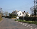
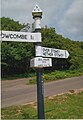
 Road junction at Over Stowey - geograph.org.uk - 1766875.jpg 640 × 480; 209 KB
-
 Road junction near Crowcombe - geograph.org.uk - 6584327.jpg 1,024 × 768; 210 KB
-
 Road junction near Plainsfield - geograph.org.uk - 1903987.jpg 640 × 480; 101 KB
-
 Road junction, Quantock Combe - geograph.org.uk - 5648896.jpg 1,024 × 683; 478 KB
-
 Road north of Plainsfield - geograph.org.uk - 1903969.jpg 640 × 480; 113 KB
-
 Road passing small woodland plantation - geograph.org.uk - 5778809.jpg 1,600 × 1,200; 884 KB
-
 Road south of Marsh Mills - geograph.org.uk - 5778794.jpg 1,600 × 1,200; 726 KB
-
 Road to Adscombe Farm - geograph.org.uk - 4390637.jpg 1,024 × 768; 285 KB
-
 Road to Cockercombe - geograph.org.uk - 5778932.jpg 1,600 × 1,280; 1.01 MB
-
 Road to Coleshill - geograph.org.uk - 5778937.jpg 1,600 × 1,200; 796 KB
-
 Road, Quantock Farm - geograph.org.uk - 5649658.jpg 1,024 × 683; 469 KB
-
 Roads in Ramscombe - geograph.org.uk - 1904301.jpg 480 × 640; 123 KB
-
 Robin Upright's Hill - geograph.org.uk - 1766890.jpg 640 × 480; 286 KB
-
 Roofs of Quantock Farm and Great Wood beyond - geograph.org.uk - 6084605.jpg 1,200 × 1,600; 1.02 MB
-
 Rough grazing edging onto woodland - geograph.org.uk - 2059972.jpg 3,072 × 2,304; 3.08 MB
-
 Sedgemoor , Adscombe Lane - geograph.org.uk - 5573662.jpg 6,000 × 4,000; 6.56 MB


.jpeg)


