Category:Over Compton
Jump to navigation
Jump to search
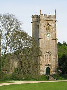
English: Over Compton is a village in north west Dorset, England, situated in the Yeo valley two miles east of Yeovil. The village has a population of 158 .
village and civil parish in Dorset, United Kingdom | |||||
| Upload media | |||||
| Instance of | |||||
|---|---|---|---|---|---|
| Location | Dorset, South West England, England | ||||
| Population |
| ||||
| Said to be the same as | Over Compton (Wikimedia duplicated page, civil parish) | ||||
 | |||||
Subcategories
This category has the following 2 subcategories, out of 2 total.
C
S
Media in category "Over Compton"
The following 59 files are in this category, out of 59 total.
-
Barn at Lower Farm - geograph.org.uk - 6619043.jpg 1,024 × 811; 198 KB
-
Barns near Lower Farm - geograph.org.uk - 1703476.jpg 640 × 480; 74 KB
-
Bench Mark, Trent - geograph.org.uk - 2277776.jpg 640 × 480; 90 KB
-
Bridge near Trent - geograph.org.uk - 2277768.jpg 640 × 480; 64 KB
-
Chinese restaurant on Babylon Hill - geograph.org.uk - 4831339.jpg 1,600 × 1,200; 223 KB
-
Compton Acres, Over Compton - geograph.org.uk - 3400980.jpg 1,600 × 1,181; 388 KB
-
Compton House - geograph.org.uk - 6767905.jpg 1,024 × 768; 209 KB
-
Compton House and Church near Yeovil - geograph.org.uk - 6448780.jpg 1,800 × 1,200; 482 KB
-
Compton Road - geograph.org.uk - 1555371.jpg 640 × 480; 89 KB
-
Compton Road - geograph.org.uk - 1555379.jpg 456 × 640; 130 KB
-
Compton Road - geograph.org.uk - 1555393.jpg 640 × 492; 118 KB
-
Compton Road entering Over Compton - geograph.org.uk - 3880685.jpg 3,776 × 2,520; 4.08 MB
-
Compton Road leading to Nether Compton - geograph.org.uk - 3880742.jpg 3,776 × 2,520; 3.93 MB
-
Countryside near Over Compton - geograph.org.uk - 1703455.jpg 640 × 480; 94 KB
-
Countryside near Trent - geograph.org.uk - 2363045.jpg 640 × 472; 41 KB
-
Crossroads at Over Compton - geograph.org.uk - 1452942.jpg 640 × 480; 190 KB
-
Crossroads at Over Compton - geograph.org.uk - 1555402.jpg 640 × 480; 124 KB
-
Crossroads, Over Compton - geograph.org.uk - 6618990.jpg 1,024 × 776; 240 KB
-
Farm building and distant Yeovil - geograph.org.uk - 5710691.jpg 1,024 × 768; 185 KB
-
Floodplain of the River Yeo - geograph.org.uk - 4571884.jpg 640 × 516; 46 KB
-
Ford at Nether Compton - geograph.org.uk - 4873922.jpg 1,600 × 1,067; 1.87 MB
-
Gate near Nether Compton - geograph.org.uk - 2277792.jpg 640 × 480; 70 KB
-
Hayle Barn, Over Compton - geograph.org.uk - 5704225.jpg 1,957 × 1,466; 1.97 MB
-
Home Farm Cottage - Over Compton - geograph.org.uk - 442071.jpg 640 × 480; 181 KB
-
Junction of Marl Lane and A30 on Babylon Hill - geograph.org.uk - 4830791.jpg 1,600 × 1,200; 250 KB
-
Landfill site, edge of Yeovil - geograph.org.uk - 4571880.jpg 640 × 426; 43 KB
-
Landmark on the road to Trent - geograph.org.uk - 1587813.jpg 640 × 457; 58 KB
-
Lanes at Over Compton - geograph.org.uk - 1555419.jpg 480 × 640; 120 KB
-
Looking down on Yeovil - geograph.org.uk - 1899602.jpg 640 × 480; 111 KB
-
Marl Lane cross roads on A30 - geograph.org.uk - 3421554.jpg 640 × 321; 40 KB
-
Over Compton, Approach road from Trent - geograph.org.uk - 3229791.jpg 1,200 × 647; 345 KB
-
Over Compton, Dorset - geograph.org.uk - 1691104.jpg 800 × 536; 104 KB
-
Pasture near Nether Compton - geograph.org.uk - 2277818.jpg 640 × 481; 70 KB
-
Power lines cross the Yeo Valley - geograph.org.uk - 6618984.jpg 1,024 × 729; 198 KB
-
Power lines near Over Compton - geograph.org.uk - 1899595.jpg 640 × 480; 102 KB
-
River Yeo - geograph.org.uk - 4571887.jpg 640 × 426; 48 KB
-
Road down towards Trent - geograph.org.uk - 1453051.jpg 640 × 480; 194 KB
-
Road sign on Babylon Hill, A30 - geograph.org.uk - 4830747.jpg 1,600 × 1,200; 181 KB
-
Rush hour in Over Compton - geograph.org.uk - 3695748.jpg 640 × 480; 79 KB
-
Scots Pines on Western Street - geograph.org.uk - 6619050.jpg 1,024 × 768; 203 KB
-
Specimen trees on Western Street - geograph.org.uk - 6619021.jpg 1,024 × 768; 243 KB
-
St. Michael, Over Compton - geograph.org.uk - 6767908.jpg 1,024 × 768; 276 KB
-
St. Michael, Over Compton - geograph.org.uk - 6767911.jpg 1,024 × 768; 246 KB
-
Terraced cottages on Western Street - geograph.org.uk - 6619002.jpg 1,024 × 768; 210 KB
-
The A30 at the Marl Lane Junction - geograph.org.uk - 3880666.jpg 3,776 × 2,520; 3.98 MB
-
Track to Over Compton - geograph.org.uk - 1555501.jpg 480 × 640; 154 KB
-
Trees bracketting the brow of the hill - geograph.org.uk - 1453044.jpg 640 × 480; 163 KB
-
Trent Brook - geograph.org.uk - 1555658.jpg 640 × 480; 136 KB
-
View towards new housing on the edge of Yeovil - geograph.org.uk - 5544799.jpg 1,024 × 768; 190 KB
-
Western Street - geograph.org.uk - 6619077.jpg 1,024 × 768; 302 KB
-
Babylon Hill Trading Estate - geograph.org.uk - 1452919.jpg 640 × 480; 141 KB
-
Higher Farmhouse - Over Compton - geograph.org.uk - 409191.jpg 640 × 625; 163 KB
-
Lower Farm, Over Compton - geograph.org.uk - 541122.jpg 640 × 453; 92 KB
-
Old Farmyard and Barn at Over Compton - geograph.org.uk - 660425.jpg 640 × 480; 69 KB
-
Over Compton - geograph.org.uk - 409182.jpg 640 × 469; 170 KB
-
The edge of Yeovil - geograph.org.uk - 541117.jpg 640 × 480; 139 KB


