Category:Oval barrow and adjacent bowl barrow, 220m west of Firle Beacon
Jump to navigation
Jump to search
| Object location | | View all coordinates using: OpenStreetMap |
|---|
|
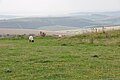
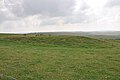
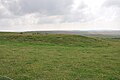
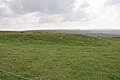
This is a category about scheduled monument number 1013207. |
barrows in Firle, East Sussex, England, UK .JPG) | |||||
| Upload media | |||||
| Instance of | |||||
|---|---|---|---|---|---|
| Location | Firle, Lewes, East Sussex, South East England, England | ||||
| Heritage designation |
| ||||
 | |||||
Media in category "Oval barrow and adjacent bowl barrow, 220m west of Firle Beacon"
The following 14 files are in this category, out of 14 total.
-
 Firle LongBarrow (1).JPG 4,288 × 2,848; 5.87 MB
-
 Firle LongBarrow (10).JPG 4,288 × 2,848; 5.71 MB
-
 Firle LongBarrow (11).JPG 4,288 × 2,848; 5.76 MB
-
 Firle LongBarrow (12).JPG 4,288 × 2,848; 5.65 MB
-
 Firle LongBarrow (13).JPG 4,288 × 2,848; 6.16 MB
-
 Firle LongBarrow (2).JPG 4,288 × 2,848; 5.61 MB
-
 Firle LongBarrow (3).JPG 4,288 × 2,848; 5.53 MB
-
 Firle LongBarrow (4).JPG 4,288 × 2,848; 5.72 MB
-
 Firle LongBarrow (6).JPG 4,288 × 2,848; 5.64 MB
-
 Firle LongBarrow (7).JPG 4,288 × 2,848; 5.81 MB
-
 Firle LongBarrow (9).JPG 4,288 × 2,848; 5.62 MB
-
 Oval barrow and adjacent bowl barrow, 220m west of Firle Beacon 01.jpg 4,000 × 3,000; 5.63 MB
-
 Oval barrow and adjacent bowl barrow, 220m west of Firle Beacon 02.jpg 4,000 × 3,000; 5.91 MB
-
 Oval barrow and adjacent bowl barrow, 220m west of Firle Beacon 03.jpg 4,000 × 3,000; 5.44 MB
.JPG)
.JPG)
.JPG)
.JPG)
.JPG)
.JPG)
.JPG)
.JPG)
.JPG)
.JPG)