Category:Ouvrage du Galgenberg
Jump to navigation
Jump to search
| Object location | | View all coordinates using: OpenStreetMap |
|---|
Ouvrage of the Maginot Line | |||||
| Upload media | |||||
| Instance of | |||||
|---|---|---|---|---|---|
| Location | Cattenom, canton of Cattenom | ||||
 | |||||
Subcategories
This category has only the following subcategory.
O
Media in category "Ouvrage du Galgenberg"
The following 136 files are in this category, out of 136 total.
-
A15 devant le magasin aux artifices vers M1.jpg 3,531 × 2,576; 1.24 MB
-
A15 Galgenberg EM.jpg 2,592 × 1,944; 986 KB
-
A15 tourelle mitrailleuse double.jpg 4,592 × 2,576; 1.05 MB
-
Base d'une coupole escamotable armée de 81.jpg 4,592 × 2,576; 2.28 MB
-
Cage d'ascenceur et escalier.jpg 2,576 × 4,592; 1.06 MB
-
Cattenom depuis le Galgenberg.jpg 2,000 × 1,074; 224 KB
-
Cuisine de la troupe.jpg 4,592 × 2,576; 450 KB
-
Double porte blindée vers le bloc 3.jpg 2,576 × 4,592; 583 KB
-
Décoration d'intérieur du PC 2.jpg 2,039 × 1,379; 461 KB
-
Décoration d'intérieur du PC 3.jpg 1,158 × 612; 165 KB
-
Décoration d'intérieur du PC.jpg 1,663 × 763; 209 KB
-
Décoration d'intérieur.jpg 2,231 × 1,355; 522 KB
-
EM porte blindée lumière du jour porte du poste.jpg 4,592 × 2,576; 464 KB
-
EM quai de déchargement.jpg 4,592 × 2,576; 655 KB
-
EM rails du canon de 25 FM et lance grenade meutrières.jpg 4,592 × 2,576; 373 KB
-
EM rails meutrières.jpg 4,592 × 2,576; 436 KB
-
Entrée de l'usine.jpg 4,578 × 2,453; 473 KB
-
Entrée des hommes Galgenberg alimentation electrique coupole.jpg 3,822 × 2,748; 655 KB
-
Espace d'hygiène corporelle de la troupe.jpg 2,576 × 4,592; 745 KB
-
Foyer du soldat.jpg 4,592 × 2,576; 402 KB
-
Galgenberg salle d'opération.jpg 4,592 × 2,576; 364 KB
-
Go-galgenberg-b6-2001-05.jpg 955 × 603; 305 KB
-
Gros Ouvrage du Galgenberg (14880040139).jpg 3,648 × 2,736; 7.25 MB
-
Gros Ouvrage du Galgenberg (14880042169).jpg 3,648 × 2,736; 6.68 MB
-
Gros Ouvrage du Galgenberg (14880044359).jpg 3,648 × 2,736; 6.74 MB
-
Gros Ouvrage du Galgenberg (14880067819).jpg 3,648 × 2,736; 7.01 MB
-
Gros Ouvrage du Galgenberg (14880070069).jpg 3,648 × 2,736; 6.49 MB
-
Gros Ouvrage du Galgenberg (14880091210).jpg 3,648 × 2,736; 6.48 MB
-
Gros Ouvrage du Galgenberg (14880095209).jpg 3,648 × 2,736; 6.49 MB
-
Gros Ouvrage du Galgenberg (14880105640).jpg 3,648 × 2,736; 7.03 MB
-
Gros Ouvrage du Galgenberg (14880126540).jpg 3,648 × 2,736; 7.07 MB
-
Gros Ouvrage du Galgenberg (14880133510).jpg 3,648 × 2,736; 7.02 MB
-
Gros Ouvrage du Galgenberg (14880146928).jpg 2,736 × 3,648; 5.67 MB
-
Gros Ouvrage du Galgenberg (14880151840).jpg 3,648 × 2,736; 5.68 MB
-
Gros Ouvrage du Galgenberg (14880169570).jpg 3,648 × 2,736; 6.55 MB
-
Gros Ouvrage du Galgenberg (14880189460).jpg 3,648 × 2,736; 6.5 MB
-
Gros Ouvrage du Galgenberg (14880191770).jpg 2,736 × 3,648; 6.4 MB
-
Gros Ouvrage du Galgenberg (14880197287).jpg 2,736 × 3,648; 6.79 MB
-
Gros Ouvrage du Galgenberg (14880198528).jpg 3,648 × 2,736; 7.33 MB
-
Gros Ouvrage du Galgenberg (14880202340).jpg 2,736 × 3,648; 6.83 MB
-
Gros Ouvrage du Galgenberg (14880203248).jpg 3,648 × 2,736; 6.46 MB
-
Gros Ouvrage du Galgenberg (14880203377).jpg 3,648 × 2,736; 7.2 MB
-
Gros Ouvrage du Galgenberg (14880223108).jpg 3,648 × 2,736; 6.41 MB
-
Gros Ouvrage du Galgenberg (14880226998).jpg 3,648 × 2,736; 6.36 MB
-
Gros Ouvrage du Galgenberg (14880233618).jpg 3,648 × 2,736; 6.83 MB
-
Gros Ouvrage du Galgenberg (14880243078).jpg 3,648 × 2,736; 6.91 MB
-
Gros Ouvrage du Galgenberg (14880248477).jpg 3,648 × 2,736; 7.02 MB
-
Gros Ouvrage du Galgenberg (14880257197).jpg 3,648 × 2,736; 6.07 MB
-
Gros Ouvrage du Galgenberg (14880257498).jpg 3,648 × 2,736; 6.44 MB
-
Gros Ouvrage du Galgenberg (14880266048).jpg 3,648 × 2,736; 7.22 MB
-
Gros Ouvrage du Galgenberg (14880276687).jpg 3,648 × 2,736; 6.42 MB
-
Gros Ouvrage du Galgenberg (14880282917).jpg 3,648 × 2,736; 6.91 MB
-
Gros Ouvrage du Galgenberg (14880294717).jpg 2,736 × 3,648; 5.39 MB
-
Gros Ouvrage du Galgenberg (15043749946).jpg 3,648 × 2,736; 5.03 MB
-
Gros Ouvrage du Galgenberg (15043751796).jpg 3,648 × 2,736; 5.03 MB
-
Gros Ouvrage du Galgenberg (15043759146).jpg 3,648 × 2,736; 6.61 MB
-
Gros Ouvrage du Galgenberg (15043761336).jpg 3,648 × 2,736; 6.49 MB
-
Gros Ouvrage du Galgenberg (15043788856).jpg 3,648 × 2,736; 6.47 MB
-
Gros Ouvrage du Galgenberg (15043797636).jpg 3,648 × 2,736; 7.39 MB
-
Gros Ouvrage du Galgenberg (15043815066).jpg 3,648 × 2,736; 6.93 MB
-
Gros Ouvrage du Galgenberg (15043825806).jpg 3,648 × 2,736; 6.09 MB
-
Gros Ouvrage du Galgenberg (15063716061).jpg 2,736 × 3,648; 6.11 MB
-
Gros Ouvrage du Galgenberg (15063770181).jpg 3,648 × 2,736; 6.4 MB
-
Gros Ouvrage du Galgenberg (15063779081).jpg 2,736 × 3,648; 6.4 MB
-
Gros Ouvrage du Galgenberg (15066375192).jpg 3,648 × 2,736; 5.64 MB
-
Gros Ouvrage du Galgenberg (15066391162).jpg 2,736 × 3,648; 6.7 MB
-
Gros Ouvrage du Galgenberg (15066402762).jpg 3,648 × 2,736; 6.48 MB
-
Gros Ouvrage du Galgenberg (15066431162).jpg 2,736 × 3,648; 6.09 MB
-
Gros Ouvrage du Galgenberg (15066485142).jpg 3,648 × 2,736; 6.28 MB
-
Gros Ouvrage du Galgenberg (15066487262).jpg 3,648 × 2,736; 6.52 MB
-
Gros Ouvrage du Galgenberg (15066734615).jpg 3,648 × 2,736; 6.35 MB
-
Gros Ouvrage du Galgenberg (15066738335).jpg 2,736 × 3,648; 5.82 MB
-
Gros Ouvrage du Galgenberg (15066821045).jpg 3,648 × 2,736; 6.82 MB
-
Gros Ouvrage du Galgenberg (9607909021).jpg 3,648 × 2,736; 6.65 MB
-
Gros Ouvrage du Galgenberg (9607910903).jpg 3,648 × 2,736; 7.07 MB
-
Gros Ouvrage du Galgenberg (9607912761).jpg 3,648 × 2,736; 7.31 MB
-
Gros Ouvrage du Galgenberg (9607914685).jpg 3,648 × 2,736; 7.32 MB
-
Gros Ouvrage du Galgenberg (9607916571).jpg 3,648 × 2,736; 7.08 MB
-
Gros Ouvrage du Galgenberg (9607924415).jpg 3,648 × 2,736; 7.08 MB
-
Gros Ouvrage du Galgenberg (9607926307).jpg 3,648 × 2,736; 6.81 MB
-
Gros Ouvrage du Galgenberg (9607928069).jpg 3,648 × 2,736; 6.16 MB
-
Gros Ouvrage du Galgenberg (9607931281).jpg 3,648 × 2,736; 5.65 MB
-
Gros Ouvrage du Galgenberg (9607932821).jpg 3,648 × 2,736; 5.52 MB
-
Gros Ouvrage du Galgenberg (9607934453).jpg 3,648 × 2,736; 6 MB
-
Gros Ouvrage du Galgenberg (9607935911).jpg 3,648 × 2,736; 5.77 MB
-
Gros Ouvrage du Galgenberg (9607939337).jpg 3,648 × 2,736; 6.29 MB
-
Gros Ouvrage du Galgenberg (9607942553).jpg 3,648 × 2,736; 6.03 MB
-
Gros Ouvrage du Galgenberg (9607944257).jpg 3,648 × 2,736; 6.25 MB
-
Gros Ouvrage du Galgenberg (9607949373).jpg 3,648 × 2,736; 5.69 MB
-
Gros Ouvrage du Galgenberg (9607952553).jpg 3,648 × 2,736; 5.87 MB
-
Gros Ouvrage du Galgenberg (9607962587).jpg 3,648 × 2,736; 6.32 MB
-
Gros Ouvrage du Galgenberg (9607967343).jpg 3,648 × 2,736; 5.8 MB
-
Gros Ouvrage du Galgenberg (9607968931).jpg 3,648 × 2,736; 6.51 MB
-
Gros Ouvrage du Galgenberg (9607970505).jpg 3,648 × 2,736; 6.48 MB
-
Gros Ouvrage du Galgenberg (9607973429).jpg 3,648 × 2,736; 5.82 MB
-
Gros Ouvrage du Galgenberg (9607974953).jpg 3,648 × 2,736; 5.81 MB
-
Gros Ouvrage du Galgenberg (9607976531).jpg 3,648 × 2,736; 5.9 MB
-
Gros Ouvrage du Galgenberg (9607979455).jpg 3,648 × 2,736; 5.24 MB
-
Gros Ouvrage du Galgenberg (9607982515).jpg 3,648 × 2,736; 5.25 MB
-
Gros Ouvrage du Galgenberg (9607993741).jpg 3,648 × 2,736; 7.19 MB
-
Gros Ouvrage du Galgenberg (9611152808).jpg 3,648 × 2,736; 6.62 MB
-
Gros Ouvrage du Galgenberg (9611154768).jpg 3,648 × 2,736; 6.91 MB
-
Gros Ouvrage du Galgenberg (9611156788).jpg 3,648 × 2,736; 7 MB
-
Gros Ouvrage du Galgenberg (9611164054).jpg 3,648 × 2,736; 5.92 MB
-
Gros Ouvrage du Galgenberg (9611172152).jpg 3,648 × 2,736; 6.04 MB
-
Gros Ouvrage du Galgenberg (9611175630).jpg 3,648 × 2,736; 5.83 MB
-
Gros Ouvrage du Galgenberg (9611180756).jpg 3,648 × 2,736; 6.17 MB
-
Gros Ouvrage du Galgenberg (9611182500).jpg 3,648 × 2,736; 6.37 MB
-
Gros Ouvrage du Galgenberg (9611185772).jpg 3,648 × 2,736; 6.2 MB
-
Gros Ouvrage du Galgenberg (9611189382).jpg 3,648 × 2,736; 6.77 MB
-
Gros Ouvrage du Galgenberg (9611190872).jpg 3,648 × 2,736; 5.43 MB
-
Gros Ouvrage du Galgenberg (9611192700).jpg 3,648 × 2,736; 6.73 MB
-
Gros Ouvrage du Galgenberg (9611194462).jpg 3,648 × 2,736; 6.59 MB
-
Gros Ouvrage du Galgenberg (9611199138).jpg 3,648 × 2,736; 6.36 MB
-
Gros Ouvrage du Galgenberg (9611200656).jpg 3,648 × 2,736; 6.02 MB
-
Gros Ouvrage du Galgenberg (9611206932).jpg 3,648 × 2,736; 6.08 MB
-
Gros Ouvrage du Galgenberg (9611212986).jpg 3,648 × 2,736; 5.53 MB
-
Gros Ouvrage du Galgenberg (9611215978).jpg 3,648 × 2,736; 5.54 MB
-
Gros Ouvrage du Galgenberg (9611219366).jpg 3,648 × 2,736; 6.84 MB
-
Gros Ouvrage du Galgenberg (9611220960).jpg 3,648 × 2,736; 5.61 MB
-
Gros Ouvrage du Galgenberg (9611222830).jpg 3,648 × 2,736; 6.21 MB
-
Gros Ouvrage du Galgenberg (9611224652).jpg 3,648 × 2,736; 6.33 MB
-
Gros Ouvrage du Galgenberg (9611226460).jpg 3,648 × 2,736; 6.32 MB
-
Générateur auxilière d'électricité.jpg 2,576 × 4,592; 640 KB
-
Latrines des casernes.jpg 2,576 × 4,592; 696 KB
-
Maçonnerie de A15.jpg 2,576 × 4,592; 708 KB
-
Meurtrière de l'EM.jpg 4,592 × 2,576; 350 KB
-
Mitrailleuse double de EM.jpg 4,592 × 2,576; 500 KB
-
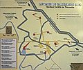
Ouvrage Galgenberg carte.png 964 × 569; 54 KB
-
P7207125 (9611195892).jpg 3,648 × 2,736; 5.94 MB
-
Plan du fort.jpg 3,061 × 2,571; 683 KB
-
Plan-secteur-bois-de-Cattenom.jpg 3,074 × 2,435; 1.42 MB
-
Porte anti-déflagration.jpg 2,480 × 3,840; 1.29 MB
-
Réseau de barbelés sur queue de cochon.jpg 4,592 × 2,576; 1.1 MB
-
Salle 49 cuisine de la troupe.jpg 4,592 × 2,576; 669 KB
-
Salle à manger de la troupe.jpg 2,663 × 3,005; 494 KB


