Category:Outcrops in Oregon
Jump to navigation
Jump to search
States of the United States: Alabama · Alaska · Arizona · Arkansas · California · Colorado · Connecticut · Delaware · Florida · Georgia · Hawaii · Idaho · Illinois · Indiana · Iowa · Kansas · Kentucky · Louisiana · Maine · Maryland · Massachusetts · Michigan · Minnesota · Mississippi · Missouri · Montana · Nebraska · Nevada · New Hampshire · New Jersey · New Mexico · New York · North Carolina · North Dakota · Ohio · Oklahoma · Oregon · Pennsylvania · Rhode Island · South Carolina · South Dakota · Tennessee · Texas · Utah · Vermont · Virginia · Washington · West Virginia · Wisconsin · Wyoming
American Samoa
American Samoa
Subcategories
This category has the following 12 subcategories, out of 12 total.
B
C
R
S
Media in category "Outcrops in Oregon"
The following 91 files are in this category, out of 91 total.
-
 2017 08 14-17.14.53.244-CDT.jpg 4,608 × 3,456; 1.87 MB
-
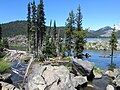
 2017-08-15 Six Lakes Trail 08.jpg 2,592 × 1,944; 1.74 MB
-
 Beach houses in the morning light (9716596818).jpg 3,235 × 2,196; 6.77 MB
-
-
 Calapooia River.jpg 3,888 × 2,592; 6.83 MB
-
 Cape Creek emptying into the Pacific Ocean (Heceta Head Beach, Oregon, USA) 4.jpg 4,288 × 2,848; 8.15 MB
-
 Cape Creek emptying into the Pacific Ocean (Heceta Head Beach, Oregon, USA) 5.jpg 4,288 × 2,848; 8.79 MB
-
-

-
 Columbia River Basalt Group 2114.JPG 4,272 × 2,848; 7.24 MB
-
 Columbia River Basalt Group 2641.JPG 4,272 × 2,848; 8.75 MB
-
 Coquille River (Coos County, Oregon scenic images) (cooDA0152a).jpg 324 × 488; 40 KB
-
 Darlingtonia californica ne7.JPG 2,048 × 1,536; 1.71 MB
-
 John Day River canyon near Clarno, OR.jpg 4,608 × 3,456; 3.31 MB
-
 Lake Owyhee (Malheur County, Oregon scenic images) (malD0124).jpg 488 × 324; 28 KB
-
 Lake Owyhee (Malheur County, Oregon scenic images) (malD0133).jpg 488 × 324; 35 KB
-
 Lake Owyhee (Malheur County, Oregon scenic images) (malDA0170).jpg 488 × 324; 29 KB
-
 Lake Owyhee (Malheur County, Oregon scenic images) (malDA0171).jpg 324 × 488; 27 KB
-
 Lake Owyhee (Malheur County, Oregon scenic images) (malDA0179).jpg 324 × 488; 36 KB
-
 Lake Owyhee (Malheur County, Oregon scenic images) (malDA0180).jpg 488 × 324; 29 KB
-
 Lava Stringer 12.jpg 1,920 × 1,198; 2.65 MB
-
 Leslie Gulch (Malheur County, Oregon scenic images) (malDA0050).jpg 488 × 324; 39 KB
-
 Leslie Gulch (Malheur County, Oregon scenic images) (malDA0073).jpg 488 × 324; 36 KB
-
 Leslie Gulch (Malheur County, Oregon scenic images) (malDA0096).jpg 488 × 324; 28 KB
-

-
-

-
-

-

-

-

-

-
 Lost Forest (Rock Outcrop), Lakeview BLM, Oregon.jpg 776 × 510; 115 KB
-
 Malheur Butte (Malheur County, Oregon scenic images) (malDA0100).jpg 324 × 488; 29 KB
-
 Malheur Butte (Malheur County, Oregon scenic images) (malDA0102).jpg 488 × 324; 28 KB
-
 Malheur River (Malheur County, Oregon scenic images) (malD0059).jpg 324 × 488; 43 KB
-
 Malheur River (Malheur County, Oregon scenic images) (malDA0030).jpg 488 × 324; 38 KB
-
 Malheur River (Malheur County, Oregon scenic images) (malDA0031).jpg 324 × 488; 47 KB
-

-
 Malheur River (Malheur County, Oregon scenic images) (malDA0042).jpg 324 × 488; 25 KB
-

-
 Newberry caldera.jpg 3,168 × 2,112; 1,017 KB
-
 On Sherrard Point (4332508481).jpg 1,024 × 770; 329 KB
-
 Owyhee Dam (Malheur County, Oregon scenic images) (malDA0002).jpg 488 × 324; 30 KB
-

-

-
-
-
 Owyhee River (9680427023).jpg 5,474 × 3,649; 16.13 MB
-
 Owyhee River (Malheur County, Oregon scenic images) (malD0084).jpg 488 × 324; 36 KB
-
 Owyhee River (Malheur County, Oregon scenic images) (malD0087).jpg 324 × 488; 40 KB
-
 Owyhee River (Malheur County, Oregon scenic images) (malD0091).jpg 488 × 324; 41 KB
-
 Owyhee River (Malheur County, Oregon scenic images) (malD0096a).jpg 324 × 488; 31 KB
-
 Owyhee River (Malheur County, Oregon scenic images) (malD0099).jpg 488 × 324; 39 KB
-
 Owyhee River (Malheur County, Oregon scenic images) (malDA0003).jpg 488 × 324; 22 KB
-
 Owyhee River (Malheur County, Oregon scenic images) (malDA0014a).jpg 488 × 324; 33 KB
-
 Owyhee River (Malheur County, Oregon scenic images) (malDA0089).jpg 488 × 324; 25 KB
-

-

-
-

-

-

-

-

-

-

-

-

-
 Rocky butte from I-205 2003.jpg 600 × 421; 98 KB
-
 Sahalie Falls (Oregon).jpg 1,280 × 960; 653 KB
-
 Sparks Lake, Oregon (2012) - 12.jpg 4,000 × 3,000; 3.92 MB
-
 Steelhead Falls (15176836240).jpg 3,000 × 2,250; 4.79 MB
-
 Steelhead Falls (15274511810).jpg 5,472 × 3,648; 16.04 MB
-
 Steelhead Falls (15458078861).jpg 5,472 × 3,648; 13.14 MB
-
 Succor Creek (Malheur County, Oregon scenic images) (malDA0051).jpg 488 × 324; 42 KB
-
-

-

-

-

-

-

-

-

-

-
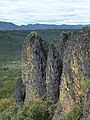 Table Rock Outcropping.jpg 3,240 × 4,320; 4.92 MB
-
 Tony Webster Columbia River Oregon 18541625222.jpg 3,264 × 2,012; 4.35 MB
-
 Wheeler Creek (Pinnacle Valley, Crater Lake National Park, Oregon, USA) 1 (42100431971).jpg 2,848 × 4,288; 5.41 MB
-
 Wheeler Creek (Pinnacle Valley, Crater Lake National Park, Oregon, USA) 3 (42055601172).jpg 4,288 × 2,848; 6.25 MB


.jpg)
_(bakDA0061a).jpg)

_(tilDA0076).jpg)
_(uniDA0078).jpg)


_(cooDA0152a).jpg)


_(malD0124).jpg)
_(malD0133).jpg)
_(malDA0170).jpg)
_(malDA0171).jpg)
_(malDA0179).jpg)
_(malDA0180).jpg)

_(malDA0050).jpg)
_(malDA0073).jpg)
_(malDA0096).jpg)
_(malDA0048).jpg)
_(malDA0067a).jpg)
_(malDA0070).jpg)
_(malDA0075).jpg)
_(malDA0085).jpg)
_(malDA0088a).jpg)
_(malDA0091a).jpg)
_(malDA0092).jpg)
_(malDA0094).jpg)
,_Lakeview_BLM,_Oregon.jpg)
_(malDA0100).jpg)
_(malDA0102).jpg)
_(malD0059).jpg)
_(malDA0030).jpg)
_(malDA0031).jpg)
_(malDA0036a).jpg)
_(malDA0042).jpg)
_(malDA0043a).jpg)

.jpg)
_(malDA0002).jpg)
_(malD0122).jpg)
_(malD0125a).jpg)
_(malDA0166).jpg)
_(malDA0167).jpg)
.jpg)
_(malD0084).jpg)
_(malD0087).jpg)
_(malD0091).jpg)
_(malD0096a).jpg)
_(malD0099).jpg)
_(malDA0003).jpg)
_(malDA0014a).jpg)
_(malDA0089).jpg)
_(malDA0142).jpg)
_(malDA0144).jpg)
_(malDA0146).jpg)
_(malDA0149).jpg)
_(malDA0152).jpg)
_(desDA0101a).jpg)
_(malDA0112).jpg)
_(malDA0113).jpg)
_(malDA0115).jpg)
_(malDA0117).jpg)
_(malDA0127).jpg)
_(clacD0019).jpg)

.jpg)
_-_12.jpg)
.jpg)
.jpg)
.jpg)
_(malDA0051).jpg)
_(malD0044).jpg)
_(malD0045).jpg)
_(malD0054).jpg)
_(malD0056).jpg)
_(malD0072).jpg)
_(malDA0033).jpg)
_(malDA0043).jpg)
_(malDA0062).jpg)
_(malDA0034).jpg)
_(malDA0054a).jpg)


_1_(42100431971).jpg)
_3_(42055601172).jpg)
_4.jpg)
_5.jpg)