Category:Out Newton
Jump to navigation
Jump to search
English: Out Newton is a hamlet in the East Riding of Yorkshire, England, in an area known as Holderness. It is situated approximately 4.5 miles (7.2 km) south east of Withernsea, just inland from the North Sea coast.
village in United Kingdom  | |||||
| Upload media | |||||
| Instance of | |||||
|---|---|---|---|---|---|
| Location | Easington, East Riding of Yorkshire, Yorkshire and the Humber, England | ||||
 | |||||
Subcategories
This category has the following 3 subcategories, out of 3 total.
B
- Balk Hill Water Tower (2 F)
O
- Old Hive Dike (3 F)
- Out Newton Wind Farm (30 F)
Media in category "Out Newton"
The following 18 files are in this category, out of 18 total.
-
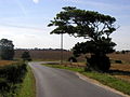 Bend in the road - geograph.org.uk - 40972.jpg 640 × 480; 89 KB
-
 Cliff Farm - geograph.org.uk - 617385.jpg 640 × 427; 61 KB
-
 Cliff Farm, above High Newton - geograph.org.uk - 758932.jpg 640 × 325; 121 KB
-
 Cliff Farm, Balk Hill - geograph.org.uk - 51711.jpg 640 × 480; 141 KB
-
 Entering Out Newton - geograph.org.uk - 2155132.jpg 800 × 600; 147 KB
-
 Farm on the bend Out Newton - geograph.org.uk - 751600.jpg 640 × 308; 26 KB
-
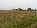
 Harvesting near Out Newton - geograph.org.uk - 538813.jpg 640 × 480; 120 KB
-
 Harvesting under the turbines - geograph.org.uk - 1451710.jpg 640 × 480; 49 KB
-
 High Grange Farm, Out Newton - geograph.org.uk - 2407465.jpg 1,600 × 1,200; 309 KB
-
 High Grange, Out Newton - geograph.org.uk - 290194.jpg 640 × 455; 83 KB
-
 Model Farm, Out Newton - geograph.org.uk - 293399.jpg 640 × 453; 105 KB
-
 Out Newton harvest - geograph.org.uk - 617393.jpg 640 × 427; 47 KB
-
 Out Newton Road - geograph.org.uk - 290195.jpg 640 × 480; 68 KB
-
 Out Newton Road - geograph.org.uk - 293391.jpg 640 × 467; 71 KB
-
 Southfield Farm, Out Newton - geograph.org.uk - 290193.jpg 640 × 465; 58 KB
-
 Three Foot Lane - geograph.org.uk - 293403.jpg 640 × 462; 78 KB
-
 Three Foot Lane - geograph.org.uk - 293404.jpg 472 × 640; 91 KB
-
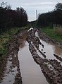
 Three Foot Lane - geograph.org.uk - 40952.jpg 640 × 480; 134 KB


