Category:Ousefleet
Jump to navigation
Jump to search
English: Ousefleet is a small hamlet in the East Riding of Yorkshire, England approximately 5 miles (8 km) east of Goole. It is located just south of the River Ouse and north of the A161 road between Goole and Scunthorpe.
village in United Kingdom | |||||
| Upload media | |||||
| Instance of |
| ||||
|---|---|---|---|---|---|
| Location | Twin Rivers, East Riding of Yorkshire, Yorkshire and the Humber, England | ||||
 | |||||
Subcategories
This category has the following 2 subcategories, out of 2 total.
B
- Blacktoft Sands RSPB reserve (16 F)
R
- River Ouse at Ousefleet (10 F)
Media in category "Ousefleet"
The following 57 files are in this category, out of 57 total.
-
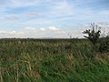
 A Huge Reedbed - geograph.org.uk - 251227.jpg 640 × 480; 107 KB
-
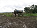 A Pit Stop For Tractors - geograph.org.uk - 251555.jpg 640 × 480; 106 KB
-
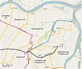 Adlingfleet map.jpg 758 × 635; 69 KB
-

-
 Another Pit For Tractors - geograph.org.uk - 251652.jpg 640 × 480; 103 KB
-
 Another View Of The Reeds - geograph.org.uk - 251471.jpg 640 × 480; 99 KB
-
 Blacktoft Channel - geograph.org.uk - 1603486.jpg 640 × 480; 71 KB
-
 Blacktoft Channel - geograph.org.uk - 1603669.jpg 640 × 480; 47 KB
-

-
 Blacktoft Sands footpaths - geograph.org.uk - 843688.jpg 640 × 480; 201 KB
-
 Blacktoft Sands RSPB Reserve - geograph.org.uk - 1742115.jpg 640 × 480; 61 KB
-

-
 Bridleway Junction - geograph.org.uk - 251563.jpg 640 × 480; 96 KB
-

-
 Draining The Bridleway - geograph.org.uk - 251569.jpg 640 × 480; 98 KB
-
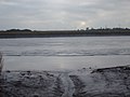
 Dyke alongside the River Ouse - geograph.org.uk - 81703.jpg 640 × 482; 105 KB
-
 Easy Walking - geograph.org.uk - 251475.jpg 640 × 480; 105 KB
-
 Electricity and water - geograph.org.uk - 1333609.jpg 640 × 329; 32 KB
-

-
 Farmland Through The Reeds - geograph.org.uk - 251710.jpg 640 × 480; 98 KB
-
 Farmland, Ousefleet Ings (geograph 7800178).jpg 2,334 × 1,751; 859 KB
-
 Fields north of Ousefleet - geograph.org.uk - 81736.jpg 640 × 482; 122 KB
-
 Fields towards the Ouse - geograph.org.uk - 1224093.jpg 640 × 480; 38 KB
-
 Floodbank protecting Ousefleet Ings (geograph 7800183).jpg 2,432 × 1,824; 3.12 MB
-
 Following The Reeds - geograph.org.uk - 251482.jpg 640 × 480; 99 KB
-
 Footpath to Blacktoft nature reserve. - geograph.org.uk - 933842.jpg 640 × 505; 96 KB
-
 Huge Horses Welcome - geograph.org.uk - 251990.jpg 640 × 480; 103 KB
-
 Humberside fields - geograph.org.uk - 56497.jpg 640 × 436; 60 KB
-
 Looking NE within SE8222 - geograph.org.uk - 496.jpg 640 × 480; 59 KB
-
 Looking Over The Reeds - geograph.org.uk - 251480.jpg 640 × 480; 106 KB
-
 Looking Towards Adlingfleet - geograph.org.uk - 251995.jpg 640 × 480; 108 KB
-

-
-

-
 Ousefleet 1.jpg 640 × 426; 112 KB
-
 Ousefleet pylons - geograph.org.uk - 933851.jpg 640 × 464; 51 KB
-
 Ousefleet. - geograph.org.uk - 81714.jpg 640 × 482; 100 KB
-
 Over The Drain - geograph.org.uk - 251573.jpg 640 × 480; 96 KB
-
 Paddock in Ousefleet - geograph.org.uk - 1234969.jpg 640 × 480; 81 KB
-

-
 Post-Medieval Gaming Chip from Ousefleet (FindID 516200).jpg 3,543 × 1,747; 870 KB
-
 Public Footpath to the Ouse Bank - geograph.org.uk - 508742.jpg 640 × 426; 133 KB
-
 Public footpath, north from Townend Causeway (geograph 7800161).jpg 2,432 × 1,824; 2.96 MB
-
 Public footpath, outside RSPB Blacktoft Sands (geograph 7800171).jpg 2,339 × 1,759; 1.17 MB
-
 Puddles On The Bridleway - geograph.org.uk - 251231.jpg 640 × 480; 108 KB
-
 Pylons over the Ouse - geograph.org.uk - 1224102.jpg 640 × 480; 43 KB
-
 River Trent embankment - geograph.org.uk - 933752.jpg 640 × 466; 71 KB
-
 Taller Than The Reeds - geograph.org.uk - 252034.jpg 640 × 480; 104 KB
-
 The Bridge over Adlingfleet Drain - geograph.org.uk - 252003.jpg 640 × 480; 102 KB
-
 The Old School Ousefleet.jpg 640 × 426; 138 KB
-
 The postbox in Ousefleet - geograph.org.uk - 1740732.jpg 640 × 455; 88 KB
-
 The Reedbed Towards Ousefleet - geograph.org.uk - 252039.jpg 640 × 480; 103 KB
-
 The Road to Ousefleet - geograph.org.uk - 508738.jpg 640 × 426; 97 KB
-

-
 Towards Trent Falls - geograph.org.uk - 933745.jpg 640 × 380; 72 KB
-
 Townend Causeway Ousefleet.jpg 640 × 485; 163 KB
-
 View upstream from Faxfleet - geograph.org.uk - 1729848.jpg 640 × 427; 37 KB


.jpg)


.jpg)


_-_geograph.org.uk_-_1224097.jpg)


.jpg)

.jpg)
.jpg)


