Category:Oulton, West Yorkshire
Jump to navigation
Jump to search
village in Leeds, West Yorkshire, United Kingdom  | |||||
| Upload media | |||||
| Instance of | |||||
|---|---|---|---|---|---|
| Location | Leeds, West Yorkshire, Yorkshire and the Humber, England | ||||
 | |||||
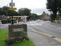
English: Oulton is a village in the City of Leeds metropolitan borough, West Yorkshire, England, between Leeds and Wakefield. It is at the junction of the A639 and A642 roads. Though now adjoining the village of Woodlesford, it was once quite separate. It was once part of the urban district of Rothwell.
Subcategories
This category has the following 4 subcategories, out of 4 total.
B
Media in category "Oulton, West Yorkshire"
The following 86 files are in this category, out of 86 total.
-
 10 Farrer Lane.jpg 4,000 × 3,000; 6.04 MB
-
 13 Farrer Lane.jpg 4,000 × 3,000; 6.36 MB
-
 9, 9A, 11, and 13 Farrer Lane.jpg 3,000 × 4,000; 7.34 MB
-
 A walk from Oulton Church ^4 - geograph.org.uk - 2010919.jpg 800 × 600; 191 KB
-
 A walk from Oulton Church ^5 - geograph.org.uk - 2010929.jpg 800 × 600; 364 KB
-
 A whole field of cabbages - geograph.org.uk - 2225270.jpg 1,024 × 768; 176 KB
-

-
 A639 roundabout at Oulton - geograph.org.uk - 3783621.jpg 640 × 480; 56 KB
-
 A642 Wakefield Road, Oulton - geograph.org.uk - 1480922.jpg 640 × 480; 72 KB
-
 A642 Wakefield Road, Oulton - geograph.org.uk - 5648796.jpg 1,024 × 683; 257 KB
-

-
 Aire ^ Calder Navigation - geograph.org.uk - 3837701.jpg 4,320 × 3,240; 1.84 MB
-
 Albert Road - Green Lea - geograph.org.uk - 1264767.jpg 640 × 436; 164 KB
-
 Arable field on the edge of Oulton - geograph.org.uk - 5225673.jpg 2,048 × 1,536; 1.12 MB
-
 Arable land south of Methley Lane - geograph.org.uk - 2221241.jpg 1,024 × 768; 193 KB
-

-
 Benchmark on New Masons Arms - geograph.org.uk - 3735512.jpg 683 × 1,024; 248 KB
-

-
 Bend in the path - geograph.org.uk - 4000389.jpg 1,024 × 768; 259 KB
-
 Bentley Square - Calverley Road - geograph.org.uk - 1265718.jpg 640 × 480; 274 KB
-
 Bentley Square.jpg 4,000 × 3,000; 5.45 MB
-
 Bryngate - Green Lea - geograph.org.uk - 1265508.jpg 640 × 444; 215 KB
-
 Building - Aberford Road, Oulton - geograph.org.uk - 841829.jpg 640 × 408; 40 KB
-
 Bus stop and turning circle (geograph 2221228).jpg 1,024 × 768; 246 KB
-
 Calverley Road - Leeds Road - geograph.org.uk - 1265723.jpg 640 × 480; 252 KB
-
 Chapel House - Calverley Road, Oulton - geograph.org.uk - 841824.jpg 640 × 480; 61 KB
-
 Chapel Yard - Calverley Road - geograph.org.uk - 1265719.jpg 640 × 480; 285 KB
-
 Croft House and Ivy Cottage.jpg 4,000 × 3,000; 3.4 MB
-
 Derwent Avenue - North Lane - geograph.org.uk - 1264733.jpg 640 × 440; 176 KB
-
 Dolphin Court Oulton House.jpg 4,080 × 3,072; 4.47 MB
-
 Dolphin Court, Aberford Road - geograph.org.uk - 3734356.jpg 1,024 × 683; 156 KB
-
 East View - North Lane - geograph.org.uk - 4419196.jpg 640 × 428; 52 KB
-

-

-
 Farmland in sight and sound of the M62 - geograph.org.uk - 3288692.jpg 1,024 × 768; 212 KB
-
 Farmland off Methley Road - geograph.org.uk - 2734830.jpg 640 × 480; 59 KB
-
 Farmland, Oulton - geograph.org.uk - 2734819.jpg 640 × 480; 48 KB
-
 Farrer Lane - Aberford Road - geograph.org.uk - 1265711.jpg 640 × 454; 192 KB
-
 Field adjacent to A642 - geograph.org.uk - 6504977.jpg 768 × 1,024; 143 KB
-
 Finger post on the Leeds Country Way - geograph.org.uk - 3916354.jpg 1,600 × 1,064; 832 KB
-
 Fishing the weirpool - geograph.org.uk - 5655673.jpg 4,608 × 3,456; 4.06 MB
-
 Fleet Lane - Aberford Road - geograph.org.uk - 1265707.jpg 640 × 414; 171 KB
-
 Fleet Lane - geograph.org.uk - 823373.jpg 640 × 288; 30 KB
-

-
 Former primary school, Oulton.jpg 4,000 × 3,000; 5.08 MB
-
 Green Lea - North Lane - geograph.org.uk - 1264749.jpg 640 × 441; 180 KB
-
 Green Lea - North Lane - geograph.org.uk - 1264754.jpg 640 × 424; 189 KB
-
 Greengate - Green Lea - geograph.org.uk - 1264759.jpg 640 × 403; 158 KB
-
 Holiday Inn Express, Oulton - geograph.org.uk - 5205043.jpg 1,024 × 683; 254 KB
-
 Holly Cottage.jpg 4,000 × 3,000; 4.48 MB
-
 Junction of paths and finger-post - geograph.org.uk - 4000351.jpg 1,024 × 768; 340 KB
-
 Langdale Road - North Lane - geograph.org.uk - 1264740.jpg 640 × 480; 254 KB
-
 Lay-by near junction 30 M62 motorway - geograph.org.uk - 1113636.jpg 640 × 393; 34 KB
-
 M62 Motorway - geograph.org.uk - 39766.jpg 640 × 480; 81 KB
-
 Manor Farmhouse, Oulton.jpg 4,000 × 3,000; 4.18 MB
-
 North Lane - Calverley Road, Oulton - geograph.org.uk - 841819.jpg 640 × 470; 40 KB
-

-
 Northgate - Green Lea - geograph.org.uk - 1264763.jpg 640 × 414; 197 KB
-
 Old Briardene Cottage.jpg 337 × 359; 51 KB
-

-
 Old Masons Arms - geograph.org.uk - 3363777.jpg 800 × 533; 76 KB
-
 Oulton Aberford Road 2016.jpg 2,784 × 2,108; 3.23 MB
-
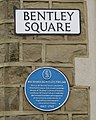 Oulton Bentley Square Plaque 2016.jpg 1,643 × 2,059; 1.53 MB
-
 Oulton Cricket Ground - geograph.org.uk - 461409.jpg 640 × 480; 59 KB
-
 Oulton Edrus Tailor 2016.jpg 2,803 × 1,799; 2.34 MB
-
 Oulton Hall Hotel - geograph.org.uk - 2221175.jpg 1,024 × 768; 133 KB
-

-
 Oulton Institute 2016.jpg 2,320 × 2,184; 2.29 MB
-
 Ploughed Footpath Moss Carr Farm - geograph.org.uk - 39769.jpg 640 × 480; 75 KB
-
 Postbox on Sanderson Lane, Royds Green - geograph.org.uk - 6176758.jpg 1,065 × 1,600; 444 KB
-
 Road junction at Royds Green - geograph.org.uk - 2221210.jpg 1,024 × 768; 217 KB
-
 Rothwell Road, Oulton - geograph.org.uk - 1480947.jpg 640 × 480; 57 KB
-
 Rothwell sports centre. - geograph.org.uk - 561591.jpg 640 × 352; 66 KB
-
 Springwell Cottage.jpg 3,000 × 4,000; 3.94 MB
-
 Stone Croft Court - Farrer Lane - geograph.org.uk - 1265712.jpg 640 × 500; 250 KB
-

-
 Total Filling Station - Aberford Road - geograph.org.uk - 1265709.jpg 640 × 387; 180 KB
-
 Ullswater Crescent - Derwent Avenue - geograph.org.uk - 1264736.jpg 640 × 480; 199 KB
-
 Willow Square - Calverley Road - geograph.org.uk - 1265721.jpg 640 × 480; 287 KB
-
 Young guarded trees, near Clumpcliffe - geograph.org.uk - 2221250.jpg 1,024 × 768; 114 KB
-
 Beck - Oulton Lane - geograph.org.uk - 841940.jpg 640 × 476; 104 KB
-
 Beck - Oulton Lane - geograph.org.uk - 841942.jpg 640 × 459; 100 KB
-
 Cornfield Oulton Leeds - geograph.org.uk - 39772.jpg 640 × 480; 101 KB
-
 Fungi on tree stump in Oulton Churchyard - geograph.org.uk - 404420.jpg 640 × 352; 116 KB
-
 Leeds Country Way Marker - geograph.org.uk - 39771.jpg 640 × 480; 164 KB
-
 Royds Green. - geograph.org.uk - 149739.jpg 640 × 480; 136 KB


.jpg)


