Category:Oughtershaw
Jump to navigation
Jump to search
village in United Kingdom  | |||||
| Upload media | |||||
| Instance of | |||||
|---|---|---|---|---|---|
| Location | Craven, North Yorkshire, Yorkshire and the Humber, England | ||||
 | |||||
English: Oughtershaw is a hamlet in the Yorkshire Dales, North Yorkshire, England. It lies on a road it shares with other small villages. Gayle, Deepdale, Yockenthwaite and Hubberholme. Contrary to popular belief the river running past Oughtershaw is not the Wharfe, it is in fact Oughtershaw Beck which runs down to Beckermonds and then merges with Greenfield Beck to source the River Wharfe at the Langstrothdale chase.
Media in category "Oughtershaw"
The following 33 files are in this category, out of 33 total.
-
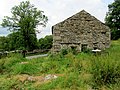 A Stone Barn near Oughtershaw - geograph.org.uk - 3580902.jpg 4,320 × 3,240; 5.57 MB
-

-
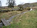
 Breadpiece Barn - geograph.org.uk - 1375462.jpg 640 × 480; 173 KB
-
 Building work in progress at Oughtershaw Hall - geograph.org.uk - 4046771.jpg 1,600 × 1,200; 700 KB
-
 Cam High Road - geograph.org.uk - 1753974.jpg 640 × 480; 70 KB
-
 Deserted barn or house near Head of Oughtershaw Beck - geograph.org.uk - 2494731.jpg 1,500 × 1,125; 1.7 MB
-

-
 Jeffery Pot Scar - geograph.org.uk - 1608993.jpg 480 × 640; 84 KB
-
 Nameless beck in spate, Oughtershaw - geograph.org.uk - 3884740.jpg 1,024 × 768; 200 KB
-
 North Gate, Cam High Road - geograph.org.uk - 1753980.jpg 640 × 480; 61 KB
-
 On Dodd Fell Hill - geograph.org.uk - 1753984.jpg 640 × 480; 64 KB
-
 Ordnance Survey Sheet SD 88 Published 1952.jpg 7,189 × 7,522; 5.43 MB
-
 Oughtershaw - geograph.org.uk - 1375371.jpg 640 × 480; 122 KB
-
 Oughtershaw Beck just west of Oughtershaw - geograph.org.uk - 4046762.jpg 1,600 × 1,200; 598 KB
-
 Oughtershaw Beck put-in - geograph.org.uk - 3662376.jpg 4,000 × 3,000; 4.85 MB
-
 Oughtershaw Beck rapids in the woods - geograph.org.uk - 3662389.jpg 4,000 × 3,000; 4.87 MB
-
 Oughtershaw dale - geograph.org.uk - 2444550.jpg 1,600 × 1,063; 300 KB
-
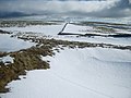
 Oughtershaw Moss - geograph.org.uk - 927481.jpg 640 × 480; 57 KB
-
 Oughtershaw School - geograph.org.uk - 550154.jpg 640 × 480; 168 KB
-
 Oughtershaw School-Memorial Hall - geograph.org.uk - 4046768.jpg 1,600 × 1,200; 682 KB
-
 Oughtershaw Side south of Long Slack Gate - geograph.org.uk - 2981246.jpg 1,024 × 683; 198 KB
-
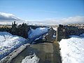
 Oughtershaw Tarn (frozen solid) - geograph.org.uk - 1608984.jpg 640 × 480; 39 KB
-
 Oughtershaw Tarn (Liquid Form) - geograph.org.uk - 3579717.jpg 4,320 × 3,240; 3.63 MB
-
 Oughtershaw Tarn - geograph.org.uk - 3579711.jpg 4,320 × 3,240; 3.27 MB
-
 Parking area - geograph.org.uk - 1207438.jpg 640 × 426; 45 KB
-
 Plantation by Oughtershaw Beck - geograph.org.uk - 927440.jpg 640 × 480; 73 KB
-
 Stone Barn near Oughtershaw - geograph.org.uk - 3580882.jpg 4,320 × 3,240; 4.56 MB
-
 The Dales Way - geograph.org.uk - 214185.jpg 640 × 480; 126 KB
-
 The Dales Way at Oughtershaw - geograph.org.uk - 927436.jpg 640 × 480; 122 KB
-

-
 The infant Wharfe - geograph.org.uk - 216441.jpg 640 × 480; 143 KB
-
 Top of Fleet Moss - geograph.org.uk - 1343578.jpg 640 × 480; 116 KB
-
 Oughtershaw. - geograph.org.uk - 92898.jpg 640 × 480; 110 KB


_-_geograph.org.uk_-_1608984.jpg)
_-_geograph.org.uk_-_3579717.jpg)


