Category:Oudtshoorn
Jump to navigation
Jump to search
town in the Western Cape, South Africa  | |||||
| Upload media | |||||
| Instance of | |||||
|---|---|---|---|---|---|
| Location | Oudtshoorn Local Municipality, Garden Route District Municipality, Western Cape, RSA | ||||
| Inception |
| ||||
| Population |
| ||||
| Area |
| ||||
| Elevation above sea level |
| ||||
| official website | |||||
 | |||||
Subcategories
This category has the following 11 subcategories, out of 11 total.
A
- Oudtshoorn airport (6 F)
C
G
H
- Holgate siding (8 F)
L
- Landscapes of Oudtshoorn (9 F)
N
O
- Ostrich Farm near Oudtshoorn (47 F)
T
V
Media in category "Oudtshoorn"
The following 34 files are in this category, out of 34 total.
-
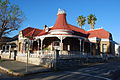
 113 Baron van Rheede Street, Oudtshoorn.JPG 3,872 × 2,592; 2.26 MB
-
 9 2 068 0020-Dorpshuis-Le Roux House-146 High Street- Oudtshoorn-s.jpg 1,500 × 1,114; 629 KB
-
 Arbeidsgenot.JPG 3,872 × 2,592; 2.33 MB
-
 Atlas Copco ECM-720 top hammer hydraulic crawler drill (21168731983).jpg 1,804 × 2,556; 625 KB
-
 Beans about coffee.jpg 4,000 × 3,000; 2.5 MB
-
 Bell 120 rough terrain forklift (21601757370).jpg 3,264 × 1,836; 919 KB
-
 Bell B25D articulated dump truck (21167094964).jpg 3,665 × 2,344; 1.32 MB
-
 Bell L1204C wheel loader (21789822225).jpg 3,545 × 2,131; 1.78 MB
-
 Bell L2106D wheel loader (21602902939).jpg 2,970 × 1,703; 717 KB
-
 Building in Oudtshoorn.jpg 4,000 × 3,000; 2.41 MB
-
 De Hoop, Oudtshoorn.jpg 640 × 427; 28 KB
-
 Gottland House.JPG 3,872 × 2,592; 2.26 MB
-
 Highgate Ostrich Show Farm, 1980 - panoramio.jpg 2,338 × 1,432; 1.53 MB
-
 Le Roux Town House.JPG 3,872 × 2,592; 2.32 MB
-
 Mimosa Lodge Oudtshoorn.JPG 3,872 × 2,592; 2.32 MB
-
 Mimosa Lodge2.JPG 2,048 × 1,537; 680 KB
-
 Montague House cafe.JPG 3,872 × 2,592; 2.35 MB
-
 NAC Oudtshoorn-ZA.jpg 2,048 × 1,536; 1.34 MB
-
 Oakdene House.JPG 3,872 × 2,592; 2.31 MB
-
 Ostrich-cross-CPNel.png 3,024 × 4,032; 10.41 MB
-
 Oudtshoorn (ZA), Straußenfarm "La Plume", Wasserleitung -- 2024 -- 1706.jpg 5,383 × 3,589; 14.51 MB
-
 Oudtshoorn (ZA), Straußenfarm "La Plume", Zaun -- 2024 -- 1729.jpg 5,367 × 3,578; 7.33 MB
-
 Oudtshoorn (ZA), Straußenfarm "La Plume", Zaun -- 2024 -- 1731.jpg 4,841 × 3,631; 6.93 MB
-
 Oudtshoorn bord.jpg 3,872 × 2,592; 2.36 MB
-
 Oudtshoorn Gaol.JPG 3,872 × 2,592; 2.35 MB
-
 Oudtshoorn rock.jpg 450 × 600; 98 KB
-
 Oudtshoorn, De Opstal - panoramio - Frans-Banja Mulder.jpg 900 × 600; 175 KB
-
 Oudtshoorn, De Opstal - panoramio.jpg 900 × 600; 234 KB
-
 Oudtshoorn.jpg 825 × 565; 525 KB
-
 Rus-in-Urbe behind trees.JPG 3,872 × 2,592; 2.31 MB
-
 Standard Bank building Oudtshoorn.JPG 3,437 × 2,579; 1.81 MB
-
 The National Archives UK - CO 1069-214-133.jpg 1,089 × 902; 204 KB
-
 Tuishuis, Oudtshoorn.JPG 3,872 × 2,592; 2.23 MB
-
 ZA-WC-Oudtshoorn-str-farm.jpg 1,215 × 810; 569 KB


.jpg)

.jpg)
.jpg)
.jpg)
.jpg)


,_Strau%C3%9Fenfarm_%22La_Plume%22,_Wasserleitung_--_2024_--_1706.jpg)
,_Strau%C3%9Fenfarm_%22La_Plume%22,_Zaun_--_2024_--_1729.jpg)
,_Strau%C3%9Fenfarm_%22La_Plume%22,_Zaun_--_2024_--_1731.jpg)


