Category:Oudezijds Voorburgwal 139, Amsterdam
Jump to navigation
Jump to search
| Object location | | View all coordinates using: OpenStreetMap |
|---|
building in Amsterdam, Netherlands  | |||||
| Upload media | |||||
| Instance of | |||||
|---|---|---|---|---|---|
| Location | Amsterdam, North Holland, Netherlands | ||||
| Street address |
| ||||
| Located on street | |||||
| Heritage designation |
| ||||
 | |||||
|
This is a category about rijksmonument number 6072
|
| Address |
|
Media in category "Oudezijds Voorburgwal 139, Amsterdam"
The following 8 files are in this category, out of 8 total.
-
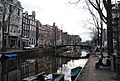
 Amsterdam - Oudezijds Voorburgwal - to the North.JPG 3,264 × 2,448; 1.87 MB
-
 Amsterdam - Oudezijds Voorburgwal - to the North2.JPG 3,264 × 2,448; 1.92 MB
-
 Amsterdam, 03.01.11-51.JPG 2,896 × 1,944; 1.29 MB
-
 Gevels - Amsterdam - 20021543 - RCE.jpg 808 × 1,200; 212 KB
-
 Oudezijds Voorburgwal 137.jpg 1,936 × 2,592; 1.71 MB
-
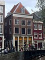
 Oudezijds Voorburgwal 139.jpg 1,936 × 2,592; 1.97 MB
-
 Pui voorgevel - Amsterdam - 20021552 - RCE.jpg 957 × 1,200; 268 KB
-
 Voorgevels - Amsterdam - 20021546 - RCE.jpg 806 × 1,200; 229 KB


