Category:Oudezijds Achterburgwal 187, Amsterdam
Jump to navigation
Jump to search
| Object location | | View all coordinates using: OpenStreetMap |
|---|
 | |||||
| Upload media | |||||
| Instance of | |||||
|---|---|---|---|---|---|
| Location | Amsterdam, North Holland, Netherlands | ||||
| Street address |
| ||||
| Located on street | |||||
| Heritage designation |
| ||||
 | |||||
|
This is a category about rijksmonument number 60
|
| Address |
|
Media in category "Oudezijds Achterburgwal 187, Amsterdam"
The following 14 files are in this category, out of 14 total.
-
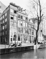
 1727 - Oudezijds Achterburgwal 187 (2309764163).jpg 1,024 × 685; 244 KB
-
 Exterieur GEVELSTEEN - Amsterdam - 20298733 - RCE.jpg 1,200 × 1,194; 310 KB
-
 Exterieur VOORGEVEL, OVERZICHT - Amsterdam - 20298732 - RCE.jpg 954 × 1,200; 294 KB
-
 Fouquet, Pierre (1729-1800), Afb 010094003898.jpg 4,264 × 3,107; 3.15 MB
-
 Fouquet, Pierre (1729-1800), Afb 010094003899.jpg 4,293 × 3,136; 3.47 MB
-
 Gevels - Amsterdam - 20015576 - RCE.jpg 1,200 × 950; 280 KB
-
 Gevels - Amsterdam - 20015577 - RCE.jpg 948 × 1,200; 290 KB
-
 Jacobus van Eck, Afb A01634000460.jpg 976 × 1,640; 221 KB
-
 Oudezijds Achterburgwal 187 corner.JPG 1,728 × 2,304; 1.23 MB
-
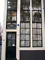 Oudezijds Achterburgwal 187 door.JPG 1,728 × 2,304; 868 KB
-
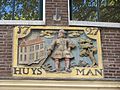 Oudezijds Achterburgwal 187 stone.JPG 2,304 × 1,728; 1 MB
-
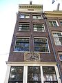 Oudezijds Achterburgwal 187 top.JPG 1,728 × 2,304; 1.02 MB
-
 Oudezijds Achterburgwal 187.jpg 1,936 × 2,592; 2.31 MB
-
 Oudezijds Achterburgwal 187a.jpg 1,936 × 2,592; 2.62 MB
.jpg)


,_Afb_010094003898.jpg)
,_Afb_010094003899.jpg)


