Category:Oudegracht 76, Utrecht
Jump to navigation
Jump to search
| Object location | | View all coordinates using: OpenStreetMap |
|---|
 | |||||
| Upload media | |||||
| Instance of |
| ||||
|---|---|---|---|---|---|
| Location | Utrecht, Netherlands | ||||
| Street address |
| ||||
| Located on street | |||||
| Heritage designation |
| ||||
 | |||||
|
This is a category about rijksmonument number 31035
|
| Address |
|
Media in category "Oudegracht 76, Utrecht"
The following 13 files are in this category, out of 13 total.
-
 Exterieur VOORGEVELS - Utrecht - 20305948 - RCE.jpg 788 × 1,200; 212 KB
-
 Exterieur VOORGEVELS - Utrecht - 20305949 - RCE.jpg 788 × 1,200; 246 KB
-
 Oude Gracht 366 - Utrecht - 20235311 - RCE.jpg 1,200 × 1,200; 405 KB
-
 Oude Gracht 37 - Utrecht - 20235307 - RCE.jpg 1,200 × 1,200; 422 KB
-
 Oude Gracht 370 - Utrecht - 20235314 - RCE.jpg 1,192 × 1,200; 445 KB
-
 Oude Gracht 370, lekkage vanuit de muur. - Utrecht - 20235315 - RCE.jpg 1,192 × 1,200; 456 KB
-
 Oude Gracht 72 - Utrecht - 20235308 - RCE.jpg 1,190 × 1,200; 409 KB
-
 Oude Gracht 72, detail kozijnlijst - Utrecht - 20235309 - RCE.jpg 1,195 × 1,200; 312 KB
-
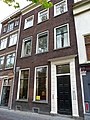 Oudegracht 76.JPG 2,592 × 3,456; 4.37 MB
-
 Overzicht - Utrecht - 20236471 - RCE.jpg 1,200 × 968; 273 KB
-
 Overzicht - Utrecht - 20236473 - RCE.jpg 1,200 × 961; 274 KB
-
 Overzicht gevels - Utrecht - 20236472 - RCE.jpg 955 × 1,200; 261 KB
-
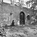
 Werfmuur - Utrecht - 20235310 - RCE.jpg 1,195 × 1,200; 441 KB


