Category:Oudegracht 57, Utrecht
Jump to navigation
Jump to search
| Object location | | View all coordinates using: OpenStreetMap |
|---|
 | |||||
| Upload media | |||||
| Instance of |
| ||||
|---|---|---|---|---|---|
| Location | Utrecht, Netherlands | ||||
| Street address |
| ||||
| Located on street | |||||
| Heritage designation |
| ||||
 | |||||
|
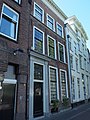
This is a category about rijksmonument number 36495
|
| Address |
|
Media in category "Oudegracht 57, Utrecht"
The following 6 files are in this category, out of 6 total.
-
 Achtergevel - Utrecht - 20236460 - RCE.jpg 951 × 1,200; 315 KB
-
 Overzicht - Utrecht - 20236457 - RCE.jpg 1,200 × 948; 252 KB
-
 Overzicht - Utrecht - 20236459 - RCE.jpg 1,200 × 959; 224 KB
-
 Rijksmonument36495.JPG 1,920 × 2,560; 1.09 MB
-
 Voorgevels - Utrecht - 20236456 - RCE.jpg 806 × 1,200; 192 KB
-
 Wijk C, Utrecht, Netherlands - panoramio (6).jpg 1,155 × 2,048; 502 KB


.jpg)