Category:Oudegracht 189, Utrecht
Jump to navigation
Jump to search
| Object location | | View all coordinates using: OpenStreetMap |
|---|
building in Utrecht, Netherlands  | |||||
| Upload media | |||||
| Instance of | |||||
|---|---|---|---|---|---|
| Location | Utrecht, Netherlands | ||||
| Street address |
| ||||
| Located on street | |||||
| Heritage designation |
| ||||
 | |||||
|
This is a category about rijksmonument number 36525
|
| Address |
|
Media in category "Oudegracht 189, Utrecht"
The following 14 files are in this category, out of 14 total.
-
 Detail van winkel interieur - Utrecht - 20236673 - RCE.jpg 1,200 × 955; 225 KB
-
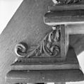
 Interieur detail muurleuning - Utrecht - 20236681 - RCE.jpg 1,200 × 1,197; 275 KB
-
 Interieur detail trap - Utrecht - 20236679 - RCE.jpg 1,200 × 1,183; 274 KB
-
 Interieur detail trap - Utrecht - 20236680 - RCE.jpg 1,195 × 1,200; 292 KB
-
 Interieur trap (instituut Blankestijn) - Utrecht - 20236678 - RCE.jpg 1,195 × 1,200; 224 KB
-
 INTERIEUR, KAPCONSTRUCTIE - Utrecht - 20305957 - RCE.jpg 1,197 × 1,200; 198 KB
-
 INTERIEUR, KAPCONSTRUCTIE - Utrecht - 20305958 - RCE.jpg 1,190 × 1,200; 212 KB
-
 INTERIEUR, KAPCONSTRUCTIE - Utrecht - 20305959 - RCE.jpg 1,200 × 1,197; 193 KB
-
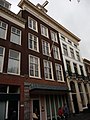 Oudegracht 189.JPG 2,592 × 3,456; 3.8 MB
-
 Voorgevel aan gracht met werfkelders - Utrecht - 20411438 - RCE.jpg 808 × 1,200; 214 KB
-
 Voorgevels - Utrecht - 20236676 - RCE.jpg 807 × 1,200; 196 KB
-
 Voorgevels van twee panden met rechte kroonlijst - Utrecht - 20400349 - RCE.jpg 956 × 1,200; 342 KB
-
 Winkel, interieur - Utrecht - 20236674 - RCE.jpg 1,200 × 954; 300 KB
-
 Winkel, interieur - Utrecht - 20236675 - RCE.jpg 963 × 1,200; 299 KB


_-_Utrecht_-_20236678_-_RCE.jpg)