Category:Oude Vest 7, Leiden
Jump to navigation
Jump to search
| Object location | | View all coordinates using: OpenStreetMap |
|---|
 | |||||
| Upload media | |||||
| Instance of |
| ||||
|---|---|---|---|---|---|
| Location | Leiden, South Holland, Netherlands | ||||
| Street address |
| ||||
| Located on street | |||||
| Heritage designation |
| ||||
 | |||||
|
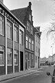
This is a category about rijksmonument number 25396
|
| Address |
|
Media in category "Oude Vest 7, Leiden"
The following 5 files are in this category, out of 5 total.
-
 Gevel - Leiden - 20136874 - RCE.jpg 803 × 1,200; 174 KB
-
 Leiden - Oude Vest 7.JPG 2,736 × 3,648; 4.54 MB
-
 Overzicht - Leiden - 20136776 - RCE.jpg 1,200 × 806; 175 KB
-
 Overzicht - Leiden - 20136865 - RCE.jpg 1,200 × 802; 184 KB
-
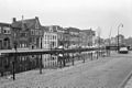
 Overzicht Oude Vest van Turfmarktbrug naar Marebrug - Leiden - 20133322 - RCE.jpg 1,188 × 1,200; 300 KB


