Category:Oude Singel 138, Leiden
Jump to navigation
Jump to search
| Object location | | View all coordinates using: OpenStreetMap |
|---|
 | |||||
| Upload media | |||||
| Instance of |
| ||||
|---|---|---|---|---|---|
| Location | Leiden, South Holland, Netherlands | ||||
| Street address |
| ||||
| Heritage designation |
| ||||
 | |||||
|
This is a category about rijksmonument number 25370
|
| Address |
|
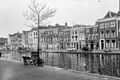
Media in category "Oude Singel 138, Leiden"
The following 9 files are in this category, out of 9 total.
-
 Leiden - Oude Singel 134-140.jpg 3,339 × 4,631; 1.2 MB
-
 Leiden - Oude Singel 138 en 138A.jpg 2,736 × 3,648; 4.26 MB
-
 Overzicht - Leiden - 20136778 - RCE.jpg 1,200 × 800; 222 KB
-
 Overzicht - Leiden - 20136779 - RCE.jpg 1,200 × 806; 214 KB
-
 Overzicht - Leiden - 20136842 - RCE.jpg 1,188 × 1,200; 257 KB
-
 Overzicht - Leiden - 20136843 - RCE.jpg 1,184 × 1,200; 317 KB
-
 Overzicht - Leiden - 20136844 - RCE.jpg 1,192 × 1,200; 347 KB
-
 Voorgevel - Leiden - 20136845 - RCE.jpg 960 × 1,200; 259 KB
-
 Voorgevel - Leiden - 20136846 - RCE.jpg 813 × 1,200; 227 KB


