Category:Oude Schulpweg 18, Egmond-Binnen
Jump to navigation
Jump to search
| Object location | | View all coordinates using: OpenStreetMap |
|---|
 | |||||
| Upload media | |||||
| Instance of | |||||
|---|---|---|---|---|---|
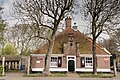
| Location | Egmond-Binnen, Bergen, North Holland, Netherlands | ||||
| Street address |
| ||||
| Located on street |
| ||||
| Heritage designation |
| ||||
 | |||||
|
This is a category about rijksmonument number 515973
|
| Address |
|
Nederlands: Restauratie in 1936 door Kees Royaards
Media in category "Oude Schulpweg 18, Egmond-Binnen"
The following 6 files are in this category, out of 6 total.
-
 Boerderij "NIEUW WESTERT" nr. HY 8 - Egmond-Binnen - 20479111 - RCE.jpg 1,200 × 900; 223 KB
-
 Oude Schulpweg, Egmond Binnen, stolpboerderij Westert.jpg 2,000 × 1,335; 286 KB
-
 Oude Schulpweg.jpg 3,024 × 4,032; 10.97 MB
-
 Stolpboerder "Westert" met bijbehorende voormalige paardenstal.jpg 4,032 × 3,024; 11.05 MB
-
 Stolpboerderij bij egmond-binnen.JPG 2,592 × 1,944; 1,016 KB
-
 Voorgevel - Egmond-Binnen - 20068014 - RCE.jpg 1,200 × 793; 277 KB


