Category:Oude Molen, Deventer
Jump to navigation
Jump to search
| Object location | | View all coordinates using: OpenStreetMap |
|---|
| Upload media | |||||
| Instance of | |||||
|---|---|---|---|---|---|
| Location | Deventer, Overijssel, Netherlands | ||||
 | |||||
Media in category "Oude Molen, Deventer"
The following 2 files are in this category, out of 2 total.
-
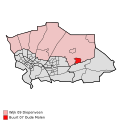 Map - NL - Deventer - Wijk 09 Diepenveen - Buurt 07 Oude Molen.svg 375 × 375; 47 KB
-
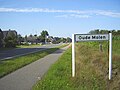 Oude Molen Deventer NL.jpg 1,536 × 1,152; 461 KB

